San Pedro Ranch Topo Map Arizona
To zoom in, hover over the map of San Pedro Ranch
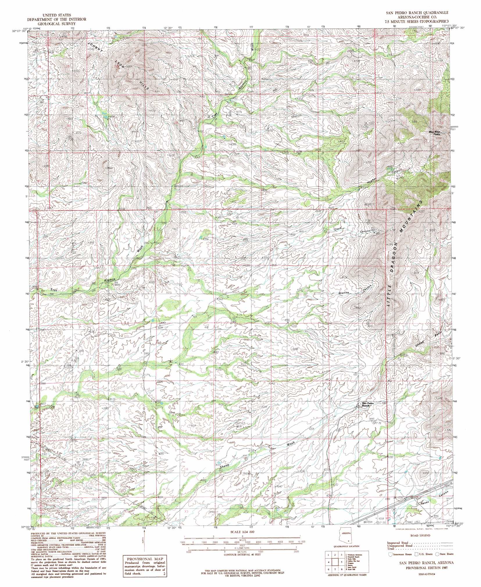
USGS Topo Quad 32110a2 - 1:24,000 scale
| Topo Map Name: | San Pedro Ranch |
| USGS Topo Quad ID: | 32110a2 |
| Print Size: | ca. 21 1/4" wide x 27" high |
| Southeast Coordinates: | 32° N latitude / 110.125° W longitude |
| Map Center Coordinates: | 32.0625° N latitude / 110.1875° W longitude |
| U.S. State: | AZ |
| Filename: | o32110a2.jpg |
| Download Map JPG Image: | San Pedro Ranch topo map 1:24,000 scale |
| Map Type: | Topographic |
| Topo Series: | 7.5´ |
| Map Scale: | 1:24,000 |
| Source of Map Images: | United States Geological Survey (USGS) |
| Alternate Map Versions: |
San Pedro Ranch AZ 1985, updated 1985 Download PDF Buy paper map San Pedro Ranch AZ 1996, updated 2002 Download PDF Buy paper map San Pedro Ranch AZ 2011 Download PDF Buy paper map San Pedro Ranch AZ 2014 Download PDF Buy paper map |
1:24,000 Topo Quads surrounding San Pedro Ranch
Soza Canyon |
Soza Mesa |
Hookers Hot Springs |
Muskhog Mountain |
Square Mountain |
Happy Valley |
Wildhorse Mountain |
Deepwell Ranch |
Steele Hills |
Red Bird Hills |
Galleta Flat West |
Galleta Flat East |
San Pedro Ranch |
Dragoon |
Cochise |
Mescal |
Benson |
Saint David |
Knob Hill |
Cochise Stronghold |
Apache Peak |
Mcgrew Spring |
Land |
Haberstock Hill |
Black Diamond Peak |
> Back to 32110a1 at 1:100,000 scale
> Back to 32110a1 at 1:250,000 scale
> Back to U.S. Topo Maps home
San Pedro Ranch topo map: Gazetteer
San Pedro Ranch: Mines
Tungsten King Mine elevation 1631m 5351′San Pedro Ranch: Summits
Keith Peak elevation 1702m 5583′San Pedro Ranch: Valleys
Clark Canyon elevation 1392m 4566′Granite Canyon elevation 1327m 4353′
Hughes Canyon elevation 1404m 4606′
Texas Canyon elevation 1338m 4389′
San Pedro Ranch digital topo map on disk
Buy this San Pedro Ranch topo map showing relief, roads, GPS coordinates and other geographical features, as a high-resolution digital map file on DVD: