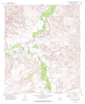
Galleta Flat East Topo Map Arizona
To zoom in, hover over the map of Galleta Flat East
USGS Topo Quad 32110a3 - 1:24,000 scale
| Topo Map Name: | Galleta Flat East |
| USGS Topo Quad ID: | 32110a3 |
| Print Size: | ca. 21 1/4" wide x 27" high |
| Southeast Coordinates: | 32° N latitude / 110.25° W longitude |
| Map Center Coordinates: | 32.0625° N latitude / 110.3125° W longitude |
| U.S. State: | AZ |
| Filename: | o32110a3.jpg |
| Download Map JPG Image: | Galleta Flat East topo map 1:24,000 scale |
| Map Type: | Topographic |
| Topo Series: | 7.5´ |
| Map Scale: | 1:24,000 |
| Source of Map Images: | United States Geological Survey (USGS) |
| Alternate Map Versions: |
Galleta Flat East AZ 1973, updated 1976 Download PDF Buy paper map Galleta Flat East AZ 1996, updated 2002 Download PDF Buy paper map Galleta Flat East AZ 2011 Download PDF Buy paper map Galleta Flat East AZ 2014 Download PDF Buy paper map |
1:24,000 Topo Quads surrounding Galleta Flat East
> Back to 32110a1 at 1:100,000 scale
> Back to 32110a1 at 1:250,000 scale
> Back to U.S. Topo Maps home
Galleta Flat East topo map: Gazetteer
Galleta Flat East: Lakes
Willow Lake elevation 1049m 3441′Galleta Flat East: Streams
Ash Creek elevation 1036m 3398′Cadillac Wash elevation 1056m 3464′
Pacheco Wash elevation 1049m 3441′
Tres Alamos Wash elevation 1038m 3405′
Galleta Flat East: Valleys
Cornfield Canyon elevation 1049m 3441′Galleta Flat East: Wells
Section Fourteen Well elevation 0m 0′Stone Tank elevation 1068m 3503′
Galleta Flat East digital topo map on disk
Buy this Galleta Flat East topo map showing relief, roads, GPS coordinates and other geographical features, as a high-resolution digital map file on DVD:


