Hookers Hot Springs Topo Map Arizona
To zoom in, hover over the map of Hookers Hot Springs
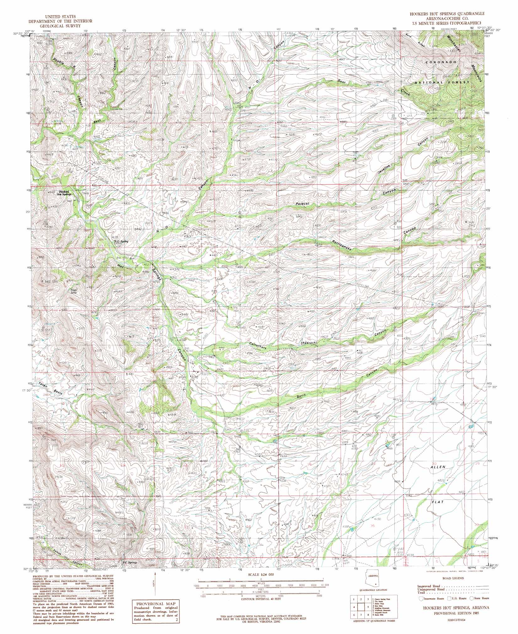
USGS Topo Quad 32110c2 - 1:24,000 scale
| Topo Map Name: | Hookers Hot Springs |
| USGS Topo Quad ID: | 32110c2 |
| Print Size: | ca. 21 1/4" wide x 27" high |
| Southeast Coordinates: | 32.25° N latitude / 110.125° W longitude |
| Map Center Coordinates: | 32.3125° N latitude / 110.1875° W longitude |
| U.S. State: | AZ |
| Filename: | o32110c2.jpg |
| Download Map JPG Image: | Hookers Hot Springs topo map 1:24,000 scale |
| Map Type: | Topographic |
| Topo Series: | 7.5´ |
| Map Scale: | 1:24,000 |
| Source of Map Images: | United States Geological Survey (USGS) |
| Alternate Map Versions: |
Hookers Hot Springs AZ 1985, updated 1985 Download PDF Buy paper map Hookers Hot Springs AZ 1985, updated 1985 Download PDF Buy paper map Hookers Hot Springs AZ 1996, updated 2002 Download PDF Buy paper map Hookers Hot Springs AZ 2011 Download PDF Buy paper map Hookers Hot Springs AZ 2014 Download PDF Buy paper map |
| FStopo: | US Forest Service topo Hookers Hot Springs is available: Download FStopo PDF Download FStopo TIF |
1:24,000 Topo Quads surrounding Hookers Hot Springs
Kielberg Canyon |
Bassett Peak |
Harrison Canyon |
Sierra Bonita Ranch |
Fort Grant |
Redington |
Cherry Spring Peak |
The Mesas |
Reiley Peak |
West Of Greasewood Mountain |
Soza Canyon |
Soza Mesa |
Hookers Hot Springs |
Muskhog Mountain |
Square Mountain |
Happy Valley |
Wildhorse Mountain |
Deepwell Ranch |
Steele Hills |
Red Bird Hills |
Galleta Flat West |
Galleta Flat East |
San Pedro Ranch |
Dragoon |
Cochise |
> Back to 32110a1 at 1:100,000 scale
> Back to 32110a1 at 1:250,000 scale
> Back to U.S. Topo Maps home
Hookers Hot Springs topo map: Gazetteer
Hookers Hot Springs: Populated Places
Hookers Hot Springs elevation 1238m 4061′Hookers Hot Springs: Reservoirs
Bald Ridge Number Two Tank elevation 1562m 5124′Bear Tank elevation 1462m 4796′
Cement Dam Tank elevation 1546m 5072′
Hookers Hot Springs: Springs
N-O Spring elevation 1295m 4248′Riggs Seep elevation 1380m 4527′
V-F Spring elevation 1313m 4307′
Hookers Hot Springs: Streams
Bear Creek elevation 1436m 4711′Hookers Hot Springs: Valleys
Carruthers Canyon elevation 1363m 4471′Davis Canyon elevation 1369m 4491′
Double R Canyon elevation 1225m 4019′
Hackberry Canyon elevation 1307m 4288′
Javelina Canyon elevation 1487m 4878′
N-O Canyon elevation 1277m 4189′
Polecat Canyon elevation 1316m 4317′
Rattlesnake Canyon elevation 1467m 4812′
Hookers Hot Springs digital topo map on disk
Buy this Hookers Hot Springs topo map showing relief, roads, GPS coordinates and other geographical features, as a high-resolution digital map file on DVD: