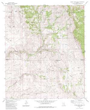
Cherry Spring Peak Topo Map Arizona
To zoom in, hover over the map of Cherry Spring Peak
USGS Topo Quad 32110d3 - 1:24,000 scale
| Topo Map Name: | Cherry Spring Peak |
| USGS Topo Quad ID: | 32110d3 |
| Print Size: | ca. 21 1/4" wide x 27" high |
| Southeast Coordinates: | 32.375° N latitude / 110.25° W longitude |
| Map Center Coordinates: | 32.4375° N latitude / 110.3125° W longitude |
| U.S. State: | AZ |
| Filename: | o32110d3.jpg |
| Download Map JPG Image: | Cherry Spring Peak topo map 1:24,000 scale |
| Map Type: | Topographic |
| Topo Series: | 7.5´ |
| Map Scale: | 1:24,000 |
| Source of Map Images: | United States Geological Survey (USGS) |
| Alternate Map Versions: |
Cherry Spring Peak AZ 1981, updated 1981 Download PDF Buy paper map Cherry Spring Peak AZ 1981, updated 1986 Download PDF Buy paper map Cherry Spring Peak AZ 1981, updated 1986 Download PDF Buy paper map Cherry Spring Peak AZ 1996, updated 2003 Download PDF Buy paper map Cherry Spring Peak AZ 2011 Download PDF Buy paper map Cherry Spring Peak AZ 2014 Download PDF Buy paper map |
| FStopo: | US Forest Service topo Cherry Spring Peak is available: Download FStopo PDF Download FStopo TIF |
1:24,000 Topo Quads surrounding Cherry Spring Peak
> Back to 32110a1 at 1:100,000 scale
> Back to 32110a1 at 1:250,000 scale
> Back to U.S. Topo Maps home
Cherry Spring Peak topo map: Gazetteer
Cherry Spring Peak: Dams
Stone Cabin Dam elevation 1317m 4320′Cherry Spring Peak: Gaps
Sol Rhea Saddle elevation 1369m 4491′Cherry Spring Peak: Mines
Jackson Mine elevation 1392m 4566′Cherry Spring Peak: Populated Places
Bradberry elevation 1230m 4035′Cherry Spring Peak: Reservoirs
Jesus Tank elevation 1409m 4622′Upper Rim Tank elevation 1804m 5918′
Cherry Spring Peak: Springs
Cherry Spring elevation 1281m 4202′Eureka Spring elevation 1180m 3871′
Jackson Canyon Spring elevation 1432m 4698′
Little Eureka Spring elevation 1130m 3707′
Miller Spring elevation 1322m 4337′
Patterson Spring elevation 1315m 4314′
Salcita Spring elevation 1232m 4041′
Stone Cabin Spring elevation 1233m 4045′
Tio Cruz Spring elevation 1458m 4783′
Upper Double R Spring elevation 1428m 4685′
Upper Sycamore Spring elevation 1485m 4872′
Walnut Spring elevation 1437m 4714′
Willow Spring elevation 1375m 4511′
Wootan Spring elevation 1245m 4084′
Cherry Spring Peak: Summits
Cherry Spring Peak elevation 1596m 5236′Cherry Spring Peak: Valleys
Bear Canyon elevation 1242m 4074′Eureka Canyon elevation 1104m 3622′
Jackson Canyon elevation 1239m 4064′
Mitchell Canyon elevation 1280m 4199′
Poor Canyon elevation 1032m 3385′
Swamp Springs Canyon elevation 1121m 3677′
Sycamore Canyon elevation 1204m 3950′
Cherry Spring Peak: Wells
Pride Well elevation 1386m 4547′Cherry Spring Peak digital topo map on disk
Buy this Cherry Spring Peak topo map showing relief, roads, GPS coordinates and other geographical features, as a high-resolution digital map file on DVD:


