Putnam Wash Topo Map Arizona
To zoom in, hover over the map of Putnam Wash
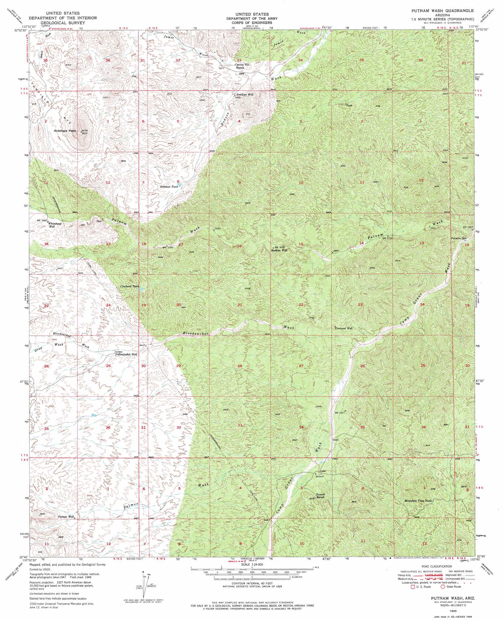
USGS Topo Quad 32110g7 - 1:24,000 scale
| Topo Map Name: | Putnam Wash |
| USGS Topo Quad ID: | 32110g7 |
| Print Size: | ca. 21 1/4" wide x 27" high |
| Southeast Coordinates: | 32.75° N latitude / 110.75° W longitude |
| Map Center Coordinates: | 32.8125° N latitude / 110.8125° W longitude |
| U.S. State: | AZ |
| Filename: | o32110g7.jpg |
| Download Map JPG Image: | Putnam Wash topo map 1:24,000 scale |
| Map Type: | Topographic |
| Topo Series: | 7.5´ |
| Map Scale: | 1:24,000 |
| Source of Map Images: | United States Geological Survey (USGS) |
| Alternate Map Versions: |
Putnam Wash AZ 1949, updated 1965 Download PDF Buy paper map Putnam Wash AZ 1949, updated 1977 Download PDF Buy paper map Putnam Wash AZ 1950, updated 1950 Download PDF Buy paper map Putnam Wash AZ 2011 Download PDF Buy paper map Putnam Wash AZ 2014 Download PDF Buy paper map |
1:24,000 Topo Quads surrounding Putnam Wash
Grayback |
Kearny |
Hayden |
Christmas |
Jerusalem Mountain |
Ninetysix Hills Ne |
Crozier Peak |
Winkelman |
Dudleyville |
Brandenburg Mountain |
Ninetysix Hills Se |
Black Mountain |
Putnam Wash |
Lookout Mountain |
Holy Joe Peak |
Chief Butte |
Fortified Peak |
North Of Oracle |
Mammoth |
Clark Ranch |
Tortolita Mountains |
Oracle Junction |
Oracle |
Campo Bonito |
Peppersauce Wash |
> Back to 32110e1 at 1:100,000 scale
> Back to 32110a1 at 1:250,000 scale
> Back to U.S. Topo Maps home
Putnam Wash topo map: Gazetteer
Putnam Wash: Arroyos
Polecat Wash elevation 1076m 3530′Putnam Wash: Reservoirs
Antelope Tank elevation 1075m 3526′Cowhead Tank elevation 1079m 3540′
Cowhead Tank elevation 1079m 3540′
Mountain View Tank elevation 1123m 3684′
Putnam Wash: Springs
Putnam Spring elevation 774m 2539′Putnam Wash: Streams
Bloodsucker Wash elevation 851m 2791′Camp Grant Wash elevation 749m 2457′
Drew Wash elevation 1093m 3585′
Palmer Wash elevation 913m 2995′
Putnam Wash: Summits
Antelope Peak elevation 1378m 4520′Putnam Wash: Trails
Camp Grant Wash Trail elevation 836m 2742′Putnam Wash: Valleys
James Wash elevation 921m 3021′Putnam Wash: Wells
Antelope Well elevation 1017m 3336′Beehive Well elevation 925m 3034′
Cowhead Well elevation 889m 2916′
Palmer Well elevation 1100m 3608′
Whitehead Well elevation 1125m 3690′
Yellowjacket Well elevation 1066m 3497′
Putnam Wash digital topo map on disk
Buy this Putnam Wash topo map showing relief, roads, GPS coordinates and other geographical features, as a high-resolution digital map file on DVD: