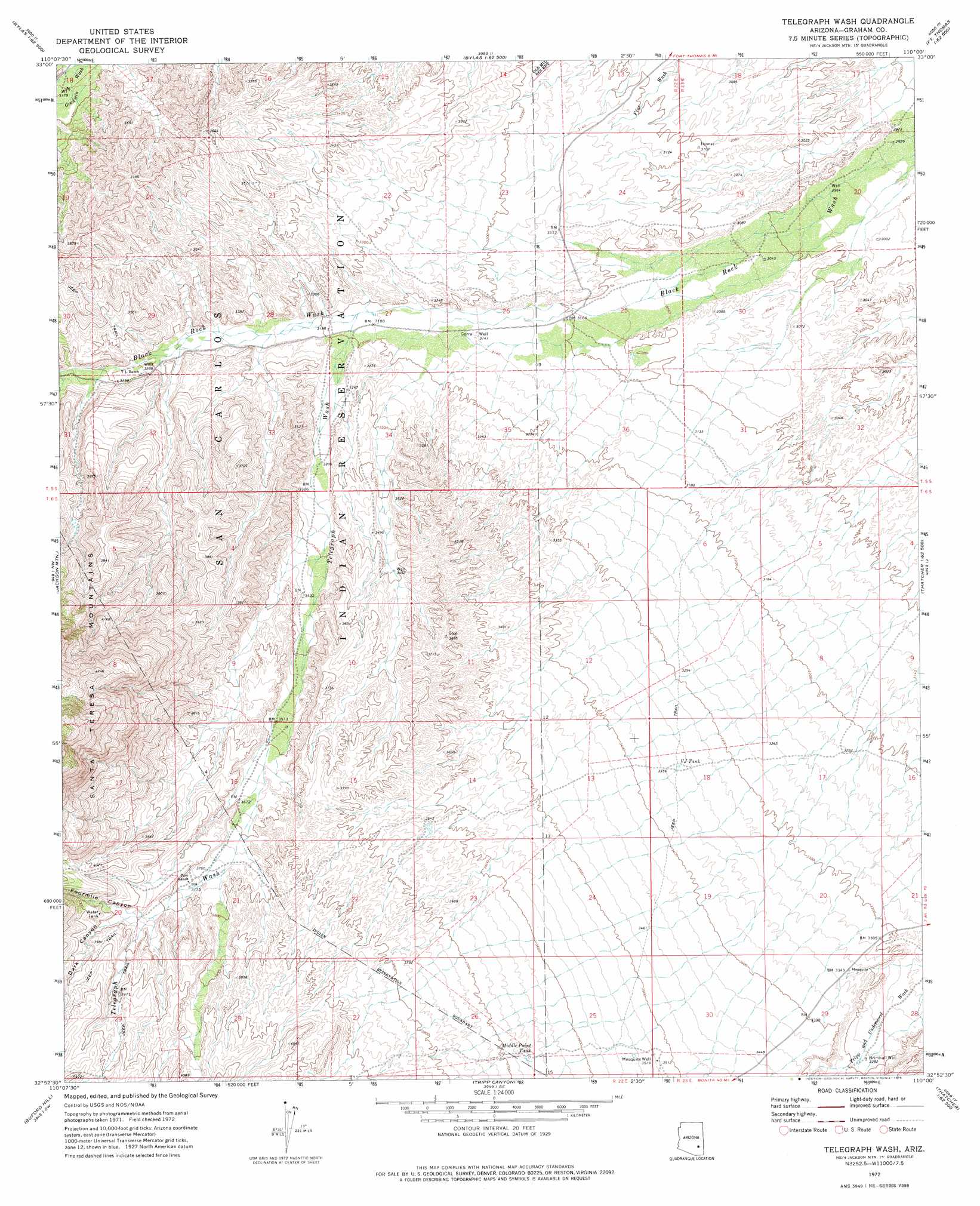
Telegraph Wash Topo Map Arizona
To zoom in, hover over the map of Telegraph Wash
USGS Topo Quad 32110h1 - 1:24,000 scale
| Topo Map Name: | Telegraph Wash |
| USGS Topo Quad ID: | 32110h1 |
| Print Size: | ca. 21 1/4" wide x 27" high |
| Southeast Coordinates: | 32.875° N latitude / 110° W longitude |
| Map Center Coordinates: | 32.9375° N latitude / 110.0625° W longitude |
| U.S. State: | AZ |
| Filename: | o32110h1.jpg |
| Download Map JPG Image: | Telegraph Wash topo map 1:24,000 scale |
| Map Type: | Topographic |
| Topo Series: | 7.5´ |
| Map Scale: | 1:24,000 |
| Source of Map Images: | United States Geological Survey (USGS) |
| Alternate Map Versions: |
Telegraph Wash AZ 1972, updated 1975 Download PDF Buy paper map Telegraph Wash AZ 2011 Download PDF Buy paper map Telegraph Wash AZ 2014 Download PDF Buy paper map |
1:24,000 Topo Quads surrounding Telegraph Wash
Dewey Flat |
Calva |
Bylas |
Gila Peak |
Bonita Tank |
Mount Turnbull |
Beargrass Basin |
Geronimo |
Fort Thomas |
Markham Creek |
Cobre Grande Mountain |
Jackson Mountain |
Telegraph Wash |
Eden |
Pima |
Klondike |
Buford Hill |
Tripp Canyon |
Shingle Mill Mountain |
Thatcher |
Kennedy Peak |
Eureka Ranch |
Blue Jay Peak |
Webb Peak |
Mount Graham |
> Back to 32110e1 at 1:100,000 scale
> Back to 32110a1 at 1:250,000 scale
> Back to U.S. Topo Maps home
Telegraph Wash topo map: Gazetteer
Telegraph Wash: Reservoirs
Middle Point Tank elevation 1117m 3664′VJ Tank elevation 1022m 3353′
Telegraph Wash: Streams
Telegraph Wash elevation 974m 3195′Telegraph Wash: Valleys
Dark Canyon elevation 1180m 3871′Fourmile Canyon elevation 1164m 3818′
Telegraph Wash: Wells
Brimhall Well elevation 1003m 3290′Corral Well elevation 958m 3143′
Mesquite Well elevation 1074m 3523′
Telegraph Wash digital topo map on disk
Buy this Telegraph Wash topo map showing relief, roads, GPS coordinates and other geographical features, as a high-resolution digital map file on DVD: