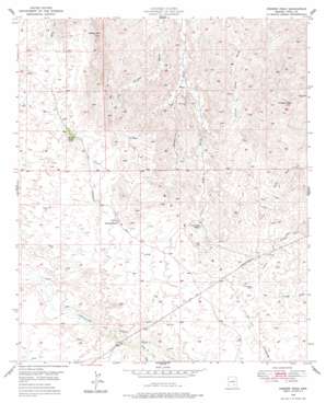
Crozier Peak Topo Map Arizona
To zoom in, hover over the map of Crozier Peak
USGS Topo Quad 32110h8 - 1:24,000 scale
| Topo Map Name: | Crozier Peak |
| USGS Topo Quad ID: | 32110h8 |
| Print Size: | ca. 21 1/4" wide x 27" high |
| Southeast Coordinates: | 32.875° N latitude / 110.875° W longitude |
| Map Center Coordinates: | 32.9375° N latitude / 110.9375° W longitude |
| U.S. State: | AZ |
| Filename: | o32110h8.jpg |
| Download Map JPG Image: | Crozier Peak topo map 1:24,000 scale |
| Map Type: | Topographic |
| Topo Series: | 7.5´ |
| Map Scale: | 1:24,000 |
| Source of Map Images: | United States Geological Survey (USGS) |
| Alternate Map Versions: |
Crozier Peak AZ 1949, updated 1955 Download PDF Buy paper map Crozier Peak AZ 1949, updated 1978 Download PDF Buy paper map Crozier Peak AZ 1950 Download PDF Buy paper map Crozier Peak AZ 2011 Download PDF Buy paper map Crozier Peak AZ 2014 Download PDF Buy paper map |
1:24,000 Topo Quads surrounding Crozier Peak
> Back to 32110e1 at 1:100,000 scale
> Back to 32110a1 at 1:250,000 scale
> Back to U.S. Topo Maps home
Crozier Peak topo map: Gazetteer
Crozier Peak: Mines
Grand Prize Mine elevation 1108m 3635′Silver Queen Mine elevation 0m 0′
Crozier Peak: Ranges
Tortilla Mountains elevation 1090m 3576′Crozier Peak: Streams
Circle S Wash elevation 1106m 3628′Eagle Wash elevation 849m 2785′
Crozier Peak: Summits
Crozier Peak elevation 1295m 4248′Ripsey Hill elevation 1193m 3914′
Crozier Peak digital topo map on disk
Buy this Crozier Peak topo map showing relief, roads, GPS coordinates and other geographical features, as a high-resolution digital map file on DVD:


