Sand Wells Topo Map Arizona
To zoom in, hover over the map of Sand Wells
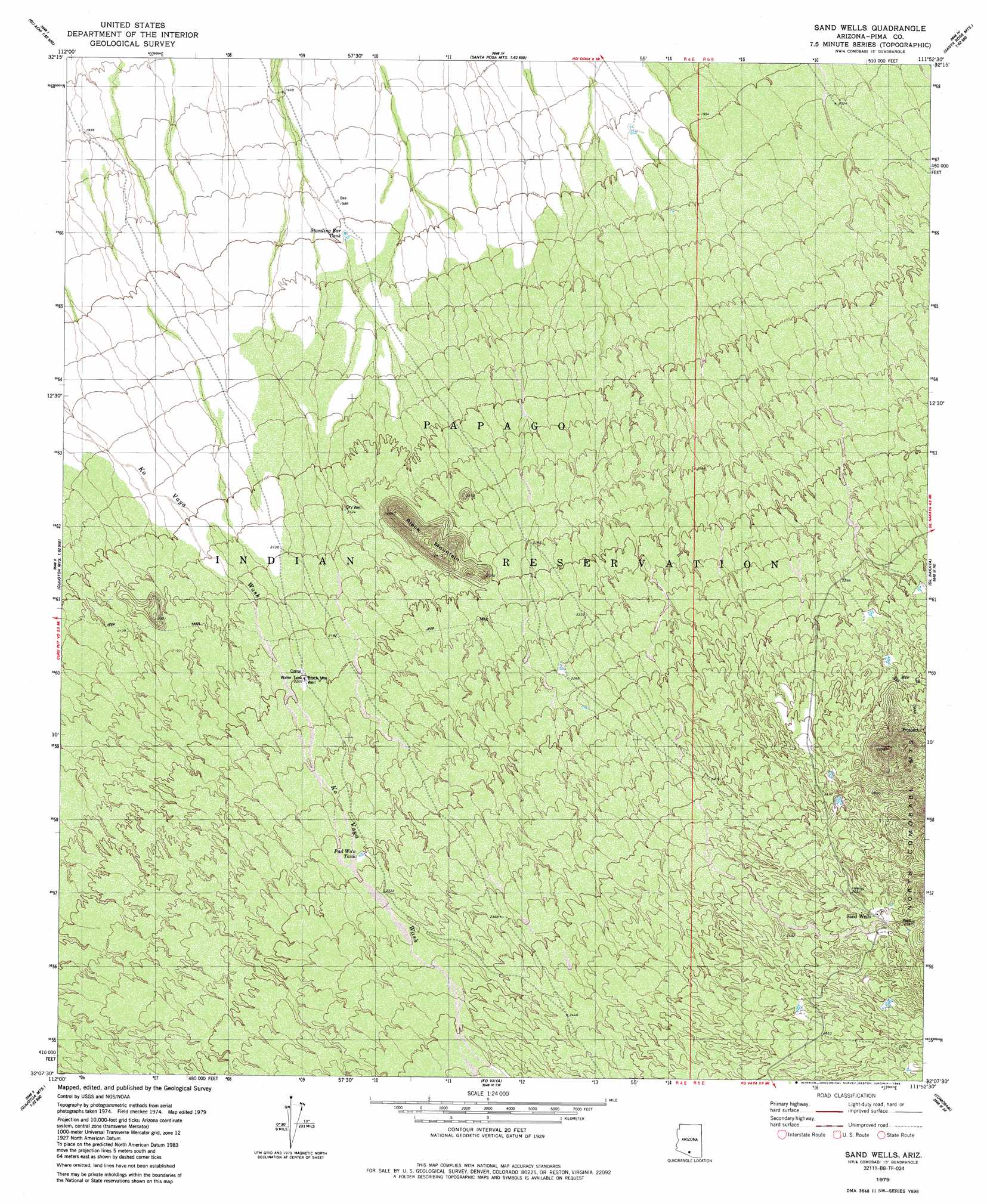
USGS Topo Quad 32111b8 - 1:24,000 scale
| Topo Map Name: | Sand Wells |
| USGS Topo Quad ID: | 32111b8 |
| Print Size: | ca. 21 1/4" wide x 27" high |
| Southeast Coordinates: | 32.125° N latitude / 111.875° W longitude |
| Map Center Coordinates: | 32.1875° N latitude / 111.9375° W longitude |
| U.S. State: | AZ |
| Filename: | o32111b8.jpg |
| Download Map JPG Image: | Sand Wells topo map 1:24,000 scale |
| Map Type: | Topographic |
| Topo Series: | 7.5´ |
| Map Scale: | 1:24,000 |
| Source of Map Images: | United States Geological Survey (USGS) |
| Alternate Map Versions: |
Sand Wells AZ 1979, updated 1979 Download PDF Buy paper map Sand Wells AZ 1979, updated 1985 Download PDF Buy paper map Sand Wells AZ 1996, updated 2002 Download PDF Buy paper map Sand Wells AZ 2011 Download PDF Buy paper map Sand Wells AZ 2014 Download PDF Buy paper map |
1:24,000 Topo Quads surrounding Sand Wells
Ventana |
Drew Spring Well |
Santa Rosa Mountains Nw |
Santa Rosa Mountains Ne |
Gap Tank |
Window Mountain |
Gu Achi |
Santa Rosa Mountains Sw |
Santa Rosa Mountains Se |
Queens Well |
Maish Vaya |
Gurli Put Vo |
Sand Wells |
Sil Nakya |
Black Hills |
Ben Nevis Mountain |
Vainom Kug |
Ko Vaya |
Comobabi |
Haivana Nakya |
Kupk |
Gu Oidak |
Sells West |
Sells East |
San Juan Spring |
> Back to 32111a1 at 1:100,000 scale
> Back to 32110a1 at 1:250,000 scale
> Back to U.S. Topo Maps home
Sand Wells topo map: Gazetteer
Sand Wells: Reservoirs
Pad Wo'o Tank elevation 701m 2299′Standing Bar Tank elevation 611m 2004′
Sand Wells: Summits
Black Mountain elevation 744m 2440′Sand Wells: Wells
Black Mountain Well elevation 672m 2204′Sand Wells elevation 0m 0′
Sand Wells digital topo map on disk
Buy this Sand Wells topo map showing relief, roads, GPS coordinates and other geographical features, as a high-resolution digital map file on DVD: