West Of Marana Topo Map Arizona
To zoom in, hover over the map of West Of Marana
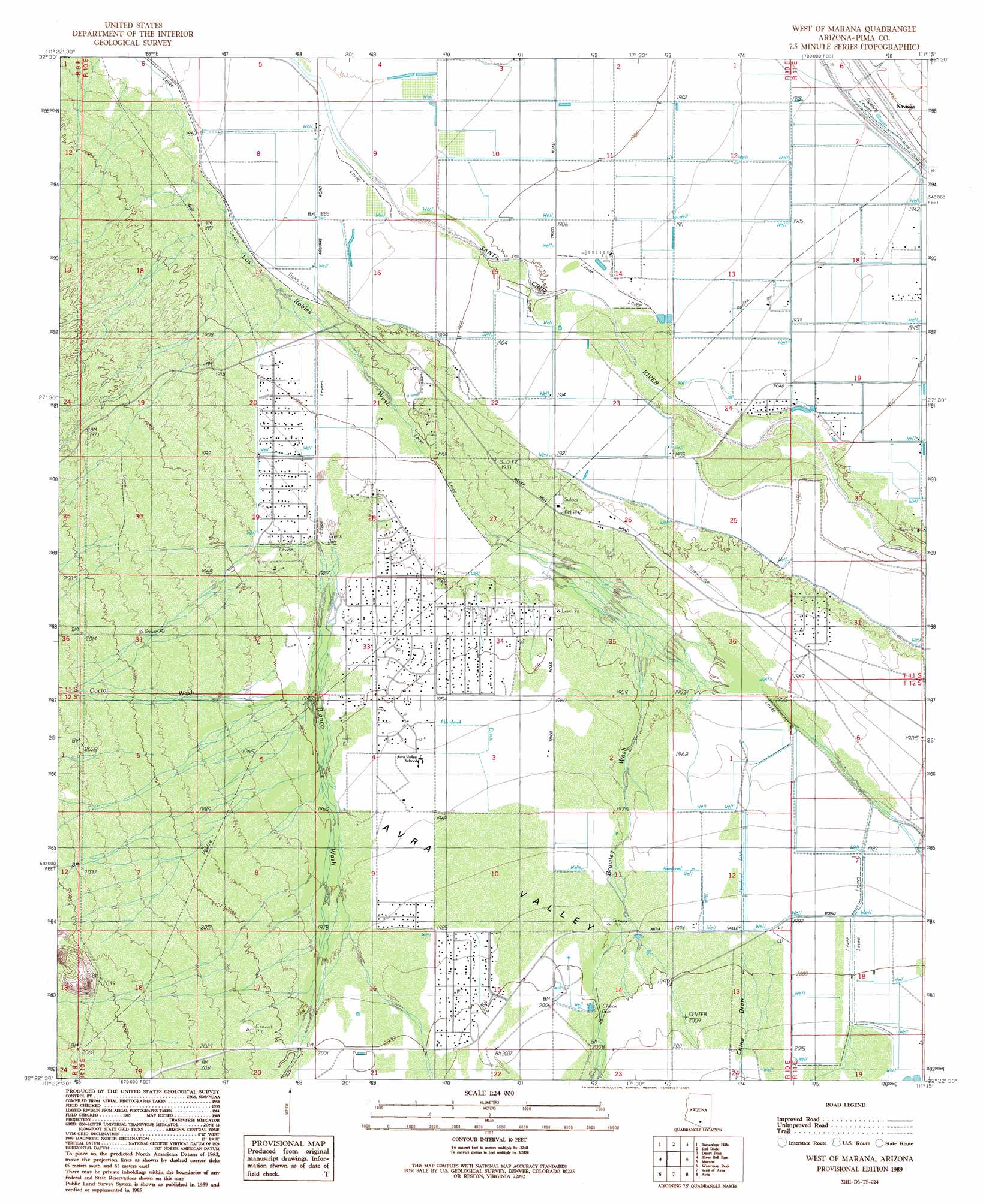
USGS Topo Quad 32111d3 - 1:24,000 scale
| Topo Map Name: | West Of Marana |
| USGS Topo Quad ID: | 32111d3 |
| Print Size: | ca. 21 1/4" wide x 27" high |
| Southeast Coordinates: | 32.375° N latitude / 111.25° W longitude |
| Map Center Coordinates: | 32.4375° N latitude / 111.3125° W longitude |
| U.S. State: | AZ |
| Filename: | o32111d3.jpg |
| Download Map JPG Image: | West Of Marana topo map 1:24,000 scale |
| Map Type: | Topographic |
| Topo Series: | 7.5´ |
| Map Scale: | 1:24,000 |
| Source of Map Images: | United States Geological Survey (USGS) |
| Alternate Map Versions: |
West of Marana AZ 1989, updated 1989 Download PDF Buy paper map West of Marana AZ 1996, updated 2002 Download PDF Buy paper map West of Marana AZ 2011 Download PDF Buy paper map West of Marana AZ 2014 Download PDF Buy paper map |
1:24,000 Topo Quads surrounding West Of Marana
Eloy South |
Newman Peak |
Picacho Pass |
Durham Hills |
Chief Butte |
Friendly Corners |
Samaniego Hills |
Red Rock |
Desert Peak |
Tortolita Mountains |
Silver Bell West |
Silver Bell East |
West Of Marana |
Marana |
Ruelas Canyon |
Koht Kohl Hill |
Waterman Peak |
West Of Avra |
Avra |
Jaynes |
San Ignacio Ranch |
La Tortuga Butte |
Cocoraque Butte |
Brown Mountain |
Cat Mountain |
> Back to 32111a1 at 1:100,000 scale
> Back to 32110a1 at 1:250,000 scale
> Back to U.S. Topo Maps home
West Of Marana topo map: Gazetteer
West Of Marana: Populated Places
Avra Valley elevation 585m 1919′Dobson elevation 583m 1912′
Naviska elevation 592m 1942′
Nelson elevation 601m 1971′
West Of Marana: Streams
Blanco Wash elevation 580m 1902′Brawley Wash elevation 591m 1938′
Cocio Wash elevation 592m 1942′
West Of Marana: Valleys
Avra Valley elevation 579m 1899′China Draw elevation 609m 1998′
West Of Marana digital topo map on disk
Buy this West Of Marana topo map showing relief, roads, GPS coordinates and other geographical features, as a high-resolution digital map file on DVD: