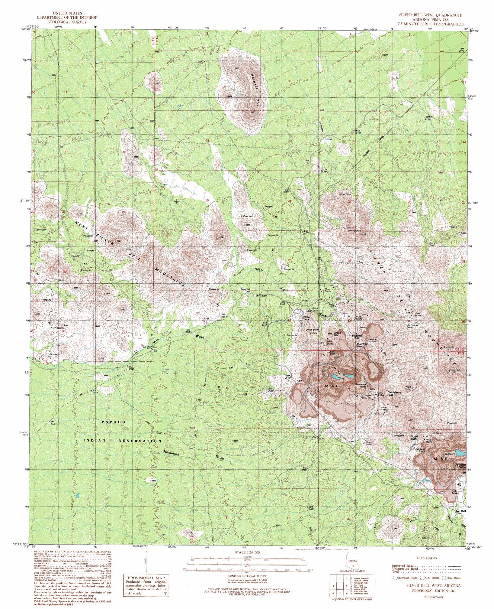
Silver Bell West Topo Map Arizona
To zoom in, hover over the map of Silver Bell West
USGS Topo Quad 32111d5 - 1:24,000 scale
| Topo Map Name: | Silver Bell West |
| USGS Topo Quad ID: | 32111d5 |
| Print Size: | ca. 21 1/4" wide x 27" high |
| Southeast Coordinates: | 32.375° N latitude / 111.5° W longitude |
| Map Center Coordinates: | 32.4375° N latitude / 111.5625° W longitude |
| U.S. State: | AZ |
| Filename: | o32111d5.jpg |
| Download Map JPG Image: | Silver Bell West topo map 1:24,000 scale |
| Map Type: | Topographic |
| Topo Series: | 7.5´ |
| Map Scale: | 1:24,000 |
| Source of Map Images: | United States Geological Survey (USGS) |
| Alternate Map Versions: |
Silver Bell West AZ 1989, updated 1989 Download PDF Buy paper map Silver Bell West AZ 1996, updated 2003 Download PDF Buy paper map Silver Bell West AZ 2011 Download PDF Buy paper map Silver Bell West AZ 2014 Download PDF Buy paper map |
1:24,000 Topo Quads surrounding Silver Bell West
Silver Reef Mountains |
Arizona City |
Eloy South |
Newman Peak |
Picacho Pass |
Silver Reef Mountains Se |
Greene Reservoir |
Friendly Corners |
Samaniego Hills |
Red Rock |
Santa Rosa Mountains Ne |
Gap Tank |
Silver Bell West |
Silver Bell East |
West Of Marana |
Santa Rosa Mountains Se |
Queens Well |
Koht Kohl Hill |
Waterman Peak |
West Of Avra |
Sil Nakya |
Black Hills |
San Ignacio Ranch |
La Tortuga Butte |
Cocoraque Butte |
> Back to 32111a1 at 1:100,000 scale
> Back to 32110a1 at 1:250,000 scale
> Back to U.S. Topo Maps home
Silver Bell West topo map: Gazetteer
Silver Bell West: Basins
El Tiro Pit elevation 756m 2480′Oxide Pit elevation 801m 2627′
Silver Bell West: Bends
Mammoth Incline elevation 859m 2818′Silver Bell West: Mines
BSK Mine elevation 762m 2500′Daisy Shaft elevation 825m 2706′
Silver Bell West: Parks
Ironwood Forest National Monument elevation 663m 2175′Silver Bell West: Populated Places
Silver Bell elevation 0m 0′Silverbell elevation 794m 2604′
Silver Bell West: Post Offices
Silver Bell Post Office elevation 817m 2680′Silver Bell West: Streams
Silver Bell Wash elevation 0m 0′Silver Bell West: Summits
Confidence Peak elevation 1139m 3736′Copper Butte elevation 857m 2811′
Jesuit Hill elevation 920m 3018′
Malpais Hill elevation 775m 2542′
North Butte elevation 925m 3034′
Quartzite Peak elevation 954m 3129′
Union Hill elevation 847m 2778′
Wild Hog Mountain elevation 898m 2946′
Silver Bell West: Tunnels
Kurtz Shaft elevation 863m 2831′Silver Bell West: Wells
Tin House Well elevation 896m 2939′Silver Bell West digital topo map on disk
Buy this Silver Bell West topo map showing relief, roads, GPS coordinates and other geographical features, as a high-resolution digital map file on DVD: