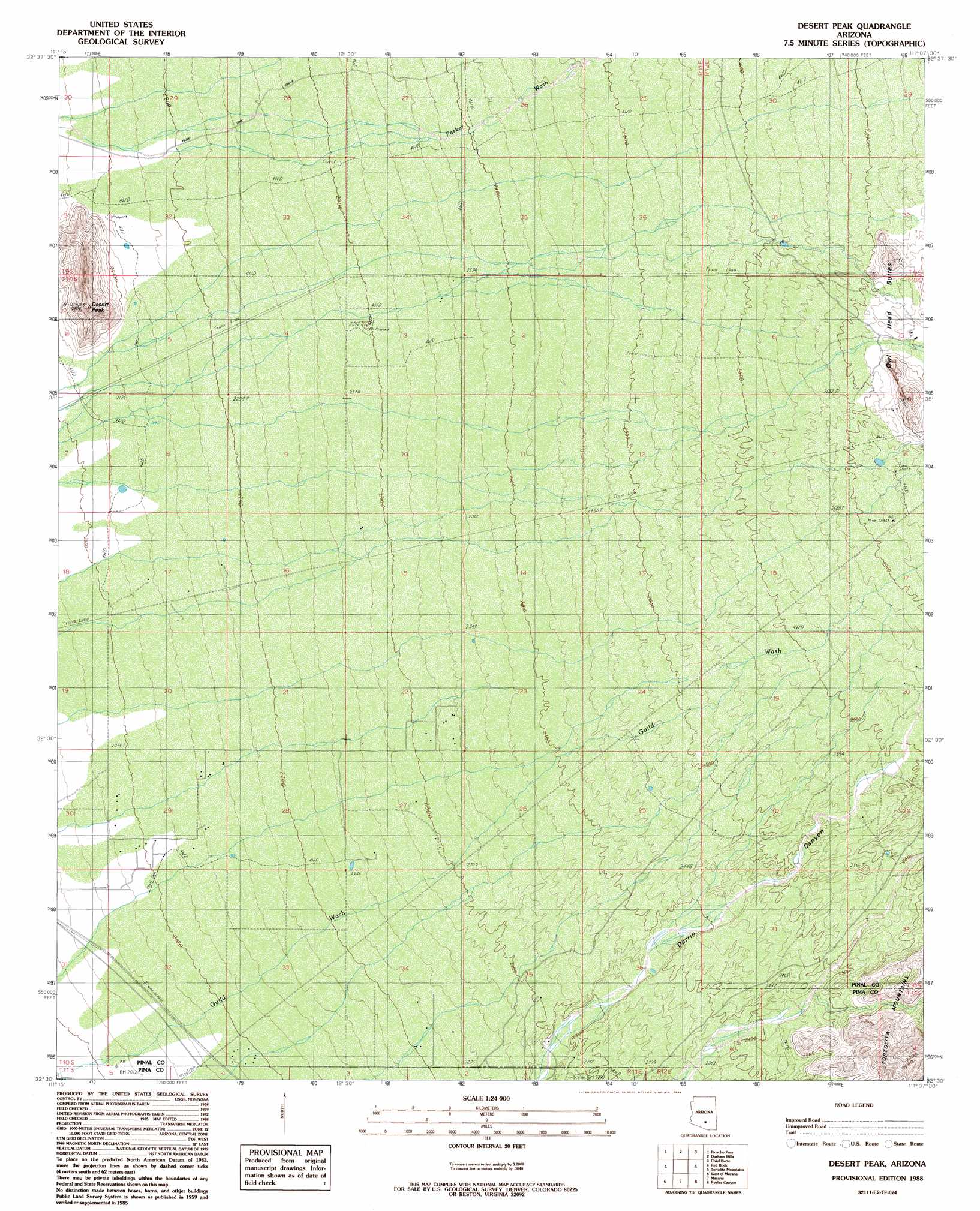
Desert Peak Topo Map Arizona
To zoom in, hover over the map of Desert Peak
USGS Topo Quad 32111e2 - 1:24,000 scale
| Topo Map Name: | Desert Peak |
| USGS Topo Quad ID: | 32111e2 |
| Print Size: | ca. 21 1/4" wide x 27" high |
| Southeast Coordinates: | 32.5° N latitude / 111.125° W longitude |
| Map Center Coordinates: | 32.5625° N latitude / 111.1875° W longitude |
| U.S. State: | AZ |
| Filename: | o32111e2.jpg |
| Download Map JPG Image: | Desert Peak topo map 1:24,000 scale |
| Map Type: | Topographic |
| Topo Series: | 7.5´ |
| Map Scale: | 1:24,000 |
| Source of Map Images: | United States Geological Survey (USGS) |
| Alternate Map Versions: |
Desert Peak AZ 1988, updated 1989 Download PDF Buy paper map Desert Peak AZ 1988, updated 1989 Download PDF Buy paper map Desert Peak AZ 1996, updated 2002 Download PDF Buy paper map Desert Peak AZ 2011 Download PDF Buy paper map Desert Peak AZ 2014 Download PDF Buy paper map |
1:24,000 Topo Quads surrounding Desert Peak
Picacho Reservoir |
Picacho Reservoir Se |
Ninetysix Hills Sw |
Ninetysix Hills Se |
Black Mountain |
Newman Peak |
Picacho Pass |
Durham Hills |
Chief Butte |
Fortified Peak |
Samaniego Hills |
Red Rock |
Desert Peak |
Tortolita Mountains |
Oracle Junction |
Silver Bell East |
West Of Marana |
Marana |
Ruelas Canyon |
Oro Valley |
Waterman Peak |
West Of Avra |
Avra |
Jaynes |
Tucson North |
> Back to 32111e1 at 1:100,000 scale
> Back to 32110a1 at 1:250,000 scale
> Back to U.S. Topo Maps home
Desert Peak topo map: Gazetteer
Desert Peak: Airports
El Mirador Airport elevation 699m 2293′Desert Peak: Streams
Guild Wash elevation 606m 1988′Desert Peak: Summits
Desert Peak elevation 777m 2549′Desert Peak: Valleys
Derrio Canyon elevation 718m 2355′Desert Peak digital topo map on disk
Buy this Desert Peak topo map showing relief, roads, GPS coordinates and other geographical features, as a high-resolution digital map file on DVD: