Friendly Corners Topo Map Arizona
To zoom in, hover over the map of Friendly Corners
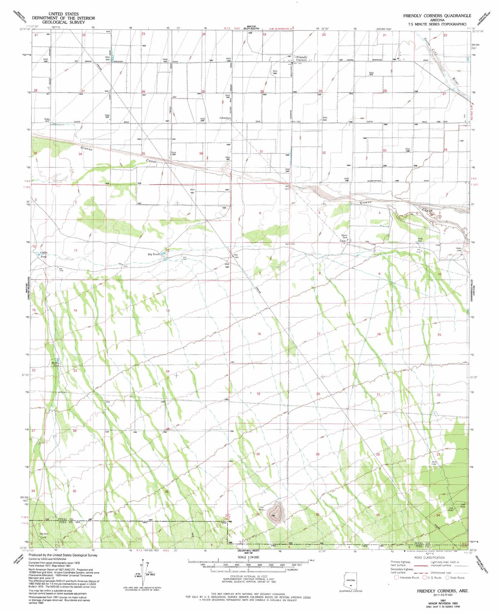
USGS Topo Quad 32111e5 - 1:24,000 scale
| Topo Map Name: | Friendly Corners |
| USGS Topo Quad ID: | 32111e5 |
| Print Size: | ca. 21 1/4" wide x 27" high |
| Southeast Coordinates: | 32.5° N latitude / 111.5° W longitude |
| Map Center Coordinates: | 32.5625° N latitude / 111.5625° W longitude |
| U.S. State: | AZ |
| Filename: | o32111e5.jpg |
| Download Map JPG Image: | Friendly Corners topo map 1:24,000 scale |
| Map Type: | Topographic |
| Topo Series: | 7.5´ |
| Map Scale: | 1:24,000 |
| Source of Map Images: | United States Geological Survey (USGS) |
| Alternate Map Versions: |
Friendly Corners AZ 1981, updated 1981 Download PDF Buy paper map Friendly Corners AZ 1981, updated 1993 Download PDF Buy paper map Friendly Corners AZ 1996, updated 2003 Download PDF Buy paper map Friendly Corners AZ 2011 Download PDF Buy paper map Friendly Corners AZ 2014 Download PDF Buy paper map |
1:24,000 Topo Quads surrounding Friendly Corners
Chuichu |
Casa Grande Mountains |
Eloy North |
Picacho Reservoir |
Picacho Reservoir Se |
Silver Reef Mountains |
Arizona City |
Eloy South |
Newman Peak |
Picacho Pass |
Silver Reef Mountains Se |
Greene Reservoir |
Friendly Corners |
Samaniego Hills |
Red Rock |
Santa Rosa Mountains Ne |
Gap Tank |
Silver Bell West |
Silver Bell East |
West Of Marana |
Santa Rosa Mountains Se |
Queens Well |
Koht Kohl Hill |
Waterman Peak |
West Of Avra |
> Back to 32111e1 at 1:100,000 scale
> Back to 32110a1 at 1:250,000 scale
> Back to U.S. Topo Maps home
Friendly Corners topo map: Gazetteer
Friendly Corners: Populated Places
Friendly Corners elevation 507m 1663′Friendly Corners: Reservoirs
Big Tank elevation 502m 1646′Coffee Tank elevation 494m 1620′
Morris Tank elevation 510m 1673′
Friendly Corners digital topo map on disk
Buy this Friendly Corners topo map showing relief, roads, GPS coordinates and other geographical features, as a high-resolution digital map file on DVD: