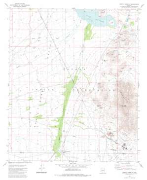
North Komelik Topo Map Arizona
To zoom in, hover over the map of North Komelik
USGS Topo Quad 32111e8 - 1:24,000 scale
| Topo Map Name: | North Komelik |
| USGS Topo Quad ID: | 32111e8 |
| Print Size: | ca. 21 1/4" wide x 27" high |
| Southeast Coordinates: | 32.5° N latitude / 111.875° W longitude |
| Map Center Coordinates: | 32.5625° N latitude / 111.9375° W longitude |
| U.S. State: | AZ |
| Filename: | o32111e8.jpg |
| Download Map JPG Image: | North Komelik topo map 1:24,000 scale |
| Map Type: | Topographic |
| Topo Series: | 7.5´ |
| Map Scale: | 1:24,000 |
| Source of Map Images: | United States Geological Survey (USGS) |
| Alternate Map Versions: |
North Komelik AZ 1981, updated 1981 Download PDF Buy paper map North Komelik AZ 1996, updated 2003 Download PDF Buy paper map North Komelik AZ 2011 Download PDF Buy paper map North Komelik AZ 2014 Download PDF Buy paper map |
1:24,000 Topo Quads surrounding North Komelik
> Back to 32111e1 at 1:100,000 scale
> Back to 32110a1 at 1:250,000 scale
> Back to U.S. Topo Maps home
North Komelik topo map: Gazetteer
North Komelik: Gaps
Tat Momoli Pass elevation 464m 1522′North Komelik: Mines
Desert Queen Mine elevation 524m 1719′House Mine elevation 581m 1906′
Jackrabbit Mine elevation 472m 1548′
Lake Shore Mine elevation 523m 1715′
Orizaba Mine elevation 483m 1584′
Orphan Mine elevation 493m 1617′
Ramona Mine elevation 561m 1840′
Red Chief Mine elevation 527m 1729′
Turning Point Mine elevation 476m 1561′
North Komelik: Populated Places
Jackrabbit House elevation 470m 1541′North Komelik elevation 489m 1604′
Tat Momoli elevation 470m 1541′
North Komelik: Ranges
Slate Mountains elevation 835m 2739′North Komelik: Streams
Bitter Well Wash elevation 464m 1522′North Komelik: Summits
Boomerang Mine elevation 529m 1735′Old Mammoth Mine elevation 565m 1853′
Prieta Peak elevation 1014m 3326′
North Komelik digital topo map on disk
Buy this North Komelik topo map showing relief, roads, GPS coordinates and other geographical features, as a high-resolution digital map file on DVD:


