Durham Hills Topo Map Arizona
To zoom in, hover over the map of Durham Hills
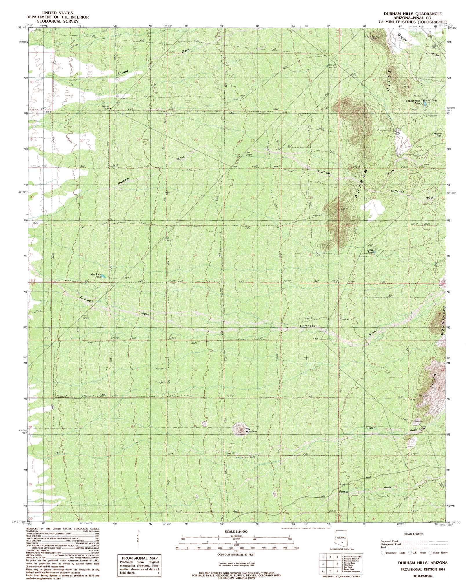
USGS Topo Quad 32111f2 - 1:24,000 scale
| Topo Map Name: | Durham Hills |
| USGS Topo Quad ID: | 32111f2 |
| Print Size: | ca. 21 1/4" wide x 27" high |
| Southeast Coordinates: | 32.625° N latitude / 111.125° W longitude |
| Map Center Coordinates: | 32.6875° N latitude / 111.1875° W longitude |
| U.S. State: | AZ |
| Filename: | o32111f2.jpg |
| Download Map JPG Image: | Durham Hills topo map 1:24,000 scale |
| Map Type: | Topographic |
| Topo Series: | 7.5´ |
| Map Scale: | 1:24,000 |
| Source of Map Images: | United States Geological Survey (USGS) |
| Alternate Map Versions: |
Durham Hills AZ 1988, updated 1989 Download PDF Buy paper map Durham Hills AZ 1996, updated 2003 Download PDF Buy paper map Durham Hills AZ 2011 Download PDF Buy paper map Durham Hills AZ 2014 Download PDF Buy paper map |
1:24,000 Topo Quads surrounding Durham Hills
Valley Farms |
Cactus Forest |
Ninetysix Hills Nw |
Ninetysix Hills Ne |
Crozier Peak |
Picacho Reservoir |
Picacho Reservoir Se |
Ninetysix Hills Sw |
Ninetysix Hills Se |
Black Mountain |
Newman Peak |
Picacho Pass |
Durham Hills |
Chief Butte |
Fortified Peak |
Samaniego Hills |
Red Rock |
Desert Peak |
Tortolita Mountains |
Oracle Junction |
Silver Bell East |
West Of Marana |
Marana |
Ruelas Canyon |
Oro Valley |
> Back to 32111e1 at 1:100,000 scale
> Back to 32110a1 at 1:250,000 scale
> Back to U.S. Topo Maps home
Durham Hills topo map: Gazetteer
Durham Hills: Reservoirs
Blue Ribbon Tank elevation 686m 2250′Copper Mine Tank elevation 830m 2723′
Gas Line Tank elevation 685m 2247′
Green Tank elevation 749m 2457′
Mesa Tank elevation 798m 2618′
Durham Hills: Streams
Suffering Wash elevation 794m 2604′Durham Hills: Summits
Durham Hills elevation 898m 2946′The Huerfano elevation 811m 2660′
Durham Hills: Wells
Magma Well elevation 832m 2729′Suizo Well elevation 822m 2696′
Durham Hills digital topo map on disk
Buy this Durham Hills topo map showing relief, roads, GPS coordinates and other geographical features, as a high-resolution digital map file on DVD: