Ninetysix Hills Se Topo Map Arizona
To zoom in, hover over the map of Ninetysix Hills Se
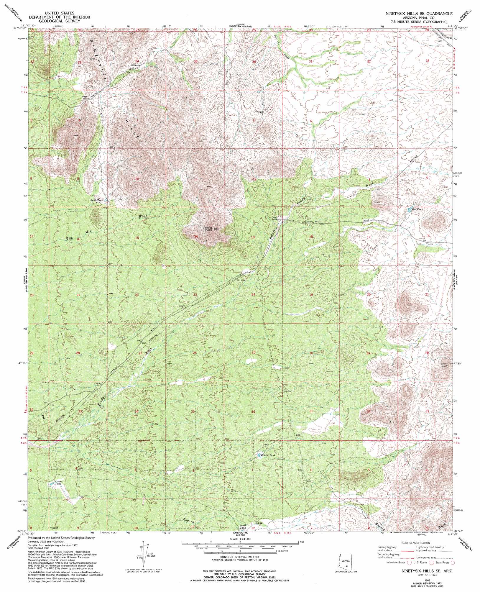
USGS Topo Quad 32111g1 - 1:24,000 scale
| Topo Map Name: | Ninetysix Hills Se |
| USGS Topo Quad ID: | 32111g1 |
| Print Size: | ca. 21 1/4" wide x 27" high |
| Southeast Coordinates: | 32.75° N latitude / 111° W longitude |
| Map Center Coordinates: | 32.8125° N latitude / 111.0625° W longitude |
| U.S. State: | AZ |
| Filename: | o32111g1.jpg |
| Download Map JPG Image: | Ninetysix Hills Se topo map 1:24,000 scale |
| Map Type: | Topographic |
| Topo Series: | 7.5´ |
| Map Scale: | 1:24,000 |
| Source of Map Images: | United States Geological Survey (USGS) |
| Alternate Map Versions: |
Ninetysix Hills SE AZ 1966, updated 1969 Download PDF Buy paper map Ninetysix Hills SE AZ 1966, updated 1983 Download PDF Buy paper map Ninetysix Hills SE AZ 1966, updated 1993 Download PDF Buy paper map Ninetysix Hills SE AZ 2011 Download PDF Buy paper map Ninetysix Hills SE AZ 2014 Download PDF Buy paper map |
1:24,000 Topo Quads surrounding Ninetysix Hills Se
Florence Se |
North Butte |
Grayback |
Kearny |
Hayden |
Cactus Forest |
Ninetysix Hills Nw |
Ninetysix Hills Ne |
Crozier Peak |
Winkelman |
Picacho Reservoir Se |
Ninetysix Hills Sw |
Ninetysix Hills Se |
Black Mountain |
Putnam Wash |
Picacho Pass |
Durham Hills |
Chief Butte |
Fortified Peak |
North Of Oracle |
Red Rock |
Desert Peak |
Tortolita Mountains |
Oracle Junction |
Oracle |
> Back to 32111e1 at 1:100,000 scale
> Back to 32110a1 at 1:250,000 scale
> Back to U.S. Topo Maps home
Ninetysix Hills Se topo map: Gazetteer
Ninetysix Hills Se: Reservoirs
Bee Tank elevation 1031m 3382′Buck Tank elevation 894m 2933′
Lower Tank elevation 840m 2755′
Middle Tank elevation 934m 3064′
South Tank elevation 922m 3024′
Ninetysix Hills Se: Summits
Coyote Peak elevation 1208m 3963′Ninetysix Hills Se digital topo map on disk
Buy this Ninetysix Hills Se topo map showing relief, roads, GPS coordinates and other geographical features, as a high-resolution digital map file on DVD: