Casa Grande West Topo Map Arizona
To zoom in, hover over the map of Casa Grande West
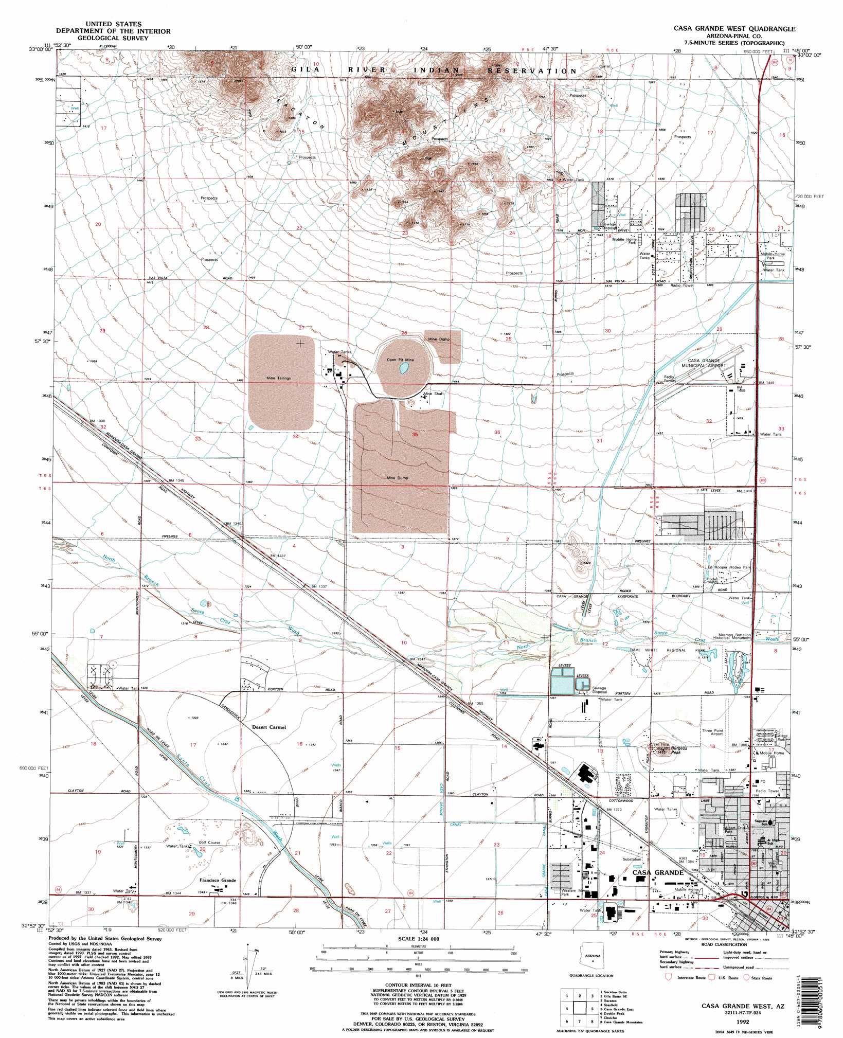
USGS Topo Quad 32111h7 - 1:24,000 scale
| Topo Map Name: | Casa Grande West |
| USGS Topo Quad ID: | 32111h7 |
| Print Size: | ca. 21 1/4" wide x 27" high |
| Southeast Coordinates: | 32.875° N latitude / 111.75° W longitude |
| Map Center Coordinates: | 32.9375° N latitude / 111.8125° W longitude |
| U.S. State: | AZ |
| Filename: | o32111h7.jpg |
| Download Map JPG Image: | Casa Grande West topo map 1:24,000 scale |
| Map Type: | Topographic |
| Topo Series: | 7.5´ |
| Map Scale: | 1:24,000 |
| Source of Map Images: | United States Geological Survey (USGS) |
| Alternate Map Versions: |
Casa Grande West AZ 1965, updated 1967 Download PDF Buy paper map Casa Grande West AZ 1965, updated 1983 Download PDF Buy paper map Casa Grande West AZ 1971, updated 1972 Download PDF Buy paper map Casa Grande West AZ 1992, updated 1992 Download PDF Buy paper map Casa Grande West AZ 2011 Download PDF Buy paper map Casa Grande West AZ 2014 Download PDF Buy paper map |
1:24,000 Topo Quads surrounding Casa Grande West
Pima Butte |
Gila Butte Nw |
Gila Butte |
Chandler Heights |
Sacaton Ne |
Maricopa |
Sacaton Butte |
Gila Butte Se |
Sacaton |
Blackwater |
Antelope Peak Ne |
Stanfield |
Casa Grande West |
Casa Crande East |
Coolidge |
Indian Butte |
Double Peak |
Chuichu |
Casa Grande Mountains |
Eloy North |
Vekol Mountains Ne |
Vaiva Vo |
Silver Reef Mountains |
Arizona City |
Eloy South |
> Back to 32111e1 at 1:100,000 scale
> Back to 32110a1 at 1:250,000 scale
> Back to U.S. Topo Maps home
Casa Grande West topo map: Gazetteer
Casa Grande West: Airports
Casa Grande Municipal Airport elevation 443m 1453′Three Point Airport elevation 422m 1384′
Casa Grande West: Parks
Francisco Grande elevation 409m 1341′Mormon Battalion Historical Monument elevation 421m 1381′
Upeart Park elevation 428m 1404′
Ward Park elevation 426m 1397′
West Side Park elevation 424m 1391′
Western Manor Park elevation 420m 1377′
Casa Grande West: Populated Places
Casa Grande elevation 426m 1397′Casa Grande West: Summits
Burgess Peak elevation 459m 1505′Casa Grande West digital topo map on disk
Buy this Casa Grande West topo map showing relief, roads, GPS coordinates and other geographical features, as a high-resolution digital map file on DVD: