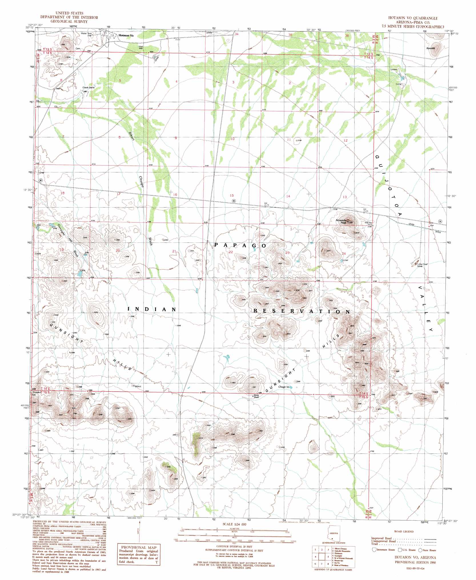
Hotason Vo Topo Map Arizona
To zoom in, hover over the map of Hotason Vo
USGS Topo Quad 32112b5 - 1:24,000 scale
| Topo Map Name: | Hotason Vo |
| USGS Topo Quad ID: | 32112b5 |
| Print Size: | ca. 21 1/4" wide x 27" high |
| Southeast Coordinates: | 32.125° N latitude / 112.5° W longitude |
| Map Center Coordinates: | 32.1875° N latitude / 112.5625° W longitude |
| U.S. State: | AZ |
| Filename: | o32112b5.jpg |
| Download Map JPG Image: | Hotason Vo topo map 1:24,000 scale |
| Map Type: | Topographic |
| Topo Series: | 7.5´ |
| Map Scale: | 1:24,000 |
| Source of Map Images: | United States Geological Survey (USGS) |
| Alternate Map Versions: |
Hotason Vo AZ 1990, updated 1990 Download PDF Buy paper map Hotason Vo AZ 1996, updated 2000 Download PDF Buy paper map Hotason Vo AZ 2011 Download PDF Buy paper map Hotason Vo AZ 2014 Download PDF Buy paper map |
1:24,000 Topo Quads surrounding Hotason Vo
Ajo North |
Burro Gap |
Coffeepot Mountain |
Cimarron Peak |
West Of Ventana |
Ajo South |
Sikort Chuapo |
Gakolik Mountains |
Hickiwan |
Vaya Chin |
Armenta Well |
Gunsight |
Hotason Vo |
West Of Wahak Hotrontk |
Wahak Hotrontk |
Tillotson Peak |
Mount Ajo |
Gu Vo |
West Of Pisinimo |
Pisinimo |
Lukeville |
Diaz Peak |
Pia Oik |
Chupan Mountain |
Kom Vo |
> Back to 32112a1 at 1:100,000 scale
> Back to 32112a1 at 1:250,000 scale
> Back to U.S. Topo Maps home
Hotason Vo topo map: Gazetteer
Hotason Vo: Lakes
Chagit Vo elevation 678m 2224′Hotason Vo: Mines
Little Chief Mine elevation 647m 2122′Hotason Vo: Populated Places
Hotason Vo elevation 640m 2099′Hotason Vo: Summits
Gunsight Hills elevation 840m 2755′Kavolik elevation 691m 2267′
Ninemile Peak elevation 732m 2401′
Hotason Vo digital topo map on disk
Buy this Hotason Vo topo map showing relief, roads, GPS coordinates and other geographical features, as a high-resolution digital map file on DVD: