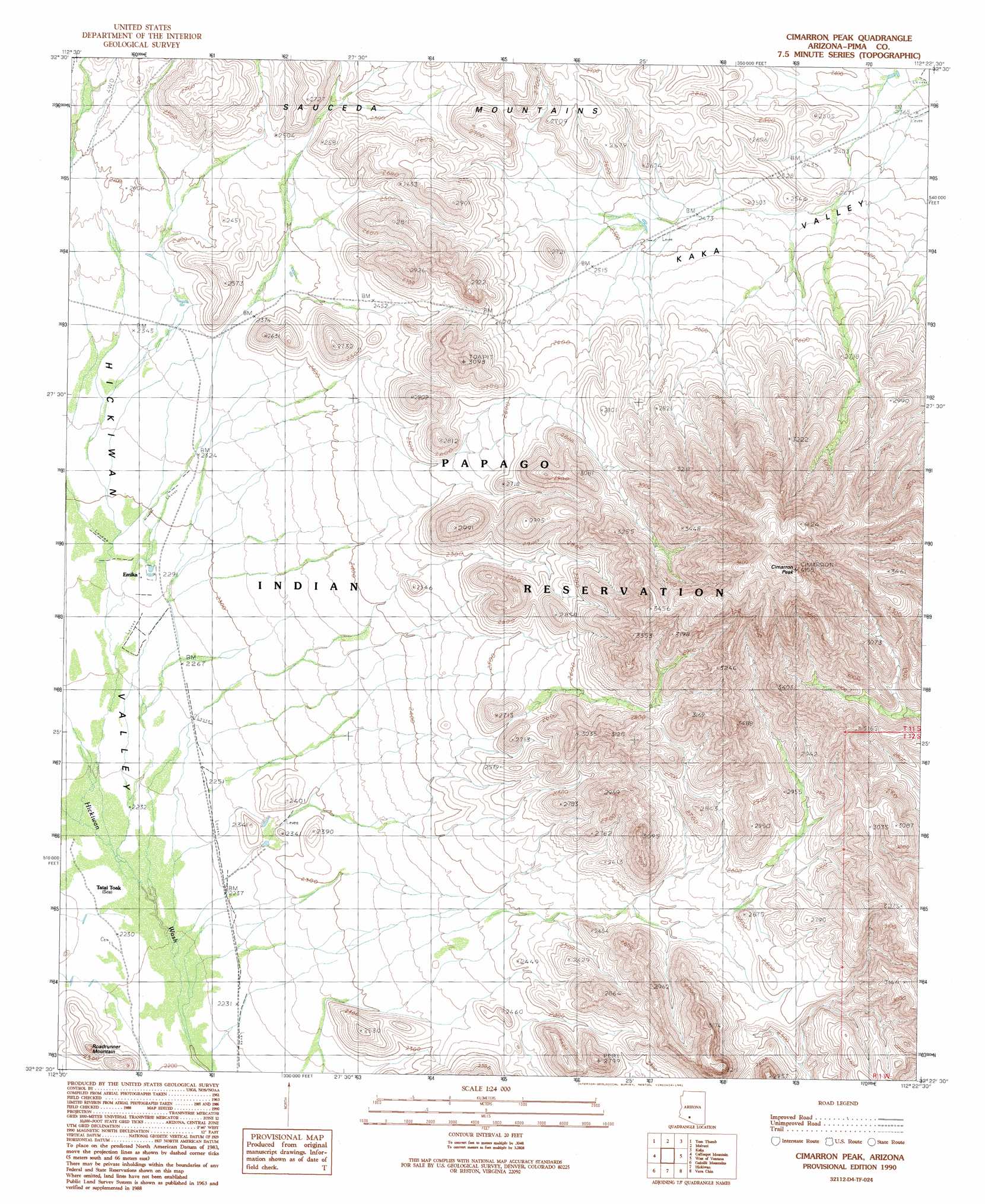
Cimarron Peak Topo Map Arizona
To zoom in, hover over the map of Cimarron Peak
USGS Topo Quad 32112d4 - 1:24,000 scale
| Topo Map Name: | Cimarron Peak |
| USGS Topo Quad ID: | 32112d4 |
| Print Size: | ca. 21 1/4" wide x 27" high |
| Southeast Coordinates: | 32.375° N latitude / 112.375° W longitude |
| Map Center Coordinates: | 32.4375° N latitude / 112.4375° W longitude |
| U.S. State: | AZ |
| Filename: | o32112d4.jpg |
| Download Map JPG Image: | Cimarron Peak topo map 1:24,000 scale |
| Map Type: | Topographic |
| Topo Series: | 7.5´ |
| Map Scale: | 1:24,000 |
| Source of Map Images: | United States Geological Survey (USGS) |
| Alternate Map Versions: |
Cimarron Peak AZ 1990, updated 1991 Download PDF Buy paper map Cimarron Peak AZ 1996, updated 2001 Download PDF Buy paper map Cimarron Peak AZ 2011 Download PDF Buy paper map Cimarron Peak AZ 2014 Download PDF Buy paper map |
1:24,000 Topo Quads surrounding Cimarron Peak
Hat Mountain |
Platt Well |
Kaka Nw |
Johnson Well |
Little Table Top |
Hat Mountain Sw |
Tom Thumb |
Moi Vaya |
Kaka |
Copperosity Hills |
Burro Gap |
Coffeepot Mountain |
Cimarron Peak |
West Of Ventana |
Ventana |
Sikort Chuapo |
Gakolik Mountains |
Hickiwan |
Vaya Chin |
Window Mountain |
Gunsight |
Hotason Vo |
West Of Wahak Hotrontk |
Wahak Hotrontk |
Maish Vaya |
> Back to 32112a1 at 1:100,000 scale
> Back to 32112a1 at 1:250,000 scale
> Back to U.S. Topo Maps home
Cimarron Peak topo map: Gazetteer
Cimarron Peak: Populated Places
Emika elevation 696m 2283′Tatai Toak elevation 683m 2240′
Cimarron Peak: Summits
Cimarron Peak elevation 1243m 4078′Roadrunner Mountain elevation 758m 2486′
Cimarron Peak digital topo map on disk
Buy this Cimarron Peak topo map showing relief, roads, GPS coordinates and other geographical features, as a high-resolution digital map file on DVD: