Hat Mountain Sw Topo Map Arizona
To zoom in, hover over the map of Hat Mountain Sw
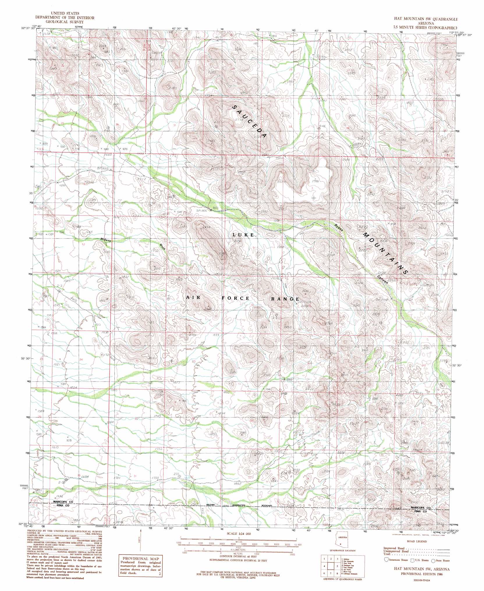
USGS Topo Quad 32112e6 - 1:24,000 scale
| Topo Map Name: | Hat Mountain Sw |
| USGS Topo Quad ID: | 32112e6 |
| Print Size: | ca. 21 1/4" wide x 27" high |
| Southeast Coordinates: | 32.5° N latitude / 112.625° W longitude |
| Map Center Coordinates: | 32.5625° N latitude / 112.6875° W longitude |
| U.S. State: | AZ |
| Filename: | o32112e6.jpg |
| Download Map JPG Image: | Hat Mountain Sw topo map 1:24,000 scale |
| Map Type: | Topographic |
| Topo Series: | 7.5´ |
| Map Scale: | 1:24,000 |
| Source of Map Images: | United States Geological Survey (USGS) |
| Alternate Map Versions: |
Hat Mountain SW AZ 1986, updated 1986 Download PDF Buy paper map Hat Mountain SW AZ 1996, updated 2003 Download PDF Buy paper map Hat Mountain SW AZ 2011 Download PDF Buy paper map Hat Mountain SW AZ 2014 Download PDF Buy paper map |
1:24,000 Topo Quads surrounding Hat Mountain Sw
South Of Theba |
Black Gap |
South Of Gila Bend |
Blue Plateau |
Big Horn |
Midway Nw |
Midway |
Hat Mountain |
Platt Well |
Kaka Nw |
Midway Sw |
Deadman Gap |
Hat Mountain Sw |
Tom Thumb |
Moi Vaya |
Childs Mountain |
Ajo North |
Burro Gap |
Coffeepot Mountain |
Cimarron Peak |
Chico Shunie |
Ajo South |
Sikort Chuapo |
Gakolik Mountains |
Hickiwan |
> Back to 32112e1 at 1:100,000 scale
> Back to 32112a1 at 1:250,000 scale
> Back to U.S. Topo Maps home
Hat Mountain Sw topo map: Gazetteer
Hat Mountain Sw: Ranges
Sauceda Mountains elevation 636m 2086′Hat Mountain Sw: Reservoirs
Javelina Tank elevation 549m 1801′Hat Mountain Sw digital topo map on disk
Buy this Hat Mountain Sw topo map showing relief, roads, GPS coordinates and other geographical features, as a high-resolution digital map file on DVD: