Midway Topo Map Arizona
To zoom in, hover over the map of Midway
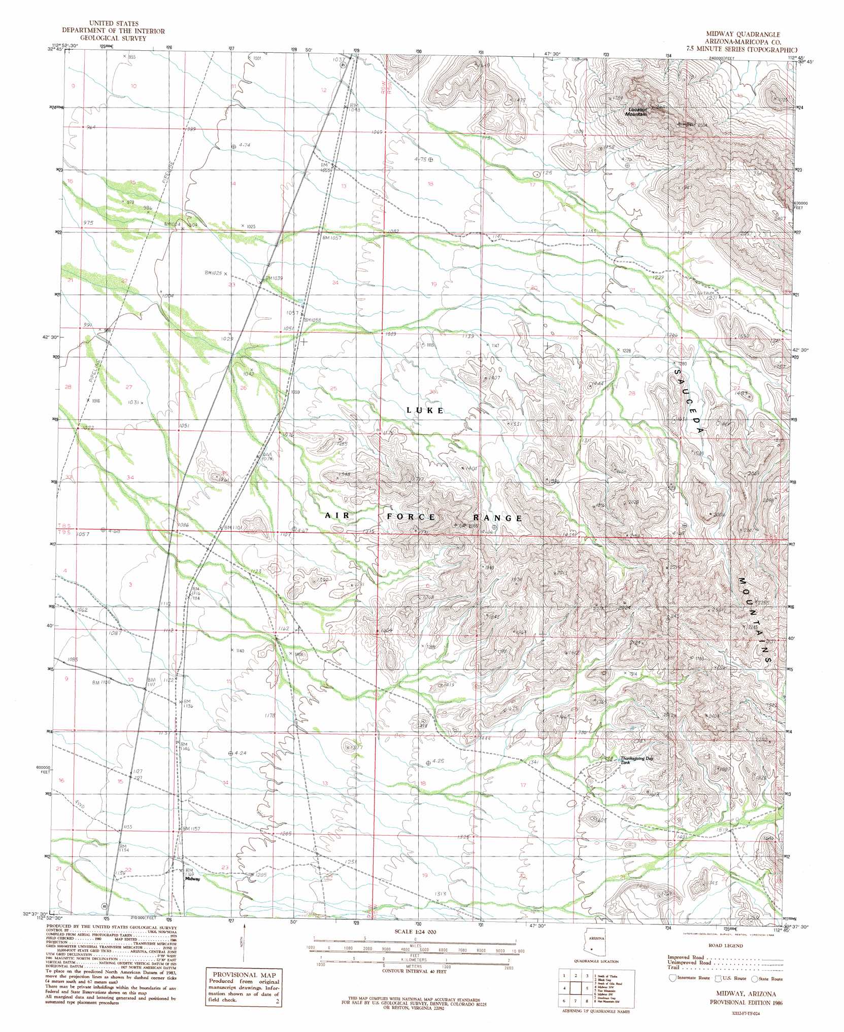
USGS Topo Quad 32112f7 - 1:24,000 scale
| Topo Map Name: | Midway |
| USGS Topo Quad ID: | 32112f7 |
| Print Size: | ca. 21 1/4" wide x 27" high |
| Southeast Coordinates: | 32.625° N latitude / 112.75° W longitude |
| Map Center Coordinates: | 32.6875° N latitude / 112.8125° W longitude |
| U.S. State: | AZ |
| Filename: | o32112f7.jpg |
| Download Map JPG Image: | Midway topo map 1:24,000 scale |
| Map Type: | Topographic |
| Topo Series: | 7.5´ |
| Map Scale: | 1:24,000 |
| Source of Map Images: | United States Geological Survey (USGS) |
| Alternate Map Versions: |
Midway AZ 1986, updated 1986 Download PDF Buy paper map Midway AZ 1996, updated 2000 Download PDF Buy paper map Midway AZ 2011 Download PDF Buy paper map Midway AZ 2014 Download PDF Buy paper map |
1:24,000 Topo Quads surrounding Midway
Sentinel Ne |
Theba |
Smurr |
Gila Bend |
Bosque |
Sentinel Se |
South Of Theba |
Black Gap |
South Of Gila Bend |
Blue Plateau |
Malpais Hill |
Midway Nw |
Midway |
Hat Mountain |
Platt Well |
East Pass |
Midway Sw |
Deadman Gap |
Hat Mountain Sw |
Tom Thumb |
Growler Peak |
Childs Mountain |
Ajo North |
Burro Gap |
Coffeepot Mountain |
> Back to 32112e1 at 1:100,000 scale
> Back to 32112a1 at 1:250,000 scale
> Back to U.S. Topo Maps home
Midway topo map: Gazetteer
Midway: Populated Places
Midway elevation 352m 1154′Midway: Reservoirs
Thanksgiving Day Tank elevation 440m 1443′Midway: Summits
Lookout Mountain elevation 811m 2660′Midway: Wells
Black Gap Well elevation 322m 1056′Midway digital topo map on disk
Buy this Midway topo map showing relief, roads, GPS coordinates and other geographical features, as a high-resolution digital map file on DVD: