Black Gap Topo Map Arizona
To zoom in, hover over the map of Black Gap
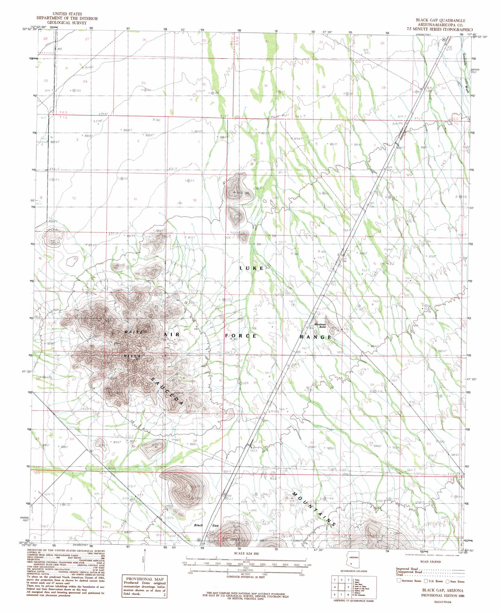
USGS Topo Quad 32112g7 - 1:24,000 scale
| Topo Map Name: | Black Gap |
| USGS Topo Quad ID: | 32112g7 |
| Print Size: | ca. 21 1/4" wide x 27" high |
| Southeast Coordinates: | 32.75° N latitude / 112.75° W longitude |
| Map Center Coordinates: | 32.8125° N latitude / 112.8125° W longitude |
| U.S. State: | AZ |
| Filename: | o32112g7.jpg |
| Download Map JPG Image: | Black Gap topo map 1:24,000 scale |
| Map Type: | Topographic |
| Topo Series: | 7.5´ |
| Map Scale: | 1:24,000 |
| Source of Map Images: | United States Geological Survey (USGS) |
| Alternate Map Versions: |
Black Gap AZ 1986, updated 1986 Download PDF Buy paper map Black Gap AZ 2011 Download PDF Buy paper map Black Gap AZ 2014 Download PDF Buy paper map |
1:24,000 Topo Quads surrounding Black Gap
Dendora Valley |
Citrus Valley West |
Citrus Valley East |
Cotton Center |
Cotton Center Se |
Sentinel Ne |
Theba |
Smurr |
Gila Bend |
Bosque |
Sentinel Se |
South Of Theba |
Black Gap |
South Of Gila Bend |
Blue Plateau |
Malpais Hill |
Midway Nw |
Midway |
Hat Mountain |
Platt Well |
East Pass |
Midway Sw |
Deadman Gap |
Hat Mountain Sw |
Tom Thumb |
> Back to 32112e1 at 1:100,000 scale
> Back to 32112a1 at 1:250,000 scale
> Back to U.S. Topo Maps home
Black Gap topo map: Gazetteer
Black Gap: Gaps
Black Gap elevation 312m 1023′Black Gap: Summits
Blindman Butte elevation 311m 1020′White Hills elevation 449m 1473′
Black Gap: Wells
Green Gate Well elevation 263m 862′Black Gap digital topo map on disk
Buy this Black Gap topo map showing relief, roads, GPS coordinates and other geographical features, as a high-resolution digital map file on DVD: