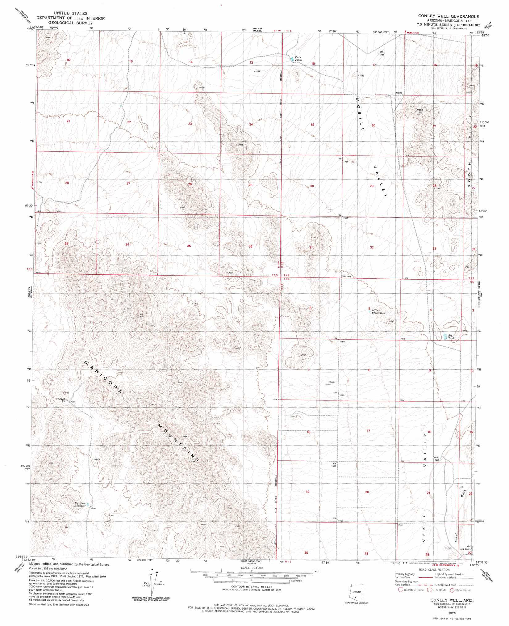
Conley Well Topo Map Arizona
To zoom in, hover over the map of Conley Well
USGS Topo Quad 32112h3 - 1:24,000 scale
| Topo Map Name: | Conley Well |
| USGS Topo Quad ID: | 32112h3 |
| Print Size: | ca. 21 1/4" wide x 27" high |
| Southeast Coordinates: | 32.875° N latitude / 112.25° W longitude |
| Map Center Coordinates: | 32.9375° N latitude / 112.3125° W longitude |
| U.S. State: | AZ |
| Filename: | o32112h3.jpg |
| Download Map JPG Image: | Conley Well topo map 1:24,000 scale |
| Map Type: | Topographic |
| Topo Series: | 7.5´ |
| Map Scale: | 1:24,000 |
| Source of Map Images: | United States Geological Survey (USGS) |
| Alternate Map Versions: |
Conley Well AZ 1979, updated 1980 Download PDF Buy paper map Conley Well AZ 2011 Download PDF Buy paper map Conley Well AZ 2014 Download PDF Buy paper map |
1:24,000 Topo Quads surrounding Conley Well
Margies Peak |
Mobile Nw |
Mobile Ne |
Montezuma Peak |
Pima Butte |
Cotton Center Se |
Butterfield Pass |
Mobile |
Enid |
Maricopa |
Bosque |
Estrella |
Conley Well |
Haley Hills |
Antelope Peak Ne |
Blue Plateau |
Big Horn |
Lost Horse Peak |
Antelope Peak |
Indian Butte |
Platt Well |
Kaka Nw |
Johnson Well |
Little Table Top |
Vekol Mountains Ne |
> Back to 32112e1 at 1:100,000 scale
> Back to 32112a1 at 1:250,000 scale
> Back to U.S. Topo Maps home
Conley Well topo map: Gazetteer
Conley Well: Airports
Flying Bucket Ranch Airport elevation 455m 1492′Serene Field elevation 442m 1450′
Walter Ranch Airport elevation 497m 1630′
Conley Well digital topo map on disk
Buy this Conley Well topo map showing relief, roads, GPS coordinates and other geographical features, as a high-resolution digital map file on DVD: