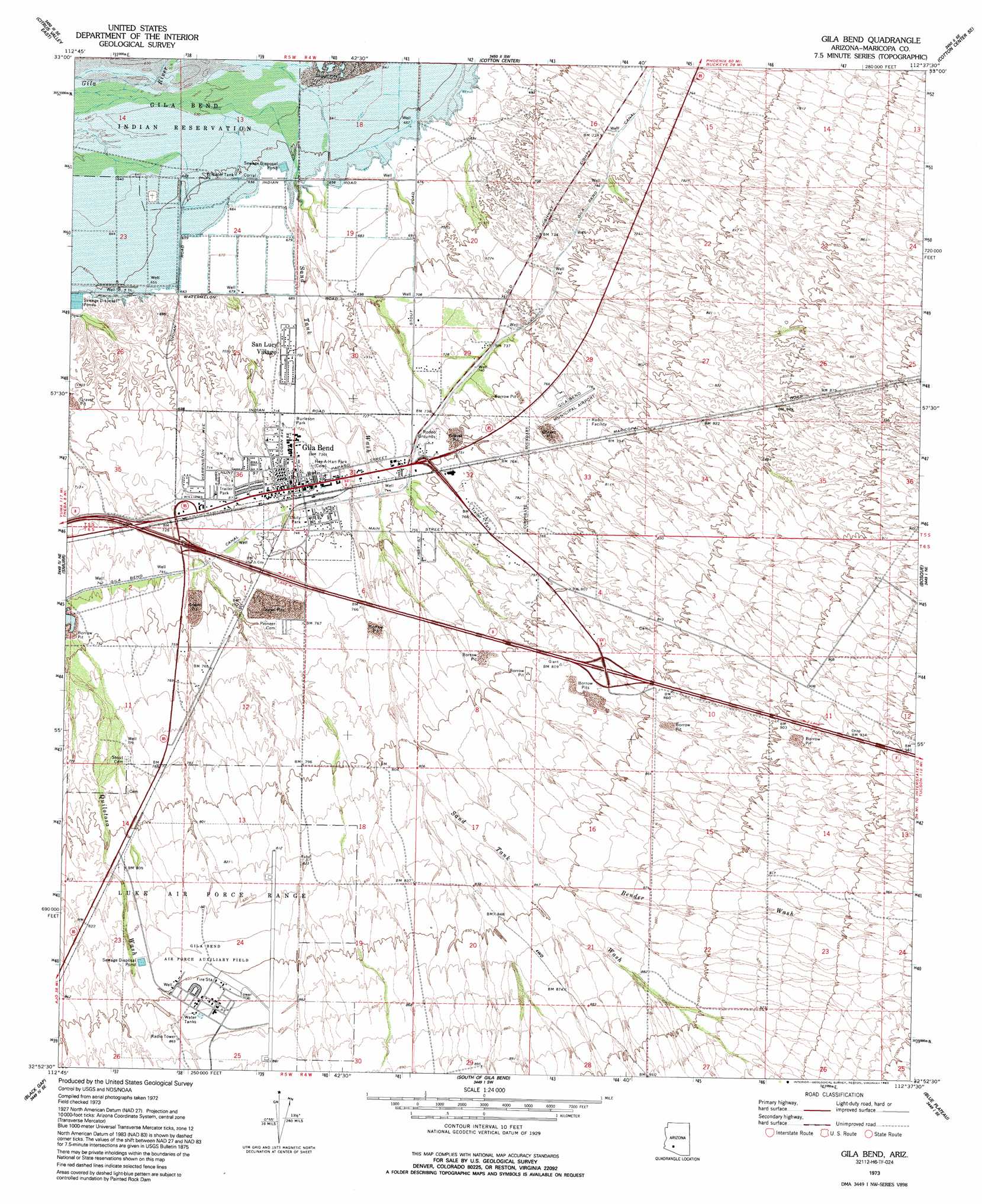
Gila Bend Topo Map Arizona
To zoom in, hover over the map of Gila Bend
USGS Topo Quad 32112h6 - 1:24,000 scale
| Topo Map Name: | Gila Bend |
| USGS Topo Quad ID: | 32112h6 |
| Print Size: | ca. 21 1/4" wide x 27" high |
| Southeast Coordinates: | 32.875° N latitude / 112.625° W longitude |
| Map Center Coordinates: | 32.9375° N latitude / 112.6875° W longitude |
| U.S. State: | AZ |
| Filename: | o32112h6.jpg |
| Download Map JPG Image: | Gila Bend topo map 1:24,000 scale |
| Map Type: | Topographic |
| Topo Series: | 7.5´ |
| Map Scale: | 1:24,000 |
| Source of Map Images: | United States Geological Survey (USGS) |
| Alternate Map Versions: |
Gila Bend AZ 1973, updated 1976 Download PDF Buy paper map Gila Bend AZ 1973, updated 1983 Download PDF Buy paper map Gila Bend AZ 2011 Download PDF Buy paper map Gila Bend AZ 2014 Download PDF Buy paper map |
1:24,000 Topo Quads surrounding Gila Bend
Woolsey Peak |
Spring Mountain |
Cotton Center Nw |
Margies Peak |
Mobile Nw |
Citrus Valley West |
Citrus Valley East |
Cotton Center |
Cotton Center Se |
Butterfield Pass |
Theba |
Smurr |
Gila Bend |
Bosque |
Estrella |
South Of Theba |
Black Gap |
South Of Gila Bend |
Blue Plateau |
Big Horn |
Midway Nw |
Midway |
Hat Mountain |
Platt Well |
Kaka Nw |
> Back to 32112e1 at 1:100,000 scale
> Back to 32112a1 at 1:250,000 scale
> Back to U.S. Topo Maps home
Gila Bend topo map: Gazetteer
Gila Bend: Airports
Gila Bend Municipal Airport elevation 236m 774′Hunts Airport elevation 224m 734′
Gila Bend: Flats
Burleson Park elevation 220m 721′Unity Park elevation 226m 741′
Gila Bend: Parks
Gatlin Site elevation 206m 675′Gila Bend: Plains
Sonoran Desert elevation 260m 853′Gila Bend: Populated Places
Gila Bend elevation 224m 734′San Lucy Village elevation 0m 0′
Sil Murk (historical) elevation 201m 659′
Gila Bend: Post Offices
Gila Bend Post Office elevation 224m 734′Gila Bend: Streams
Bender Wash elevation 241m 790′Sand Tank Wash elevation 0m 0′
Gila Bend digital topo map on disk
Buy this Gila Bend topo map showing relief, roads, GPS coordinates and other geographical features, as a high-resolution digital map file on DVD: