Agua Dulce Mountains Topo Map Arizona
To zoom in, hover over the map of Agua Dulce Mountains
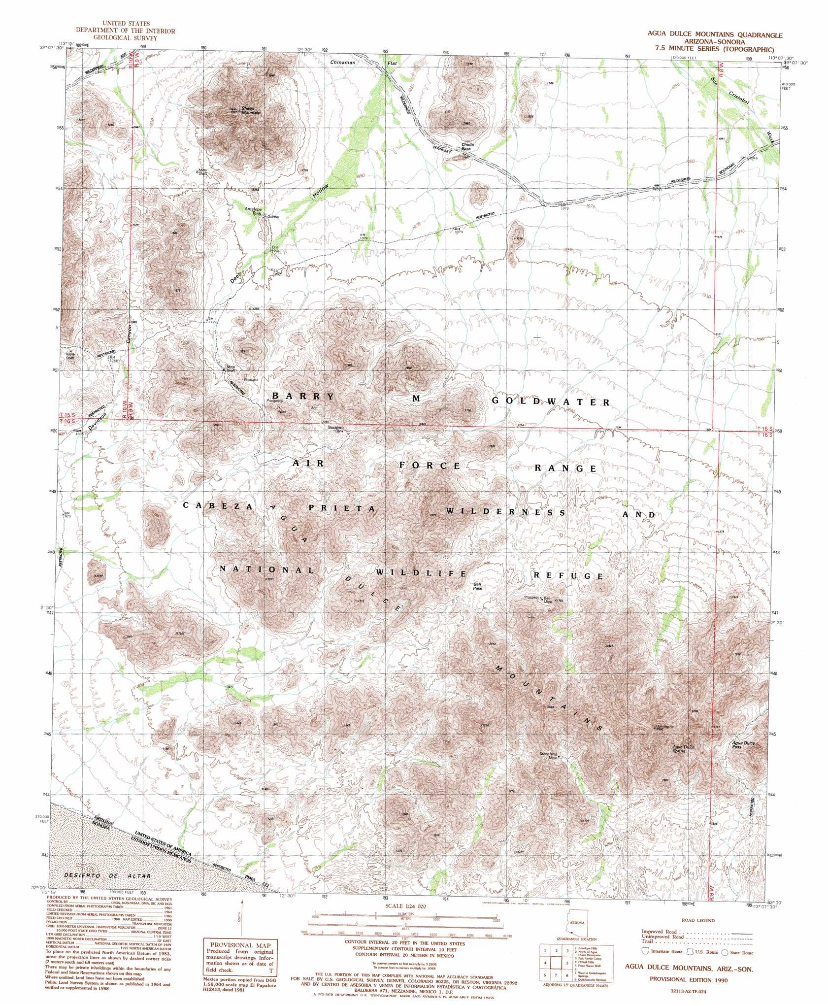
USGS Topo Quad 32113a2 - 1:24,000 scale
| Topo Map Name: | Agua Dulce Mountains |
| USGS Topo Quad ID: | 32113a2 |
| Print Size: | ca. 21 1/4" wide x 27" high |
| Southeast Coordinates: | 32° N latitude / 113.125° W longitude |
| Map Center Coordinates: | 32.0625° N latitude / 113.1875° W longitude |
| U.S. State: | AZ |
| Filename: | o32113a2.jpg |
| Download Map JPG Image: | Agua Dulce Mountains topo map 1:24,000 scale |
| Map Type: | Topographic |
| Topo Series: | 7.5´ |
| Map Scale: | 1:24,000 |
| Source of Map Images: | United States Geological Survey (USGS) |
| Alternate Map Versions: |
Agua Dulce Mountains AZ 1990, updated 1990 Download PDF Buy paper map Agua Dulce Mountains AZ 1996, updated 2000 Download PDF Buy paper map Agua Dulce Mountains AZ 2011 Download PDF Buy paper map Agua Dulce Mountains AZ 2014 Download PDF Buy paper map |
1:24,000 Topo Quads surrounding Agua Dulce Mountains
Bryan Mountains |
Granite Mountains South |
Saguaro Gap Well |
Temporal Pass |
Chico Shunie |
Pinta Playa |
Antelope Hills |
North Of Agua Dulce Mountains |
Palo Verde Camp |
Bates Well |
Las Playas |
O'Neill Hills |
Agua Dulce Mountains |
Pozo Nuevo Well |
Kino Peak |
West Of Quitobaquito Springs |
Quitobaquito Springs |
West Of Lukeville |
||
> Back to 32113a1 at 1:100,000 scale
> Back to 32112a1 at 1:250,000 scale
> Back to U.S. Topo Maps home
Agua Dulce Mountains topo map: Gazetteer
Agua Dulce Mountains: Flats
Chinaman Flat elevation 312m 1023′Agua Dulce Mountains: Gaps
Agua Dulce Pass elevation 501m 1643′Cholla Pass elevation 323m 1059′
Agua Dulce Mountains: Mines
Bell Mine elevation 459m 1505′Agua Dulce Mountains: Reservoirs
Antelope Tank elevation 329m 1079′Bassarisc Tank elevation 397m 1302′
Agua Dulce Mountains: Springs
Agua Dulce Spring elevation 639m 2096′Agua Dulce Mountains: Summits
Agua Dulce Mountains elevation 520m 1706′Sheep Mountain elevation 0m 0′
Agua Dulce Mountains digital topo map on disk
Buy this Agua Dulce Mountains topo map showing relief, roads, GPS coordinates and other geographical features, as a high-resolution digital map file on DVD: