Christmas Pass Topo Map Arizona
To zoom in, hover over the map of Christmas Pass
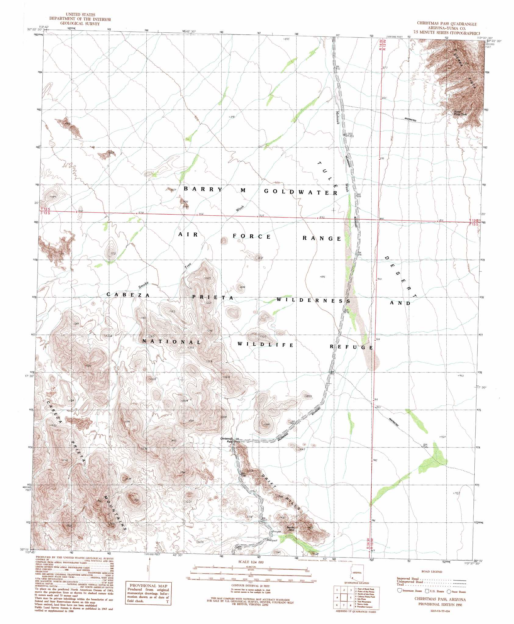
USGS Topo Quad 32113c6 - 1:24,000 scale
| Topo Map Name: | Christmas Pass |
| USGS Topo Quad ID: | 32113c6 |
| Print Size: | ca. 21 1/4" wide x 27" high |
| Southeast Coordinates: | 32.25° N latitude / 113.625° W longitude |
| Map Center Coordinates: | 32.3125° N latitude / 113.6875° W longitude |
| U.S. State: | AZ |
| Filename: | o32113c6.jpg |
| Download Map JPG Image: | Christmas Pass topo map 1:24,000 scale |
| Map Type: | Topographic |
| Topo Series: | 7.5´ |
| Map Scale: | 1:24,000 |
| Source of Map Images: | United States Geological Survey (USGS) |
| Alternate Map Versions: |
Christmas Pass AZ 1990, updated 1991 Download PDF Buy paper map Christmas Pass AZ 2011 Download PDF Buy paper map Christmas Pass AZ 2014 Download PDF Buy paper map |
1:24,000 Topo Quads surrounding Christmas Pass
Mohawk Sw |
Mohawk Se |
Mohawk Mountains Sw |
Mohawk Mountains Se |
Aguila Mountains Sw |
Buck Peak |
East Of Buck Peak |
Point Of The Pintas |
North Of Isla Pinta |
Monreal Well |
Coyote Water |
Cabeza Prieta Peak |
Christmas Pass |
Isla Pinta |
Bryan Mountains |
Sierra De La Lechuguilla |
Tule Mountains |
Sierra Arida |
Paradise Canyon |
Pinta Playa |
Monument Bluff |
Las Playas |
> Back to 32113a1 at 1:100,000 scale
> Back to 32112a1 at 1:250,000 scale
> Back to U.S. Topo Maps home
Christmas Pass topo map: Gazetteer
Christmas Pass: Gaps
Christmas Pass elevation 308m 1010′Christmas Pass: Plains
Tule Desert elevation 285m 935′Christmas Pass: Reservoirs
North Pinta Tank elevation 314m 1030′Senita Tank elevation 0m 0′
Christmas Pass: Ridges
Drift Hills elevation 315m 1033′Christmas Pass: Streams
Smoke Tree Wash elevation 264m 866′Christmas Pass digital topo map on disk
Buy this Christmas Pass topo map showing relief, roads, GPS coordinates and other geographical features, as a high-resolution digital map file on DVD: