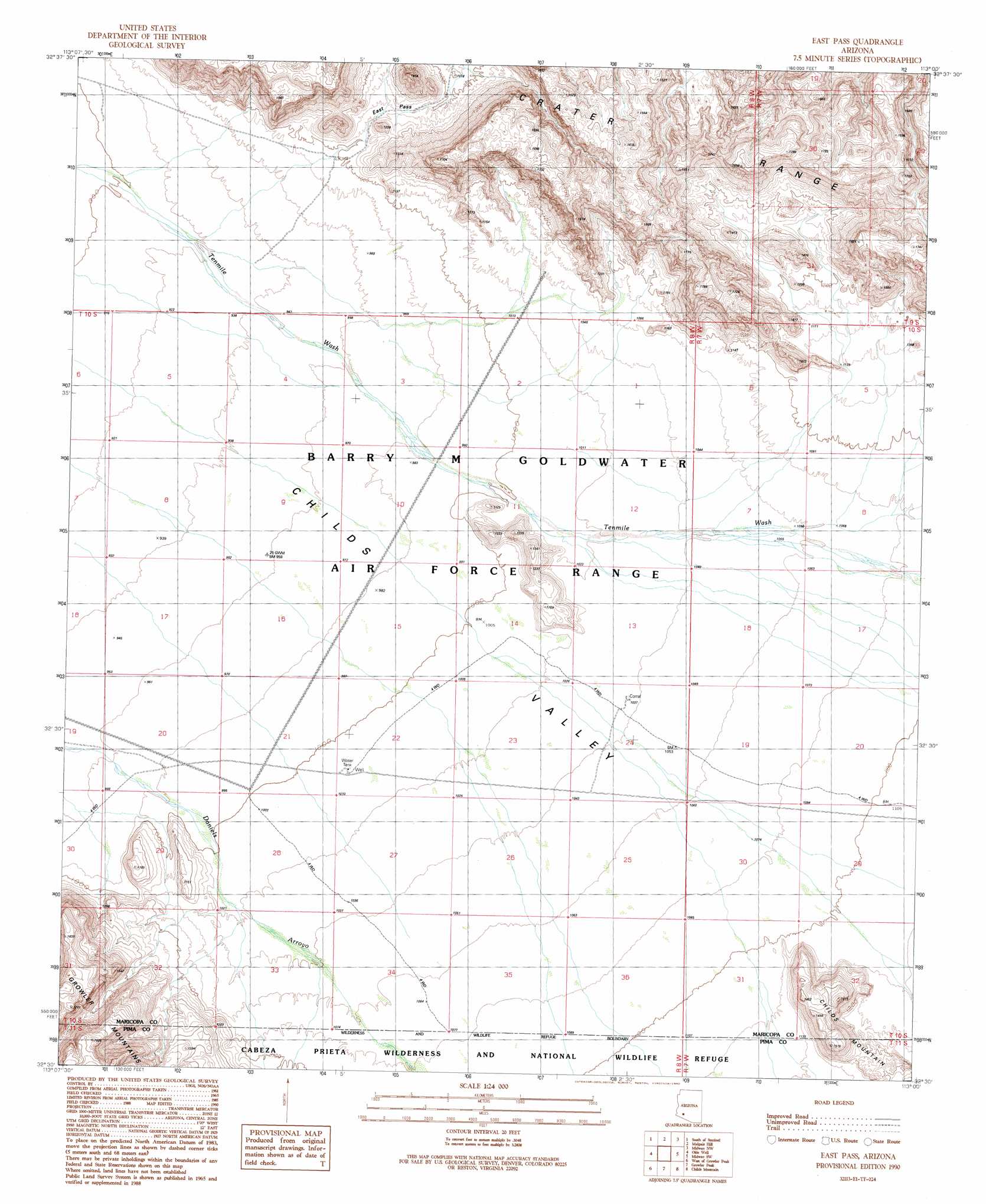
East Pass Topo Map Arizona
To zoom in, hover over the map of East Pass
USGS Topo Quad 32113e1 - 1:24,000 scale
| Topo Map Name: | East Pass |
| USGS Topo Quad ID: | 32113e1 |
| Print Size: | ca. 21 1/4" wide x 27" high |
| Southeast Coordinates: | 32.5° N latitude / 113° W longitude |
| Map Center Coordinates: | 32.5625° N latitude / 113.0625° W longitude |
| U.S. State: | AZ |
| Filename: | o32113e1.jpg |
| Download Map JPG Image: | East Pass topo map 1:24,000 scale |
| Map Type: | Topographic |
| Topo Series: | 7.5´ |
| Map Scale: | 1:24,000 |
| Source of Map Images: | United States Geological Survey (USGS) |
| Alternate Map Versions: |
East Pass AZ 1990, updated 1990 Download PDF Buy paper map East Pass AZ 1996, updated 2000 Download PDF Buy paper map East Pass AZ 2011 Download PDF Buy paper map East Pass AZ 2014 Download PDF Buy paper map |
1:24,000 Topo Quads surrounding East Pass
Aztec Se |
Sentinel |
Sentinel Se |
South Of Theba |
Black Gap |
Aguila Mountains Ne |
South Of Sentinel |
Malpais Hill |
Midway Nw |
Midway |
Aguila Mountains Se |
Okie Well |
East Pass |
Midway Sw |
Deadman Gap |
Granite Mountains North |
West Of Growler Peak |
Growler Peak |
Childs Mountain |
Ajo North |
Granite Mountains South |
Saguaro Gap Well |
Temporal Pass |
Chico Shunie |
Ajo South |
> Back to 32113e1 at 1:100,000 scale
> Back to 32112a1 at 1:250,000 scale
> Back to U.S. Topo Maps home
East Pass digital topo map on disk
Buy this East Pass topo map showing relief, roads, GPS coordinates and other geographical features, as a high-resolution digital map file on DVD: