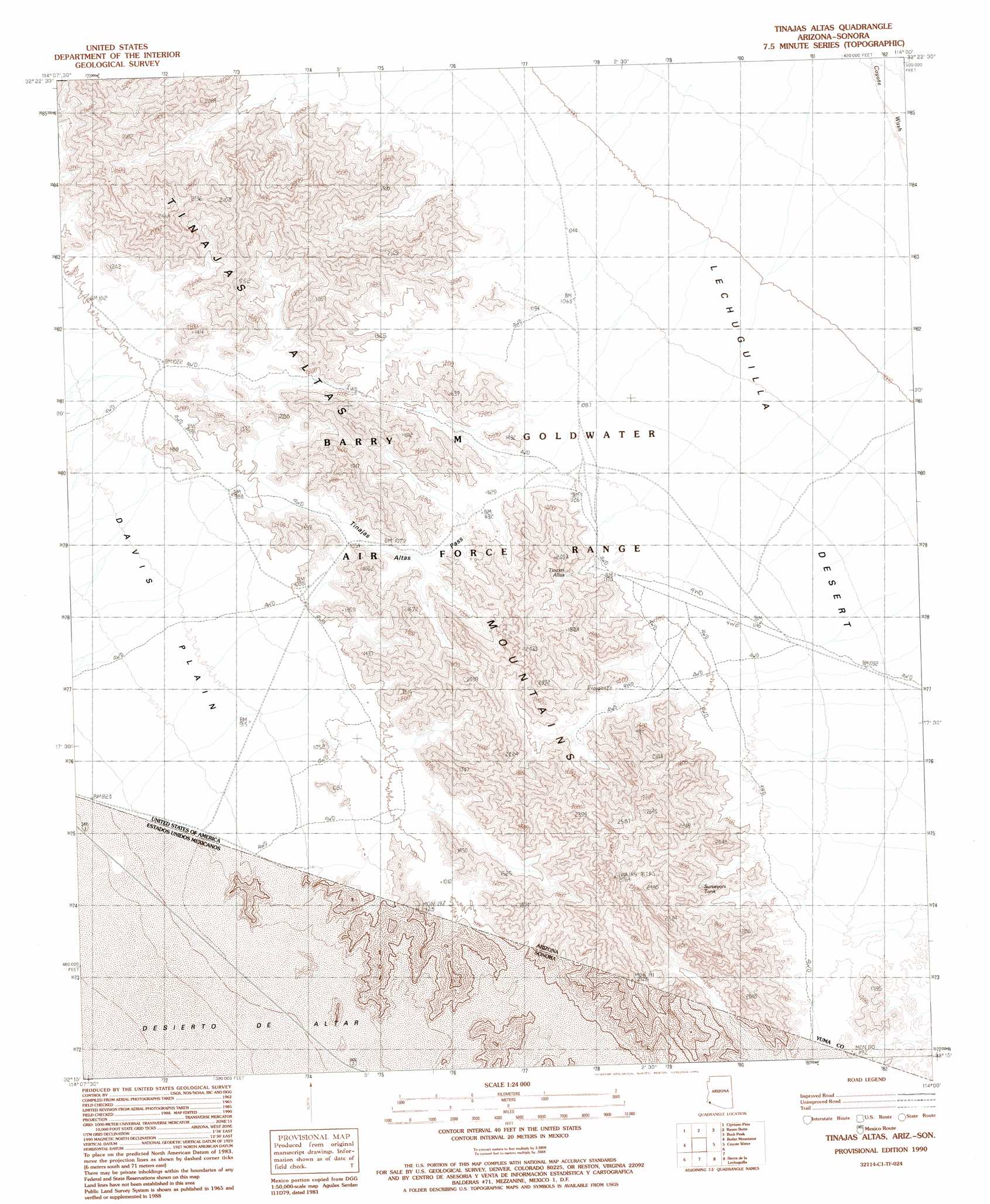
Tinajas Altas Topo Map Arizona
To zoom in, hover over the map of Tinajas Altas
USGS Topo Quad 32114c1 - 1:24,000 scale
| Topo Map Name: | Tinajas Altas |
| USGS Topo Quad ID: | 32114c1 |
| Print Size: | ca. 21 1/4" wide x 27" high |
| Southeast Coordinates: | 32.25° N latitude / 114° W longitude |
| Map Center Coordinates: | 32.3125° N latitude / 114.0625° W longitude |
| U.S. State: | AZ |
| Filename: | o32114c1.jpg |
| Download Map JPG Image: | Tinajas Altas topo map 1:24,000 scale |
| Map Type: | Topographic |
| Topo Series: | 7.5´ |
| Map Scale: | 1:24,000 |
| Source of Map Images: | United States Geological Survey (USGS) |
| Alternate Map Versions: |
Tinajas Altas AZ 1990, updated 1991 Download PDF Buy paper map Tinajas Altas AZ 1996, updated 2002 Download PDF Buy paper map Tinajas Altas AZ 2011 Download PDF Buy paper map Tinajas Altas AZ 2014 Download PDF Buy paper map |
1:24,000 Topo Quads surrounding Tinajas Altas
Fortuna Mine |
Wellton Hills |
Wellton Se |
Mohawk Sw |
Mohawk Se |
Vopoki Ridge |
Cipriano Pass |
Raven Butte |
Buck Peak |
East Of Buck Peak |
Vopoki Ridge Se |
Butler Mountains |
Tinajas Altas |
Coyote Water |
Cabeza Prieta Peak |
Sierra De La Lechuguilla |
Tule Mountains |
|||
> Back to 32114a1 at 1:100,000 scale
> Back to 32114a1 at 1:250,000 scale
> Back to U.S. Topo Maps home
Tinajas Altas topo map: Gazetteer
Tinajas Altas: Falls
Tinajas Altas elevation 434m 1423′Tinajas Altas: Gaps
Tinajas Altas Pass elevation 338m 1108′Tinajas Altas: Ranges
Tinajas Altas Mountains elevation 603m 1978′Tinajas Altas: Reservoirs
Surveyors Tank elevation 406m 1332′Tinajas Altas digital topo map on disk
Buy this Tinajas Altas topo map showing relief, roads, GPS coordinates and other geographical features, as a high-resolution digital map file on DVD: