Vopoki Ridge Topo Map Arizona
To zoom in, hover over the map of Vopoki Ridge
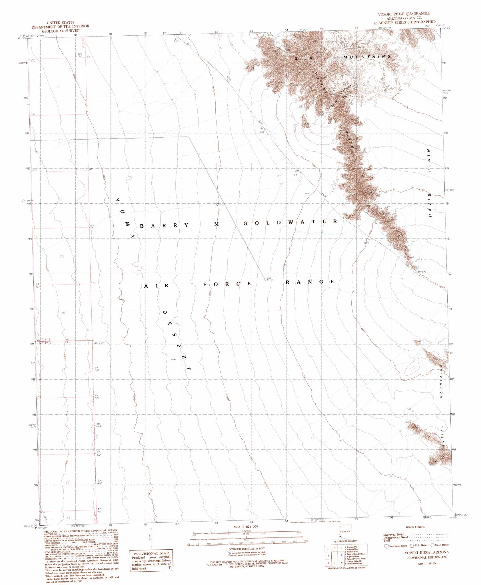
USGS Topo Quad 32114d3 - 1:24,000 scale
| Topo Map Name: | Vopoki Ridge |
| USGS Topo Quad ID: | 32114d3 |
| Print Size: | ca. 21 1/4" wide x 27" high |
| Southeast Coordinates: | 32.375° N latitude / 114.25° W longitude |
| Map Center Coordinates: | 32.4375° N latitude / 114.3125° W longitude |
| U.S. State: | AZ |
| Filename: | o32114d3.jpg |
| Download Map JPG Image: | Vopoki Ridge topo map 1:24,000 scale |
| Map Type: | Topographic |
| Topo Series: | 7.5´ |
| Map Scale: | 1:24,000 |
| Source of Map Images: | United States Geological Survey (USGS) |
| Alternate Map Versions: |
Vopoki Ridge AZ 1990, updated 1991 Download PDF Buy paper map Vopoki Ridge AZ 2011 Download PDF Buy paper map Vopoki Ridge AZ 2014 Download PDF Buy paper map |
1:24,000 Topo Quads surrounding Vopoki Ridge
Yuma East |
Fortuna |
Ligurta |
Wellton |
Wellton Mesa |
Yuma Se |
Fortuna Sw |
Fortuna Mine |
Wellton Hills |
Wellton Se |
Southeast Of Somerton |
West Of Vopoki Ridge |
Vopoki Ridge |
Cipriano Pass |
Raven Butte |
Vopoki Ridge Se |
Butler Mountains |
Tinajas Altas |
||
> Back to 32114a1 at 1:100,000 scale
> Back to 32114a1 at 1:250,000 scale
> Back to U.S. Topo Maps home
Vopoki Ridge topo map: Gazetteer
Vopoki Ridge: Plains
Davis Plain elevation 403m 1322′Vopoki Ridge: Reservoirs
Spook Tank elevation 309m 1013′Vopoki Ridge: Ridges
Vopoki Ridge elevation 407m 1335′Vopoki Ridge: Valleys
Spook Canyon elevation 239m 784′Vopoki Ridge digital topo map on disk
Buy this Vopoki Ridge topo map showing relief, roads, GPS coordinates and other geographical features, as a high-resolution digital map file on DVD: