Wellton Hills Topo Map Arizona
To zoom in, hover over the map of Wellton Hills
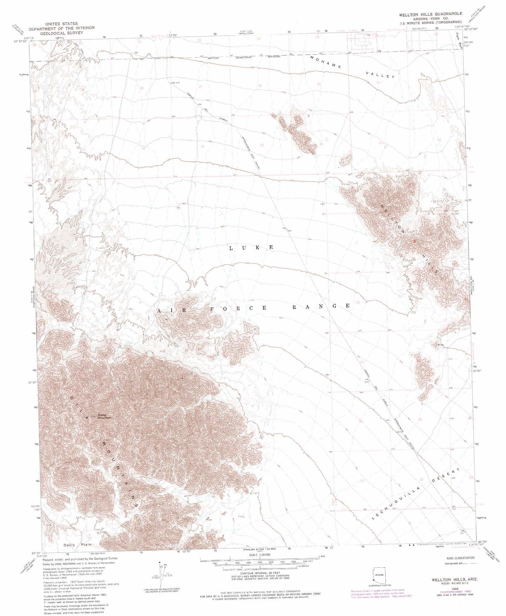
USGS Topo Quad 32114e2 - 1:24,000 scale
| Topo Map Name: | Wellton Hills |
| USGS Topo Quad ID: | 32114e2 |
| Print Size: | ca. 21 1/4" wide x 27" high |
| Southeast Coordinates: | 32.5° N latitude / 114.125° W longitude |
| Map Center Coordinates: | 32.5625° N latitude / 114.1875° W longitude |
| U.S. State: | AZ |
| Filename: | o32114e2.jpg |
| Download Map JPG Image: | Wellton Hills topo map 1:24,000 scale |
| Map Type: | Topographic |
| Topo Series: | 7.5´ |
| Map Scale: | 1:24,000 |
| Source of Map Images: | United States Geological Survey (USGS) |
| Alternate Map Versions: |
Wellton Hills AZ 1965, updated 1966 Download PDF Buy paper map Wellton Hills AZ 1965, updated 1982 Download PDF Buy paper map Wellton Hills AZ 2011 Download PDF Buy paper map Wellton Hills AZ 2014 Download PDF Buy paper map |
1:24,000 Topo Quads surrounding Wellton Hills
Laguna Dam |
Dome |
Red Bluff Mountain West |
Red Bluff Mountain East |
Roll |
Fortuna |
Ligurta |
Wellton |
Wellton Mesa |
Tacna |
Fortuna Sw |
Fortuna Mine |
Wellton Hills |
Wellton Se |
Mohawk Sw |
West Of Vopoki Ridge |
Vopoki Ridge |
Cipriano Pass |
Raven Butte |
Buck Peak |
Vopoki Ridge Se |
Butler Mountains |
Tinajas Altas |
Coyote Water |
> Back to 32114e1 at 1:100,000 scale
> Back to 32114a1 at 1:250,000 scale
> Back to U.S. Topo Maps home
Wellton Hills topo map: Gazetteer
Wellton Hills: Mines
Draghi Mine elevation 227m 744′Northern Mine elevation 140m 459′
Wellton Hills: Summits
Sheep Mountain elevation 0m 0′Wellton Hills digital topo map on disk
Buy this Wellton Hills topo map showing relief, roads, GPS coordinates and other geographical features, as a high-resolution digital map file on DVD: