Fortuna Mine Topo Map Arizona
To zoom in, hover over the map of Fortuna Mine
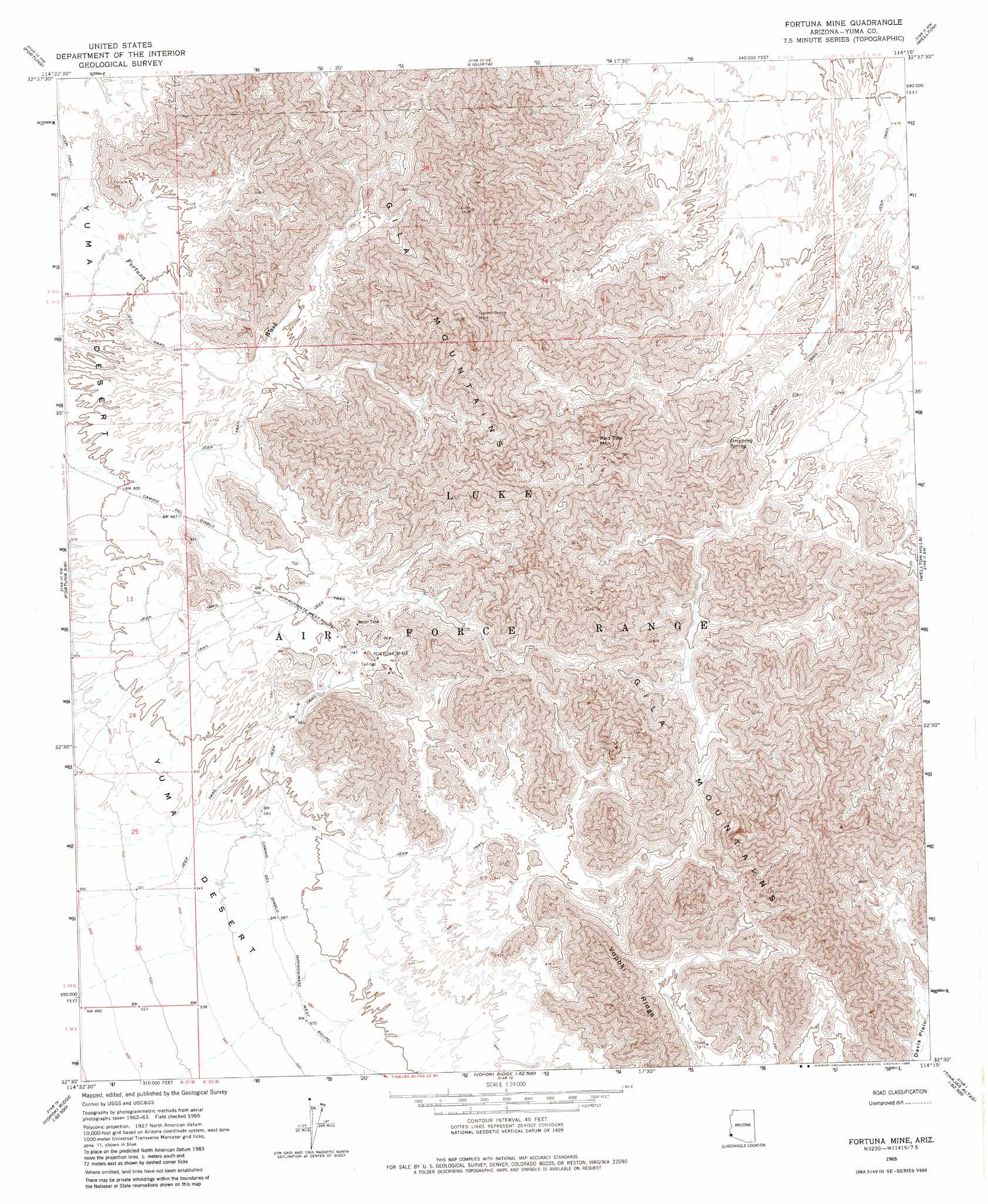
USGS Topo Quad 32114e3 - 1:24,000 scale
| Topo Map Name: | Fortuna Mine |
| USGS Topo Quad ID: | 32114e3 |
| Print Size: | ca. 21 1/4" wide x 27" high |
| Southeast Coordinates: | 32.5° N latitude / 114.25° W longitude |
| Map Center Coordinates: | 32.5625° N latitude / 114.3125° W longitude |
| U.S. State: | AZ |
| Filename: | o32114e3.jpg |
| Download Map JPG Image: | Fortuna Mine topo map 1:24,000 scale |
| Map Type: | Topographic |
| Topo Series: | 7.5´ |
| Map Scale: | 1:24,000 |
| Source of Map Images: | United States Geological Survey (USGS) |
| Alternate Map Versions: |
Fortuna Mine AZ 1965, updated 1966 Download PDF Buy paper map Fortuna Mine AZ 1965, updated 1980 Download PDF Buy paper map Fortuna Mine AZ 2011 Download PDF Buy paper map Fortuna Mine AZ 2014 Download PDF Buy paper map |
1:24,000 Topo Quads surrounding Fortuna Mine
Bard |
Laguna Dam |
Dome |
Red Bluff Mountain West |
Red Bluff Mountain East |
Yuma East |
Fortuna |
Ligurta |
Wellton |
Wellton Mesa |
Yuma Se |
Fortuna Sw |
Fortuna Mine |
Wellton Hills |
Wellton Se |
Southeast Of Somerton |
West Of Vopoki Ridge |
Vopoki Ridge |
Cipriano Pass |
Raven Butte |
Vopoki Ridge Se |
Butler Mountains |
Tinajas Altas |
> Back to 32114e1 at 1:100,000 scale
> Back to 32114a1 at 1:250,000 scale
> Back to U.S. Topo Maps home
Fortuna Mine topo map: Gazetteer
Fortuna Mine: Mines
Black Butte Mine elevation 774m 2539′Fortuna Mine elevation 241m 790′
Golden Dream Mine elevation 736m 2414′
Mica Mine elevation 383m 1256′
Fortuna Mine: Ranges
Gila Mountains elevation 832m 2729′Fortuna Mine: Springs
Dripping Spring elevation 246m 807′Fortuna Mine: Summits
Red Top Mountain elevation 643m 2109′Fortuna Mine digital topo map on disk
Buy this Fortuna Mine topo map showing relief, roads, GPS coordinates and other geographical features, as a high-resolution digital map file on DVD: