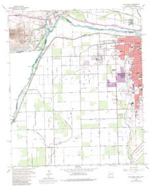
Yuma West Topo Map Arizona
To zoom in, hover over the map of Yuma West
USGS Topo Quad 32114f6 - 1:24,000 scale
| Topo Map Name: | Yuma West |
| USGS Topo Quad ID: | 32114f6 |
| Print Size: | ca. 21 1/4" wide x 27" high |
| Southeast Coordinates: | 32.625° N latitude / 114.625° W longitude |
| Map Center Coordinates: | 32.6875° N latitude / 114.6875° W longitude |
| U.S. States: | AZ, CA |
| Filename: | o32114f6.jpg |
| Download Map JPG Image: | Yuma West topo map 1:24,000 scale |
| Map Type: | Topographic |
| Topo Series: | 7.5´ |
| Map Scale: | 1:24,000 |
| Source of Map Images: | United States Geological Survey (USGS) |
| Alternate Map Versions: |
Yuma West AZ 1952, updated 1953 Download PDF Buy paper map Yuma West AZ 1965, updated 1966 Download PDF Buy paper map Yuma West AZ 1965, updated 1975 Download PDF Buy paper map Yuma West AZ 1965, updated 1979 Download PDF Buy paper map Yuma West AZ 1965, updated 1979 Download PDF Buy paper map Yuma West AZ 1997, updated 2003 Download PDF Buy paper map Yuma West AZ 2011 Download PDF Buy paper map Yuma West AZ 2014 Download PDF Buy paper map |
1:24,000 Topo Quads surrounding Yuma West
> Back to 32114e1 at 1:100,000 scale
> Back to 32114a1 at 1:250,000 scale
> Back to U.S. Topo Maps home
Yuma West topo map: Gazetteer
Yuma West: Airports
Yuma Regional Medical Center Heliport elevation 56m 183′Yuma West: Canals
Alamo Canal elevation 37m 121′Arnold Lateral elevation 33m 108′
Auxiliary Supply Canal elevation 40m 131′
Baker Lateral elevation 34m 111′
Central Canal elevation 33m 108′
Central Drain elevation 36m 118′
Central Stub Number One elevation 36m 118′
Central Stub Number Two Drain elevation 36m 118′
Cloyd Lateral elevation 37m 121′
Cooper Lateral elevation 36m 118′
Daniel Lateral elevation 31m 101′
Donovan Lateral elevation 36m 118′
East Central Drain elevation 35m 114′
East Drain elevation 35m 114′
East Drain Extension elevation 37m 121′
East Main Canal elevation 43m 141′
Flint Lateral elevation 34m 111′
Gardenhire Drain elevation 36m 118′
George Lateral elevation 34m 111′
Gibson Lateral elevation 36m 118′
Gilbert Lateral elevation 36m 118′
Greer Lateral elevation 36m 118′
Hanna Lateral elevation 36m 118′
Harmon Lateral elevation 37m 121′
Haupt Lateral elevation 38m 124′
Hayden Lateral elevation 34m 111′
Howe Lateral elevation 34m 111′
Jordan Lateral elevation 37m 121′
Kent Lateral elevation 39m 127′
Lawler Lateral elevation 38m 124′
Livingston Lateral elevation 34m 111′
Lorona Lateral elevation 34m 111′
Main Drain Extension elevation 36m 118′
Main Outlet Drain elevation 39m 127′
Marble Lateral elevation 39m 127′
Martin Lateral elevation 36m 118′
Maxey Lateral elevation 38m 124′
Miller Lateral elevation 35m 114′
Modest Lateral elevation 36m 118′
North Drain elevation 31m 101′
Northwest Drain elevation 36m 118′
Nugent Lateral elevation 36m 118′
Pancrazi Lateral elevation 34m 111′
Patterson Lateral elevation 37m 121′
Potter Lateral elevation 32m 104′
Potter Lateral elevation 34m 111′
Rose Lateral elevation 38m 124′
Sioux Lateral elevation 42m 137′
Stofella Lateral elevation 36m 118′
Thacker Lateral elevation 37m 121′
West Main Canal elevation 36m 118′
Winsor Lateral elevation 36m 118′
Yakima Lateral elevation 39m 127′
Yarwood Lateral elevation 36m 118′
Yocum Lateral elevation 34m 111′
Yuma West: Capes
Rockwood Heading elevation 34m 111′Yuma West: Dams
Elevenmile Spillway elevation 31m 101′Hanlon Heading elevation 37m 121′
Morelos Dam elevation 34m 111′
Yuma West: Parks
Bridge Park elevation 41m 134′Carver Park elevation 40m 131′
City Park elevation 55m 180′
Joe Henry Memorial Park elevation 39m 127′
Latino Americano Park elevation 40m 131′
Ray Smucker Park elevation 48m 157′
Sanguinetti Athletic Field elevation 0m 0′
Sanguinetti Memorial Park elevation 0m 0′
Yuma West: Populated Places
Araz Junction elevation 62m 203′Steam elevation 38m 124′
Winterhaven elevation 40m 131′
Yuma Indian Homesteads elevation 31m 101′
Yuma West: Streams
Araz Wash elevation 34m 111′Yuma West: Summits
Pilot Knob elevation 252m 826′Pilot Knob Mesa elevation 209m 685′
Yuma West digital topo map on disk
Buy this Yuma West topo map showing relief, roads, GPS coordinates and other geographical features, as a high-resolution digital map file on DVD:


