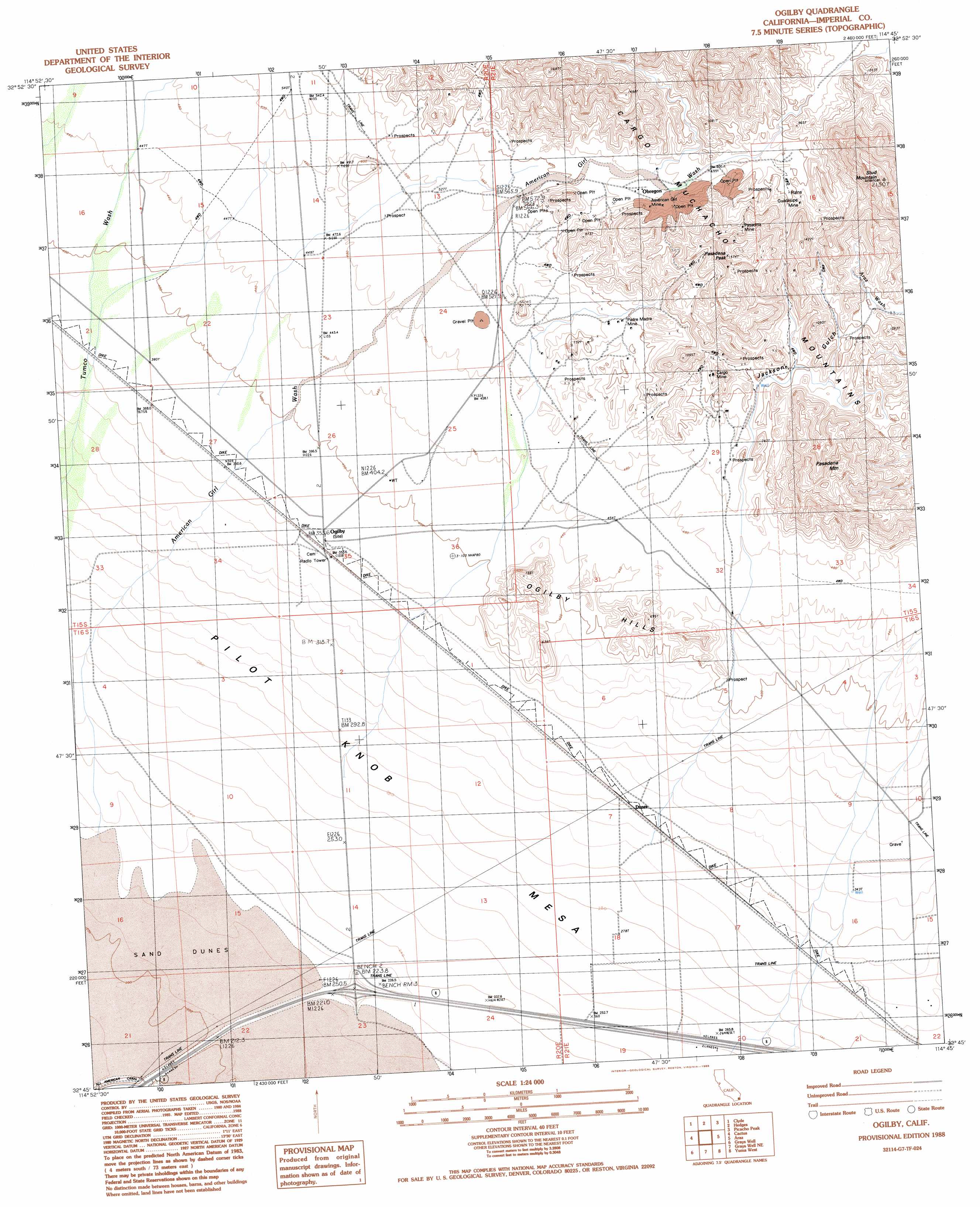
Ogilby Topo Map California
To zoom in, hover over the map of Ogilby
USGS Topo Quad 32114g7 - 1:24,000 scale
| Topo Map Name: | Ogilby |
| USGS Topo Quad ID: | 32114g7 |
| Print Size: | ca. 21 1/4" wide x 27" high |
| Southeast Coordinates: | 32.75° N latitude / 114.75° W longitude |
| Map Center Coordinates: | 32.8125° N latitude / 114.8125° W longitude |
| U.S. State: | CA |
| Filename: | o32114g7.jpg |
| Download Map JPG Image: | Ogilby topo map 1:24,000 scale |
| Map Type: | Topographic |
| Topo Series: | 7.5´ |
| Map Scale: | 1:24,000 |
| Source of Map Images: | United States Geological Survey (USGS) |
| Alternate Map Versions: |
Ogilby CA 1988, updated 1988 Download PDF Buy paper map Ogilby CA 1997, updated 2002 Download PDF Buy paper map Ogilby CA 2012 Download PDF Buy paper map Ogilby CA 2015 Download PDF Buy paper map |
1:24,000 Topo Quads surrounding Ogilby
East Of Acolita |
Gables Wash |
Quartz Peak |
Picacho Sw |
Picacho |
Glamis |
Clyde |
Hedges |
Picacho Peak |
Little Picacho Peak |
Glamis Se |
Cactus |
Ogilby |
Araz |
Bard |
Midway Well |
Grays Well |
Grays Well Ne |
Yuma West |
Yuma East |
Somerton |
Yuma Se |
> Back to 32114e1 at 1:100,000 scale
> Back to 32114a1 at 1:250,000 scale
> Back to U.S. Topo Maps home
Ogilby topo map: Gazetteer
Ogilby: Mines
American Girl Mine elevation 237m 777′Cargo Mine elevation 208m 682′
Guadalupe Mine elevation 258m 846′
Occidental Mine elevation 391m 1282′
Padre Madre Mine elevation 181m 593′
Pasadena Mine elevation 280m 918′
Ogilby: Populated Places
Dunes elevation 101m 331′Felicity elevation 87m 285′
Obregon elevation 202m 662′
Ogilby elevation 111m 364′
Ogilby: Post Offices
Felicity Post Office elevation 87m 285′Ogilby: Ranges
Cargo Muchacho Mountains elevation 252m 826′Ogilby Hills elevation 128m 419′
Ogilby: Streams
American Girl Wash elevation 68m 223′Ogilby: Summits
Pasadena Mountain elevation 437m 1433′Pasadena Peak elevation 468m 1535′
Stud Mountain elevation 611m 2004′
Ogilby: Valleys
Jackson Gulch elevation 153m 501′Ogilby digital topo map on disk
Buy this Ogilby topo map showing relief, roads, GPS coordinates and other geographical features, as a high-resolution digital map file on DVD: