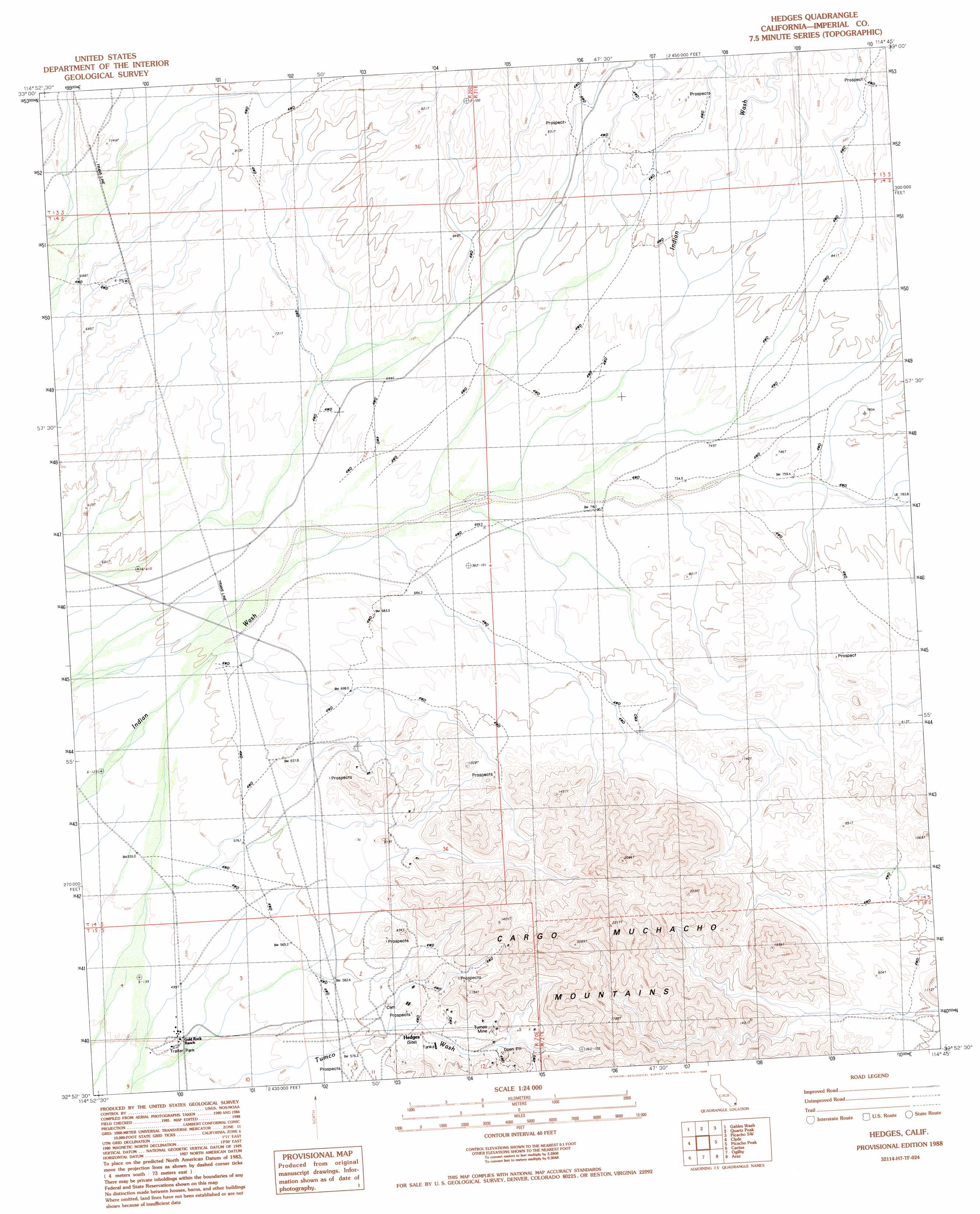
Hedges Topo Map California
To zoom in, hover over the map of Hedges
USGS Topo Quad 32114h7 - 1:24,000 scale
| Topo Map Name: | Hedges |
| USGS Topo Quad ID: | 32114h7 |
| Print Size: | ca. 21 1/4" wide x 27" high |
| Southeast Coordinates: | 32.875° N latitude / 114.75° W longitude |
| Map Center Coordinates: | 32.9375° N latitude / 114.8125° W longitude |
| U.S. State: | CA |
| Filename: | o32114h7.jpg |
| Download Map JPG Image: | Hedges topo map 1:24,000 scale |
| Map Type: | Topographic |
| Topo Series: | 7.5´ |
| Map Scale: | 1:24,000 |
| Source of Map Images: | United States Geological Survey (USGS) |
| Alternate Map Versions: |
Hedges CA 1988, updated 1988 Download PDF Buy paper map Hedges CA 2012 Download PDF Buy paper map Hedges CA 2015 Download PDF Buy paper map |
1:24,000 Topo Quads surrounding Hedges
Blue Mountain |
Mount Barrow |
Buzzards Peak |
Picacho Nw |
Hidden Valley |
East Of Acolita |
Gables Wash |
Quartz Peak |
Picacho Sw |
Picacho |
Glamis |
Clyde |
Hedges |
Picacho Peak |
Little Picacho Peak |
Glamis Se |
Cactus |
Ogilby |
Araz |
Bard |
Midway Well |
Grays Well |
Grays Well Ne |
Yuma West |
Yuma East |
> Back to 32114e1 at 1:100,000 scale
> Back to 32114a1 at 1:250,000 scale
> Back to U.S. Topo Maps home
Hedges topo map: Gazetteer
Hedges: Mines
La Colorado Mine elevation 238m 780′Tumco Mine elevation 247m 810′
Hedges digital topo map on disk
Buy this Hedges topo map showing relief, roads, GPS coordinates and other geographical features, as a high-resolution digital map file on DVD: