Tierra Del Sol Topo Map California
To zoom in, hover over the map of Tierra Del Sol
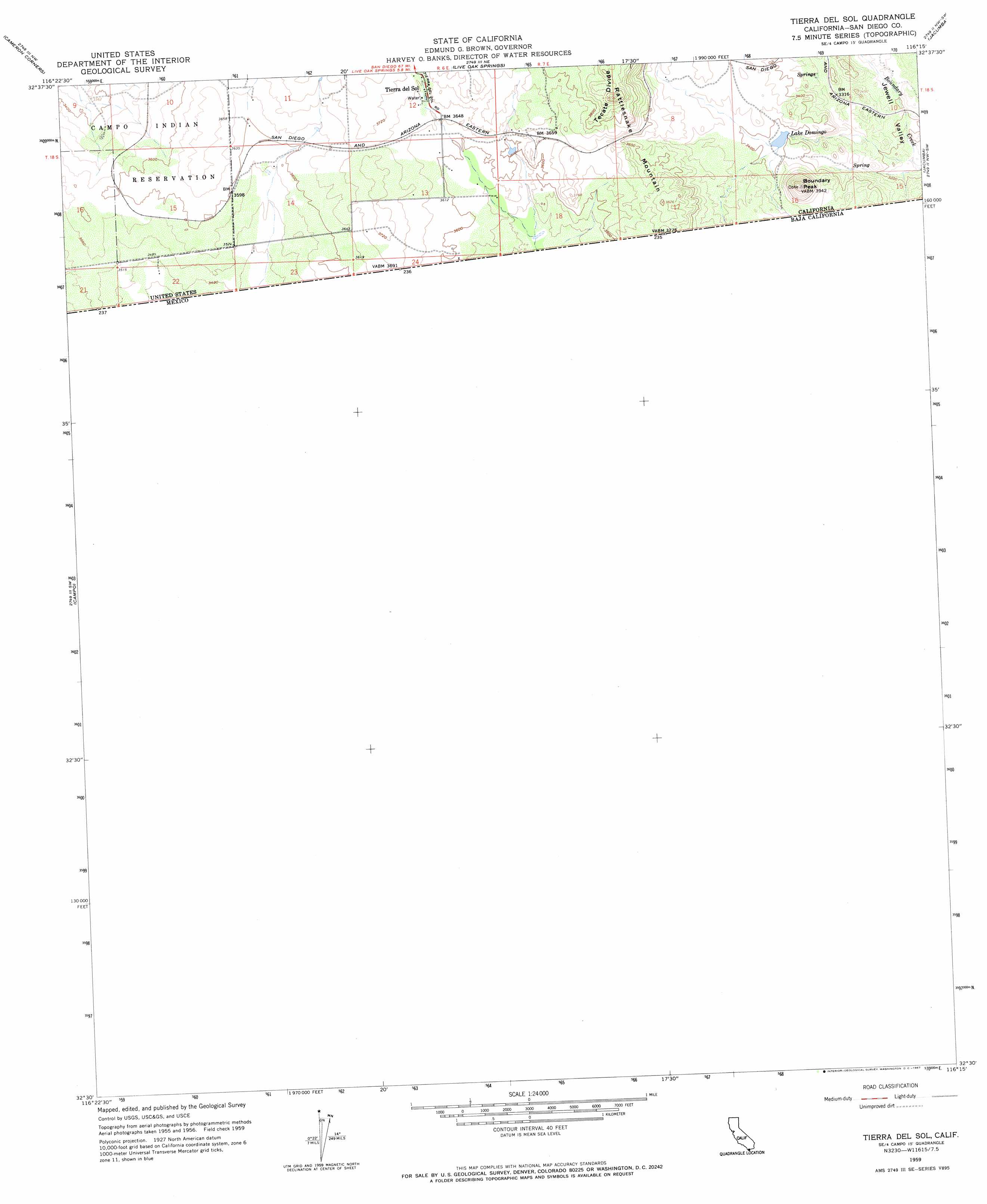
USGS Topo Quad 32116e3 - 1:24,000 scale
| Topo Map Name: | Tierra Del Sol |
| USGS Topo Quad ID: | 32116e3 |
| Print Size: | ca. 21 1/4" wide x 27" high |
| Southeast Coordinates: | 32.5° N latitude / 116.25° W longitude |
| Map Center Coordinates: | 32.5625° N latitude / 116.3125° W longitude |
| U.S. State: | CA |
| Filename: | o32116e3.jpg |
| Download Map JPG Image: | Tierra Del Sol topo map 1:24,000 scale |
| Map Type: | Topographic |
| Topo Series: | 7.5´ |
| Map Scale: | 1:24,000 |
| Source of Map Images: | United States Geological Survey (USGS) |
| Alternate Map Versions: |
Tierra Del Sol CA 1959, updated 1961 Download PDF Buy paper map Tierra Del Sol CA 1959, updated 1967 Download PDF Buy paper map Tierra Del Sol CA 1959, updated 1967 Download PDF Buy paper map Tierra Del Sol CA 1996, updated 2002 Download PDF Buy paper map Tierra del Sol CA 2012 Download PDF Buy paper map Tierra del Sol CA 2015 Download PDF Buy paper map |
1:24,000 Topo Quads surrounding Tierra Del Sol
Descanso |
Mount Laguna |
Sombrero Peak |
Sweeney Pass |
Carrizo Mountain |
Morena Reservoir |
Cameron Corners |
Live Oak Springs |
Jacumba |
In-Ko-Pah Gorge |
Potrero |
Campo |
Tierra Del Sol |
||
> Back to 32116e1 at 1:100,000 scale
> Back to 32116a1 at 1:250,000 scale
> Back to U.S. Topo Maps home
Tierra Del Sol topo map: Gazetteer
Tierra Del Sol: Populated Places
Tierra del Sol elevation 1120m 3674′Tierra Del Sol: Reservoirs
Lake Domingo elevation 1027m 3369′Tierra Del Sol: Summits
Boundary Peak elevation 1195m 3920′Rattlesnake Mountain elevation 1232m 4041′
Tierra Del Sol: Valleys
Jewell Valley elevation 994m 3261′Tierra Del Sol digital topo map on disk
Buy this Tierra Del Sol topo map showing relief, roads, GPS coordinates and other geographical features, as a high-resolution digital map file on DVD: