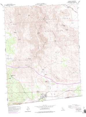
Jacumba Topo Map California
To zoom in, hover over the map of Jacumba
USGS Topo Quad 32116f2 - 1:24,000 scale
| Topo Map Name: | Jacumba |
| USGS Topo Quad ID: | 32116f2 |
| Print Size: | ca. 21 1/4" wide x 27" high |
| Southeast Coordinates: | 32.625° N latitude / 116.125° W longitude |
| Map Center Coordinates: | 32.6875° N latitude / 116.1875° W longitude |
| U.S. State: | CA |
| Filename: | o32116f2.jpg |
| Download Map JPG Image: | Jacumba topo map 1:24,000 scale |
| Map Type: | Topographic |
| Topo Series: | 7.5´ |
| Map Scale: | 1:24,000 |
| Source of Map Images: | United States Geological Survey (USGS) |
| Alternate Map Versions: |
Jacumba CA 1959, updated 1960 Download PDF Buy paper map Jacumba CA 1959, updated 1968 Download PDF Buy paper map Jacumba CA 1959, updated 1978 Download PDF Buy paper map Jacumba CA 1959, updated 1978 Download PDF Buy paper map Jacumba CA 1997, updated 2003 Download PDF Buy paper map Jacumba CA 2012 Download PDF Buy paper map Jacumba CA 2015 Download PDF Buy paper map |
1:24,000 Topo Quads surrounding Jacumba
> Back to 32116e1 at 1:100,000 scale
> Back to 32116a1 at 1:250,000 scale
> Back to U.S. Topo Maps home
Jacumba topo map: Gazetteer
Jacumba: Dams
West 844 Dam elevation 1048m 3438′Jacumba: Flats
Redondo Flat elevation 1010m 3313′Jacumba: Populated Places
Bankhead Springs elevation 1010m 3313′Dos Cabezas elevation 532m 1745′
Mortero Palms elevation 715m 2345′
Palm Grove elevation 562m 1843′
Titus elevation 840m 2755′
Jacumba: Ranges
Jacumba Mountains elevation 1000m 3280′Jacumba: Reservoirs
Tule Lake elevation 1048m 3438′Tule Lake elevation 1048m 3438′
Jacumba: Springs
Arsenic Spring elevation 823m 2700′Bankhead Spring elevation 1024m 3359′
Camp Sizzle Spring elevation 853m 2798′
Dos Cabezas Spring elevation 608m 1994′
Iron Spring elevation 879m 2883′
Lone Tiger Spring elevation 855m 2805′
Redondo Spring elevation 981m 3218′
Sacotone Spring elevation 1199m 3933′
Jacumba: Streams
Boundary Creek elevation 851m 2791′Jacumba: Summits
Gray Mountain elevation 1113m 3651′Mount Tule elevation 1413m 4635′
Piedras Grandes elevation 784m 2572′
Round Mountain elevation 1014m 3326′
Squaw Tit elevation 1184m 3884′
Table Mountain elevation 1245m 4084′
Jacumba: Valleys
Carrizo Gorge elevation 430m 1410′Goat Canyon elevation 515m 1689′
Jacumba Valley elevation 807m 2647′
McCain Valley elevation 1031m 3382′
Tule Canyon elevation 718m 2355′
Jacumba digital topo map on disk
Buy this Jacumba topo map showing relief, roads, GPS coordinates and other geographical features, as a high-resolution digital map file on DVD:


