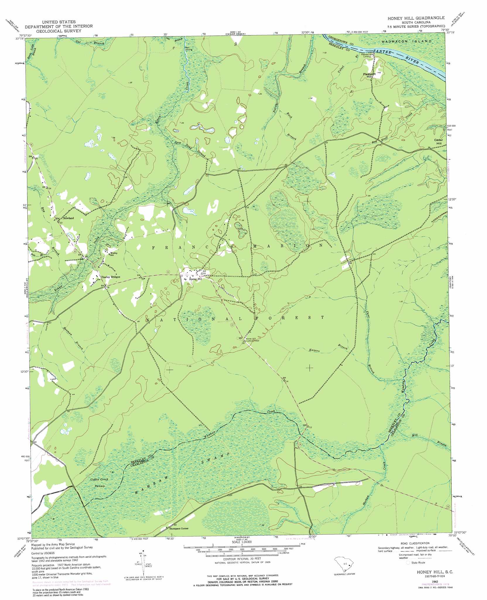
Honey Hill Topo Map South Carolina
To zoom in, hover over the map of Honey Hill
USGS Topo Quad 33079b5 - 1:24,000 scale
| Topo Map Name: | Honey Hill |
| USGS Topo Quad ID: | 33079b5 |
| Print Size: | ca. 21 1/4" wide x 27" high |
| Southeast Coordinates: | 33.125° N latitude / 79.5° W longitude |
| Map Center Coordinates: | 33.1875° N latitude / 79.5625° W longitude |
| U.S. State: | SC |
| Filename: | o33079b5.jpg |
| Download Map JPG Image: | Honey Hill topo map 1:24,000 scale |
| Map Type: | Topographic |
| Topo Series: | 7.5´ |
| Map Scale: | 1:24,000 |
| Source of Map Images: | United States Geological Survey (USGS) |
| Alternate Map Versions: |
Honey Hill SC 1942, updated 1962 Download PDF Buy paper map Honey Hill SC 1942, updated 1976 Download PDF Buy paper map Honey Hill SC 1942, updated 1989 Download PDF Buy paper map Honey Hill SC 2011 Download PDF Buy paper map Honey Hill SC 2014 Download PDF Buy paper map |
| FStopo: | US Forest Service topo Honey Hill is available: Download FStopo PDF Download FStopo TIF |
1:24,000 Topo Quads surrounding Honey Hill
Blakely |
Trio |
Andrews |
Olin |
Georgetown North |
Wedboo Creek |
Jamestown |
Cedar Creek |
Kilsock Bay |
Georgetown South |
Bethera |
Shulerville |
Honey Hill |
Santee |
Minim Island |
Huger |
Ocean Bay |
Awendaw |
Mcclellanville |
Cape Romain |
Cainhoy |
Sewee Bay |
Bull Island |
> Back to 33079a1 at 1:100,000 scale
> Back to 33078a1 at 1:250,000 scale
> Back to U.S. Topo Maps home
Honey Hill topo map: Gazetteer
Honey Hill: Bridges
Charlie Bridges elevation 3m 9′Coffey Bridges (historical) elevation 4m 13′
Palmer Bridges elevation 4m 13′
Thompson Bridges elevation 6m 19′
Honey Hill: Populated Places
Green Bay (historical) elevation 9m 29′Honey Hill elevation 12m 39′
Newland elevation 9m 29′
Pitch Landing elevation 3m 9′
Pleasant Hill Landing elevation 6m 19′
Thompson Corner elevation 7m 22′
Honey Hill: Streams
Bay Branch elevation 3m 9′Beaman Branch elevation 3m 9′
Buck Branch elevation 6m 19′
Cane Branch elevation 4m 13′
June Pond Strand elevation 4m 13′
Keepers Branch elevation 4m 13′
Mechaw Creek elevation 4m 13′
Mill Branch elevation 4m 13′
Pole Branch elevation 8m 26′
Red Bluff Creek elevation 4m 13′
Velvet Branch elevation 1m 3′
Honey Hill: Summits
Pleasant Hill elevation 13m 42′Honey Hill: Swamps
Coffee Creek Swamp elevation 4m 13′Wambaw Swamp elevation 4m 13′
Honey Hill digital topo map on disk
Buy this Honey Hill topo map showing relief, roads, GPS coordinates and other geographical features, as a high-resolution digital map file on DVD:
South Carolina, Western North Carolina & Northeastern Georgia
Buy digital topo maps: South Carolina, Western North Carolina & Northeastern Georgia