Andrews Topo Map South Carolina
To zoom in, hover over the map of Andrews
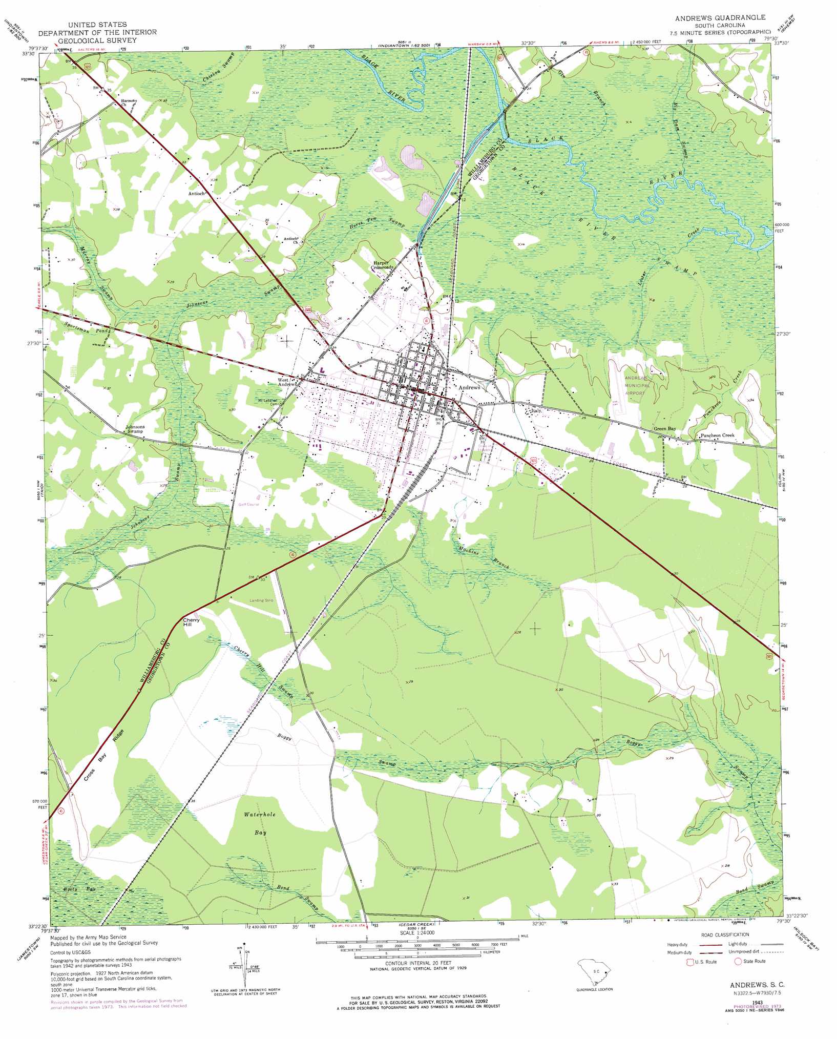
USGS Topo Quad 33079d5 - 1:24,000 scale
| Topo Map Name: | Andrews |
| USGS Topo Quad ID: | 33079d5 |
| Print Size: | ca. 21 1/4" wide x 27" high |
| Southeast Coordinates: | 33.375° N latitude / 79.5° W longitude |
| Map Center Coordinates: | 33.4375° N latitude / 79.5625° W longitude |
| U.S. State: | SC |
| Filename: | o33079d5.jpg |
| Download Map JPG Image: | Andrews topo map 1:24,000 scale |
| Map Type: | Topographic |
| Topo Series: | 7.5´ |
| Map Scale: | 1:24,000 |
| Source of Map Images: | United States Geological Survey (USGS) |
| Alternate Map Versions: |
Andrews SC 1943, updated 1962 Download PDF Buy paper map Andrews SC 1943, updated 1963 Download PDF Buy paper map Andrews SC 1943, updated 1976 Download PDF Buy paper map Andrews SC 2011 Download PDF Buy paper map Andrews SC 2014 Download PDF Buy paper map |
1:24,000 Topo Quads surrounding Andrews
Kingstree |
Fowler |
Indiantown |
Henry |
Outland |
Salters |
Kellehan Crossroads |
Warsaw |
Rhems |
Carvers Bay |
Blakely |
Trio |
Andrews |
Olin |
Georgetown North |
Wedboo Creek |
Jamestown |
Cedar Creek |
Kilsock Bay |
Georgetown South |
Bethera |
Shulerville |
Honey Hill |
Santee |
Minim Island |
> Back to 33079a1 at 1:100,000 scale
> Back to 33078a1 at 1:250,000 scale
> Back to U.S. Topo Maps home
Andrews topo map: Gazetteer
Andrews: Airports
Andrews Municipal Airport elevation 6m 19′Andrews: Basins
Waterhole Bay elevation 10m 32′Andrews: Crossings
Potato Ferry (historical) elevation 6m 19′Andrews: Dams
Andrews Sewage Pond Dam D-3594 elevation 6m 19′Andrews: Populated Places
Andrews elevation 8m 26′Antioch elevation 9m 29′
Cherry Hill elevation 8m 26′
Green Bay elevation 8m 26′
Harper Crossroads elevation 7m 22′
Italy elevation 7m 22′
Puncheon Creek elevation 6m 19′
West Andrews elevation 11m 36′
Andrews: Post Offices
Andrews Post Office elevation 8m 26′Andrews: Ridges
Cross Bay Ridge elevation 12m 39′Andrews: Streams
Big Dam Swamp elevation 5m 16′Birch Creek elevation 5m 16′
Gin Branch elevation 5m 16′
Horse Pen Swamp elevation 5m 16′
Johnsons Swamp elevation 6m 19′
Lester Creek elevation 2m 6′
Machine Branch elevation 6m 19′
Murray Swamp elevation 6m 19′
Sportsman Pond elevation 6m 19′
Andrews: Swamps
Black River Swamp elevation 5m 16′Boety Bay elevation 12m 39′
Cherry Hill Swamp elevation 9m 29′
Chicken Swamp elevation 8m 26′
Johnsons Swamp elevation 7m 22′
Andrews digital topo map on disk
Buy this Andrews topo map showing relief, roads, GPS coordinates and other geographical features, as a high-resolution digital map file on DVD:
South Carolina, Western North Carolina & Northeastern Georgia
Buy digital topo maps: South Carolina, Western North Carolina & Northeastern Georgia