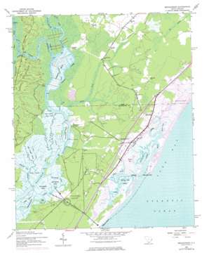
Brookgreen Topo Map South Carolina
To zoom in, hover over the map of Brookgreen
USGS Topo Quad 33079e1 - 1:24,000 scale
| Topo Map Name: | Brookgreen |
| USGS Topo Quad ID: | 33079e1 |
| Print Size: | ca. 21 1/4" wide x 27" high |
| Southeast Coordinates: | 33.5° N latitude / 79° W longitude |
| Map Center Coordinates: | 33.5625° N latitude / 79.0625° W longitude |
| U.S. State: | SC |
| Filename: | o33079e1.jpg |
| Download Map JPG Image: | Brookgreen topo map 1:24,000 scale |
| Map Type: | Topographic |
| Topo Series: | 7.5´ |
| Map Scale: | 1:24,000 |
| Source of Map Images: | United States Geological Survey (USGS) |
| Alternate Map Versions: |
Brookgreen SC 1943, updated 1962 Download PDF Buy paper map Brookgreen SC 1943, updated 1974 Download PDF Buy paper map Brookgreen SC 1943, updated 1976 Download PDF Buy paper map Brookgreen SC 1943, updated 1976 Download PDF Buy paper map Brookgreen SC 2011 Download PDF Buy paper map Brookgreen SC 2014 Download PDF Buy paper map |
1:24,000 Topo Quads surrounding Brookgreen
> Back to 33079e1 at 1:100,000 scale
> Back to 33078a1 at 1:250,000 scale
> Back to U.S. Topo Maps home
Brookgreen topo map: Gazetteer
Brookgreen: Bays
Murrells Inlet elevation 0m 0′Brookgreen: Capes
Drunken Jack Island elevation 1m 3′Silver Island elevation 0m 0′
Brookgreen: Guts
Main Creek elevation 0m 0′Oaks Creek elevation 0m 0′
Parsonage Creek elevation 0m 0′
Woodland Creek elevation 0m 0′
Brookgreen: Islands
Brookgreen Island elevation 1m 3′Bull Tongue Island elevation 2m 6′
Flagg Island elevation 3m 9′
Laurel Hill Island elevation 0m 0′
Longwood Island elevation 1m 3′
Oaks Island elevation 1m 3′
Richmond Island elevation 0m 0′
Springfield Island elevation 1m 3′
Vaux Island elevation 0m 0′
Brookgreen: Lakes
Jessamine Pond elevation 5m 16′Brookgreen: Parks
Brookgreen Gardens elevation 7m 22′Huntington Beach State Park elevation 1m 3′
Murrells Inlet Historic District elevation 1m 3′
Murrells Inlet Park elevation 7m 22′
Brookgreen: Populated Places
Blue Heron elevation 3m 9′Burgess elevation 4m 13′
Captains Cove elevation 6m 19′
Carriage Run elevation 6m 19′
Crystal Oaks elevation 3m 9′
Eagle Crest elevation 7m 22′
Garden City elevation 6m 19′
Garden City Beach elevation 0m 0′
Huntington Marsh elevation 2m 6′
Inlet Harbor elevation 0m 0′
Inlet Oaks Village elevation 4m 13′
Jamestown elevation 5m 16′
Jensens elevation 6m 19′
Live Oaks elevation 6m 19′
Longwood Landing elevation 0m 0′
Moss Creek elevation 3m 9′
Mount Gilead elevation 5m 16′
Mulberry Landing elevation 0m 0′
Murrells Inlet elevation 1m 3′
Oak Hill elevation 8m 26′
Ocean Pines elevation 6m 19′
Pirate Cove elevation 3m 9′
Richmond Hill elevation 6m 19′
Robin Hood elevation 3m 9′
Seabreeze elevation 6m 19′
Sunny Side elevation 2m 6′
Thompson (historical) elevation 7m 22′
Wachesaw Landing elevation 2m 6′
Wachesaw Place elevation 4m 13′
Wayside Forest elevation 4m 13′
Windjammer Village elevation 5m 16′
Brookgreen: Post Offices
Garden City Beach Post Office (historical) elevation 0m 0′Murrells Inlet Post Office elevation 5m 16′
Brookgreen: Streams
Allston Creek elevation -3m -10′Black Creek elevation 0m 0′
Brookgreen Creek elevation 1m 3′
Bull Creek elevation 0m 0′
Collins Creek elevation 0m 0′
Cow House Creek elevation 0m 0′
Crane Creek elevation 0m 0′
Fisherman Creek elevation 0m 0′
Little Bull Creek elevation 0m 0′
Prince Creek elevation 0m 0′
Ruinsville Creek elevation 0m 0′
Sandhole Creek elevation 0m 0′
Silver Creek elevation 0m 0′
Silvers Creek elevation 0m 0′
Springfield Creek elevation 0m 0′
Still Creek elevation 3m 9′
Vaux Creek elevation 0m 0′
Whale Creek elevation 0m 0′
White Creek elevation 0m 0′
Brookgreen: Summits
Sandy Island elevation 18m 59′Brookgreen: Swamps
Weston Flat elevation 1m 3′Brookgreen digital topo map on disk
Buy this Brookgreen topo map showing relief, roads, GPS coordinates and other geographical features, as a high-resolution digital map file on DVD:
South Carolina, Western North Carolina & Northeastern Georgia
Buy digital topo maps: South Carolina, Western North Carolina & Northeastern Georgia


