Carvers Bay Topo Map South Carolina
To zoom in, hover over the map of Carvers Bay
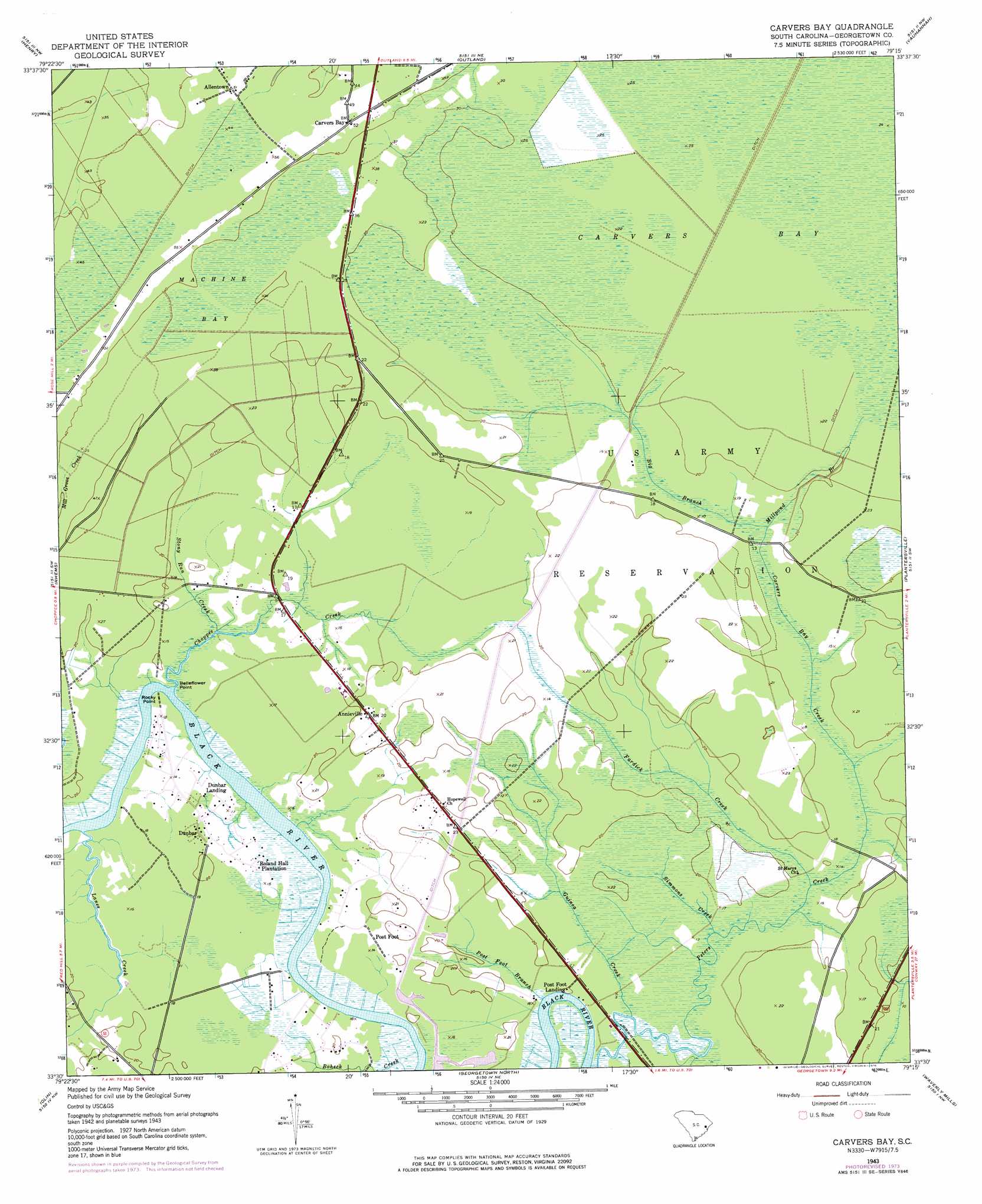
USGS Topo Quad 33079e3 - 1:24,000 scale
| Topo Map Name: | Carvers Bay |
| USGS Topo Quad ID: | 33079e3 |
| Print Size: | ca. 21 1/4" wide x 27" high |
| Southeast Coordinates: | 33.5° N latitude / 79.25° W longitude |
| Map Center Coordinates: | 33.5625° N latitude / 79.3125° W longitude |
| U.S. State: | SC |
| Filename: | o33079e3.jpg |
| Download Map JPG Image: | Carvers Bay topo map 1:24,000 scale |
| Map Type: | Topographic |
| Topo Series: | 7.5´ |
| Map Scale: | 1:24,000 |
| Source of Map Images: | United States Geological Survey (USGS) |
| Alternate Map Versions: |
Carvers Bay SC 1943, updated 1962 Download PDF Buy paper map Carvers Bay SC 1943, updated 1976 Download PDF Buy paper map Carvers Bay SC 2011 Download PDF Buy paper map Carvers Bay SC 2014 Download PDF Buy paper map |
1:24,000 Topo Quads surrounding Carvers Bay
Prospect Crossroads |
Johnsonville |
Snow Island |
Dongola |
Conway |
Indiantown |
Henry |
Outland |
Yauhannah |
Bucksville |
Warsaw |
Rhems |
Carvers Bay |
Plantersville |
Brookgreen |
Andrews |
Olin |
Georgetown North |
Waverly Mills |
Magnolia Beach |
Cedar Creek |
Kilsock Bay |
Georgetown South |
North Island |
> Back to 33079e1 at 1:100,000 scale
> Back to 33078a1 at 1:250,000 scale
> Back to U.S. Topo Maps home
Carvers Bay topo map: Gazetteer
Carvers Bay: Capes
Belleflower Point elevation 5m 16′Rocky Point elevation 2m 6′
Carvers Bay: Dams
Black River House One Pond Dam D-3591 elevation 6m 19′Black River House Two Pond Dam D-3590 elevation 2m 6′
Carvers Bay: Parks
Rock Point Park elevation 5m 16′Carvers Bay: Populated Places
Annieville elevation 6m 19′Dunbar elevation 6m 19′
Dunbar Landing elevation 5m 16′
Post Foot Landing elevation 5m 16′
Carvers Bay: Streams
Big Branch elevation 6m 19′Black Swamp elevation 6m 19′
Carvers Bay Creek elevation 6m 19′
Choppee Creek elevation 3m 9′
Fardick Creek elevation 6m 19′
Guinea Creek elevation 6m 19′
Lanes Creek elevation 4m 13′
Millpond Branch elevation 6m 19′
Peters Creek elevation 3m 9′
Post Foot Branch elevation 2m 6′
Simmons Creek elevation 6m 19′
Stony Run Creek elevation 5m 16′
Carvers Bay: Swamps
Carvers Bay elevation 8m 26′Machine Bay elevation 11m 36′
Carvers Bay digital topo map on disk
Buy this Carvers Bay topo map showing relief, roads, GPS coordinates and other geographical features, as a high-resolution digital map file on DVD:
South Carolina, Western North Carolina & Northeastern Georgia
Buy digital topo maps: South Carolina, Western North Carolina & Northeastern Georgia