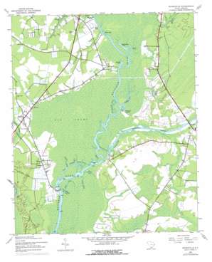
Bucksville Topo Map South Carolina
To zoom in, hover over the map of Bucksville
USGS Topo Quad 33079f1 - 1:24,000 scale
| Topo Map Name: | Bucksville |
| USGS Topo Quad ID: | 33079f1 |
| Print Size: | ca. 21 1/4" wide x 27" high |
| Southeast Coordinates: | 33.625° N latitude / 79° W longitude |
| Map Center Coordinates: | 33.6875° N latitude / 79.0625° W longitude |
| U.S. State: | SC |
| Filename: | o33079f1.jpg |
| Download Map JPG Image: | Bucksville topo map 1:24,000 scale |
| Map Type: | Topographic |
| Topo Series: | 7.5´ |
| Map Scale: | 1:24,000 |
| Source of Map Images: | United States Geological Survey (USGS) |
| Alternate Map Versions: |
Bucksville SC 1943, updated 1962 Download PDF Buy paper map Bucksville SC 1943, updated 1976 Download PDF Buy paper map Bucksville SC 2011 Download PDF Buy paper map Bucksville SC 2014 Download PDF Buy paper map |
1:24,000 Topo Quads surrounding Bucksville
> Back to 33079e1 at 1:100,000 scale
> Back to 33078a1 at 1:250,000 scale
> Back to U.S. Topo Maps home
Bucksville topo map: Gazetteer
Bucksville: Cliffs
Ransoms Bluff elevation 2m 6′Bucksville: Crossings
Peachtree Ferry (historical) elevation 0m 0′Bucksville: Guts
Seven Prongs elevation 1m 3′Bucksville: Islands
Oatbed Island elevation 0m 0′Bucksville: Lakes
Old Mill Lake elevation 0m 0′Old Womans Lake elevation 0m 0′
Peachtree Lake elevation 0m 0′
Strons Lake elevation 0m 0′
Bucksville: Populated Places
Bucksport elevation 3m 9′Bucksville elevation 6m 19′
Coopers elevation 2m 6′
Eddy Lake (historical) elevation 9m 29′
Enterprise Landing elevation 0m 0′
Keys Field elevation 6m 19′
Klondike elevation 4m 13′
Peachtree Landing elevation 1m 3′
Port Harrelson (historical) elevation 4m 13′
Rheuark Landing elevation 1m 3′
Bucksville: Reservoirs
Mills Pond elevation 3m 9′Bucksville: Streams
Big Buckskin Creek elevation 0m 0′Clark Creek elevation 1m 3′
Enterprise Creek elevation 0m 0′
Halfway Swamp elevation 0m 0′
Nimrod Creek elevation 1m 3′
Oatbed Creek elevation 1m 3′
Old Dock Creek elevation 0m 0′
Old River elevation 0m 0′
Peach Creek elevation 1m 3′
Righthand Creek elevation 1m 3′
Socastee Creek elevation 1m 3′
Bucksville digital topo map on disk
Buy this Bucksville topo map showing relief, roads, GPS coordinates and other geographical features, as a high-resolution digital map file on DVD:
South Carolina, Western North Carolina & Northeastern Georgia
Buy digital topo maps: South Carolina, Western North Carolina & Northeastern Georgia


