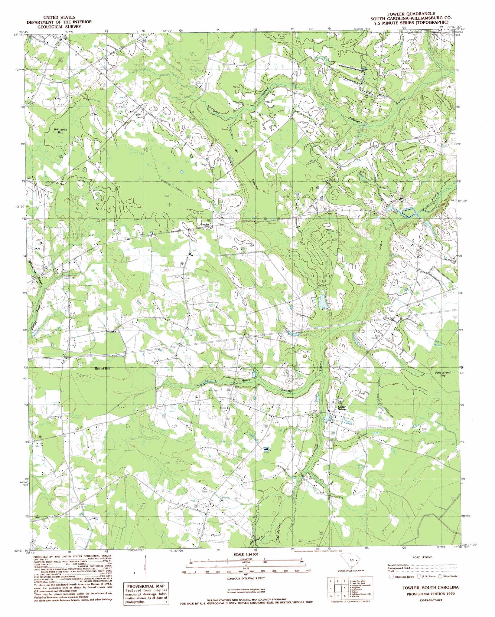
Fowler Topo Map South Carolina
To zoom in, hover over the map of Fowler
USGS Topo Quad 33079f6 - 1:24,000 scale
| Topo Map Name: | Fowler |
| USGS Topo Quad ID: | 33079f6 |
| Print Size: | ca. 21 1/4" wide x 27" high |
| Southeast Coordinates: | 33.625° N latitude / 79.625° W longitude |
| Map Center Coordinates: | 33.6875° N latitude / 79.6875° W longitude |
| U.S. State: | SC |
| Filename: | o33079f6.jpg |
| Download Map JPG Image: | Fowler topo map 1:24,000 scale |
| Map Type: | Topographic |
| Topo Series: | 7.5´ |
| Map Scale: | 1:24,000 |
| Source of Map Images: | United States Geological Survey (USGS) |
| Alternate Map Versions: |
Fowler SC 1990, updated 1990 Download PDF Buy paper map Fowler SC 2011 Download PDF Buy paper map Fowler SC 2014 Download PDF Buy paper map |
1:24,000 Topo Quads surrounding Fowler
Olanta |
Mill Bay |
Scranton |
Pamplico South |
Gresham |
Hebron Crossroads |
Lake City West |
Lake City East |
Prospect Crossroads |
Johnsonville |
Workman |
Kingstree |
Fowler |
Indiantown |
Henry |
Greeleyville |
Salters |
Kellehan Crossroads |
Warsaw |
Rhems |
Saint Stephens |
Blakely |
Trio |
Andrews |
Olin |
> Back to 33079e1 at 1:100,000 scale
> Back to 33078a1 at 1:250,000 scale
> Back to U.S. Topo Maps home
Fowler topo map: Gazetteer
Fowler: Basins
McCants Bay elevation 16m 52′Pine Island Bay elevation 16m 52′
Round Bay elevation 19m 62′
Whiteoak Bay elevation 22m 72′
Fowler: Dams
South Carolina Noname 45004 D-3094 Dam elevation 13m 42′Fowler: Populated Places
Cedar Swamp elevation 15m 49′Fowler elevation 23m 75′
Fowler: Reservoirs
Jack McGill Pond elevation 13m 42′Fowler: Streams
Dry Swamp elevation 15m 49′Home Swamp elevation 11m 36′
Whiteoak Swamp elevation 13m 42′
Whiteoak Swamp elevation 18m 59′
Fowler: Swamps
Orr Swamp elevation 18m 59′Fowler digital topo map on disk
Buy this Fowler topo map showing relief, roads, GPS coordinates and other geographical features, as a high-resolution digital map file on DVD:
South Carolina, Western North Carolina & Northeastern Georgia
Buy digital topo maps: South Carolina, Western North Carolina & Northeastern Georgia