Kingstree Topo Map South Carolina
To zoom in, hover over the map of Kingstree
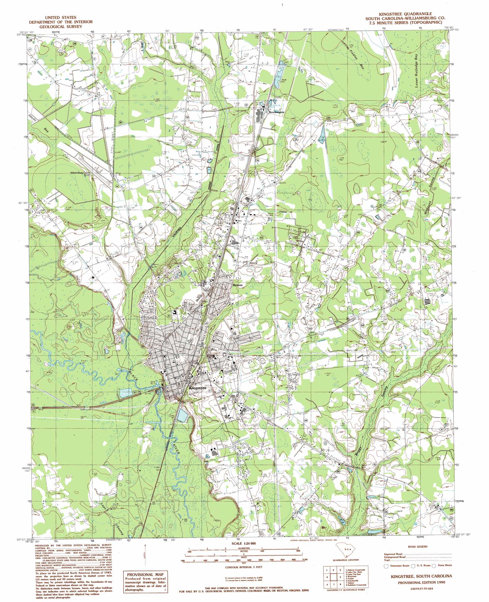
USGS Topo Quad 33079f7 - 1:24,000 scale
| Topo Map Name: | Kingstree |
| USGS Topo Quad ID: | 33079f7 |
| Print Size: | ca. 21 1/4" wide x 27" high |
| Southeast Coordinates: | 33.625° N latitude / 79.75° W longitude |
| Map Center Coordinates: | 33.6875° N latitude / 79.8125° W longitude |
| U.S. State: | SC |
| Filename: | o33079f7.jpg |
| Download Map JPG Image: | Kingstree topo map 1:24,000 scale |
| Map Type: | Topographic |
| Topo Series: | 7.5´ |
| Map Scale: | 1:24,000 |
| Source of Map Images: | United States Geological Survey (USGS) |
| Alternate Map Versions: |
Kingstree SC 1990, updated 1990 Download PDF Buy paper map Kingstree SC 2011 Download PDF Buy paper map Kingstree SC 2014 Download PDF Buy paper map |
1:24,000 Topo Quads surrounding Kingstree
Turbeville |
Olanta |
Mill Bay |
Scranton |
Pamplico South |
Sardinia |
Hebron Crossroads |
Lake City West |
Lake City East |
Prospect Crossroads |
Foreston |
Workman |
Kingstree |
Fowler |
Indiantown |
Butlers Bay |
Greeleyville |
Salters |
Kellehan Crossroads |
Warsaw |
Pineville |
Saint Stephens |
Blakely |
Trio |
Andrews |
> Back to 33079e1 at 1:100,000 scale
> Back to 33078a1 at 1:250,000 scale
> Back to U.S. Topo Maps home
Kingstree topo map: Gazetteer
Kingstree: Airports
Williamsburg County Airport elevation 20m 65′Kingstree: Basins
Lower Rutledge Bay elevation 20m 65′Kingstree: Bridges
Wallace D Conner Bridge elevation 13m 42′Kingstree: Dams
Kingstree Oxidation Pond Dam D-3086 elevation 11m 36′Kingstree: Parks
Kingstree Historic District elevation 16m 52′Kingstree: Populated Places
Brockington elevation 18m 59′Kingstree elevation 19m 62′
Nexsen (historical) elevation 17m 55′
Woodland Acres elevation 19m 62′
Kingstree: Post Offices
Kingstree Post Office elevation 18m 59′Kingstree: Reservoirs
Kingstree Oxidation Pond elevation 11m 36′Kingstree: Swamps
Findley Bay elevation 20m 65′Flat Swamp elevation 13m 42′
Kingstree digital topo map on disk
Buy this Kingstree topo map showing relief, roads, GPS coordinates and other geographical features, as a high-resolution digital map file on DVD:
South Carolina, Western North Carolina & Northeastern Georgia
Buy digital topo maps: South Carolina, Western North Carolina & Northeastern Georgia