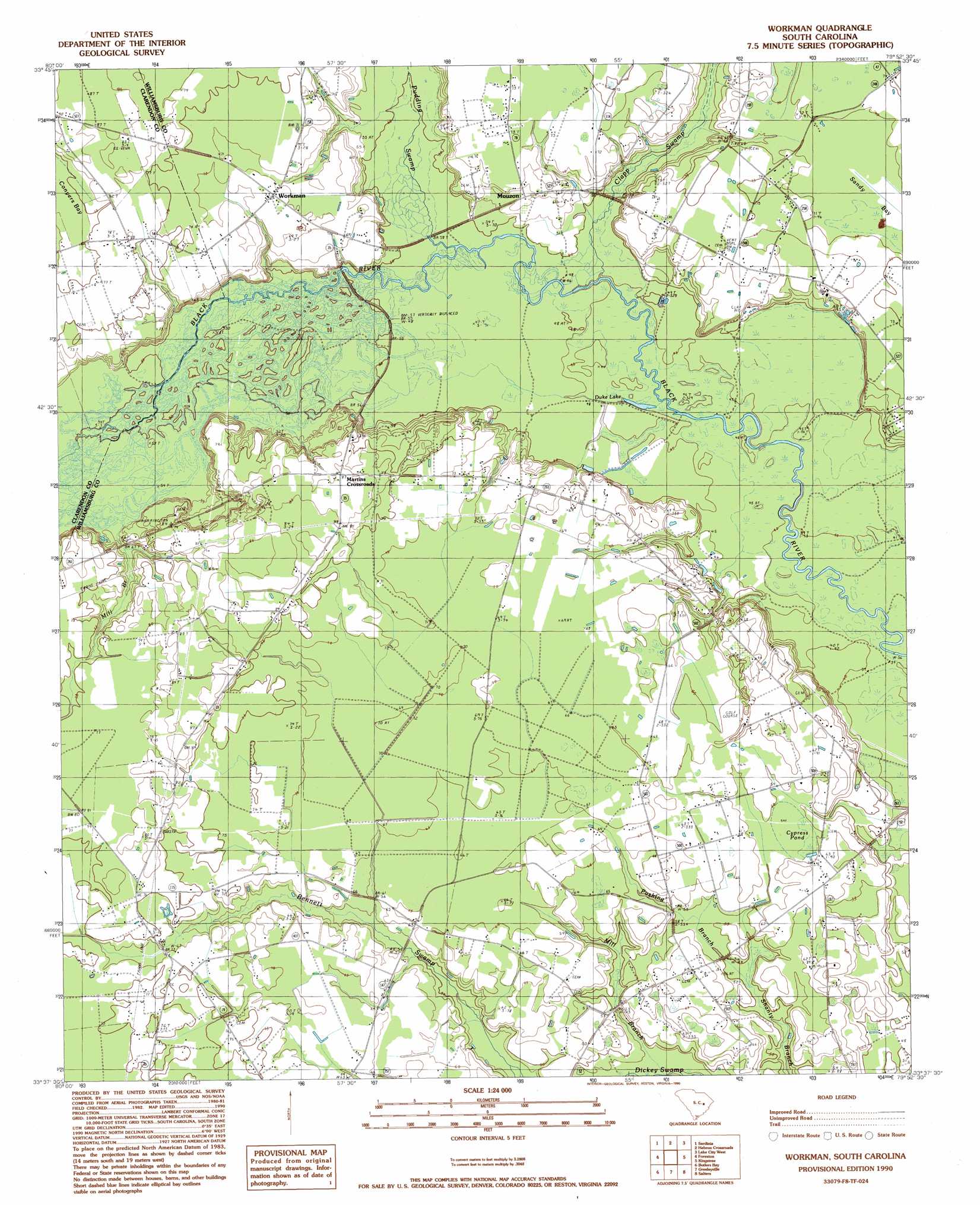
Workman Topo Map South Carolina
To zoom in, hover over the map of Workman
USGS Topo Quad 33079f8 - 1:24,000 scale
| Topo Map Name: | Workman |
| USGS Topo Quad ID: | 33079f8 |
| Print Size: | ca. 21 1/4" wide x 27" high |
| Southeast Coordinates: | 33.625° N latitude / 79.875° W longitude |
| Map Center Coordinates: | 33.6875° N latitude / 79.9375° W longitude |
| U.S. State: | SC |
| Filename: | o33079f8.jpg |
| Download Map JPG Image: | Workman topo map 1:24,000 scale |
| Map Type: | Topographic |
| Topo Series: | 7.5´ |
| Map Scale: | 1:24,000 |
| Source of Map Images: | United States Geological Survey (USGS) |
| Alternate Map Versions: |
Workman SC 1990, updated 1990 Download PDF Buy paper map Workman SC 2011 Download PDF Buy paper map Workman SC 2014 Download PDF Buy paper map |
1:24,000 Topo Quads surrounding Workman
Mayesville |
Turbeville |
Olanta |
Mill Bay |
Scranton |
Tearcoat Branch |
Sardinia |
Hebron Crossroads |
Lake City West |
Lake City East |
Manning |
Foreston |
Workman |
Kingstree |
Fowler |
Jordan |
Butlers Bay |
Greeleyville |
Salters |
Kellehan Crossroads |
Eadytown |
Pineville |
Saint Stephens |
Blakely |
Trio |
> Back to 33079e1 at 1:100,000 scale
> Back to 33078a1 at 1:250,000 scale
> Back to U.S. Topo Maps home
Workman topo map: Gazetteer
Workman: Islands
Conyer Lake Island elevation 22m 72′Workman: Lakes
Conyer Lake elevation 15m 49′Duke Lake elevation 12m 39′
Jordan Pond elevation 16m 52′
Workman: Populated Places
Belsers Crossroads elevation 19m 62′Martins Crossroads elevation 26m 85′
Mouzon elevation 20m 65′
Workman elevation 22m 72′
Workman: Streams
Clapp Swamp elevation 13m 42′Mill Branch elevation 15m 49′
Mill Branch elevation 13m 42′
Pudding Swamp elevation 14m 45′
Pushing Branch elevation 15m 49′
Workman: Swamps
Cypress Pond elevation 18m 59′Workman digital topo map on disk
Buy this Workman topo map showing relief, roads, GPS coordinates and other geographical features, as a high-resolution digital map file on DVD:
South Carolina, Western North Carolina & Northeastern Georgia
Buy digital topo maps: South Carolina, Western North Carolina & Northeastern Georgia