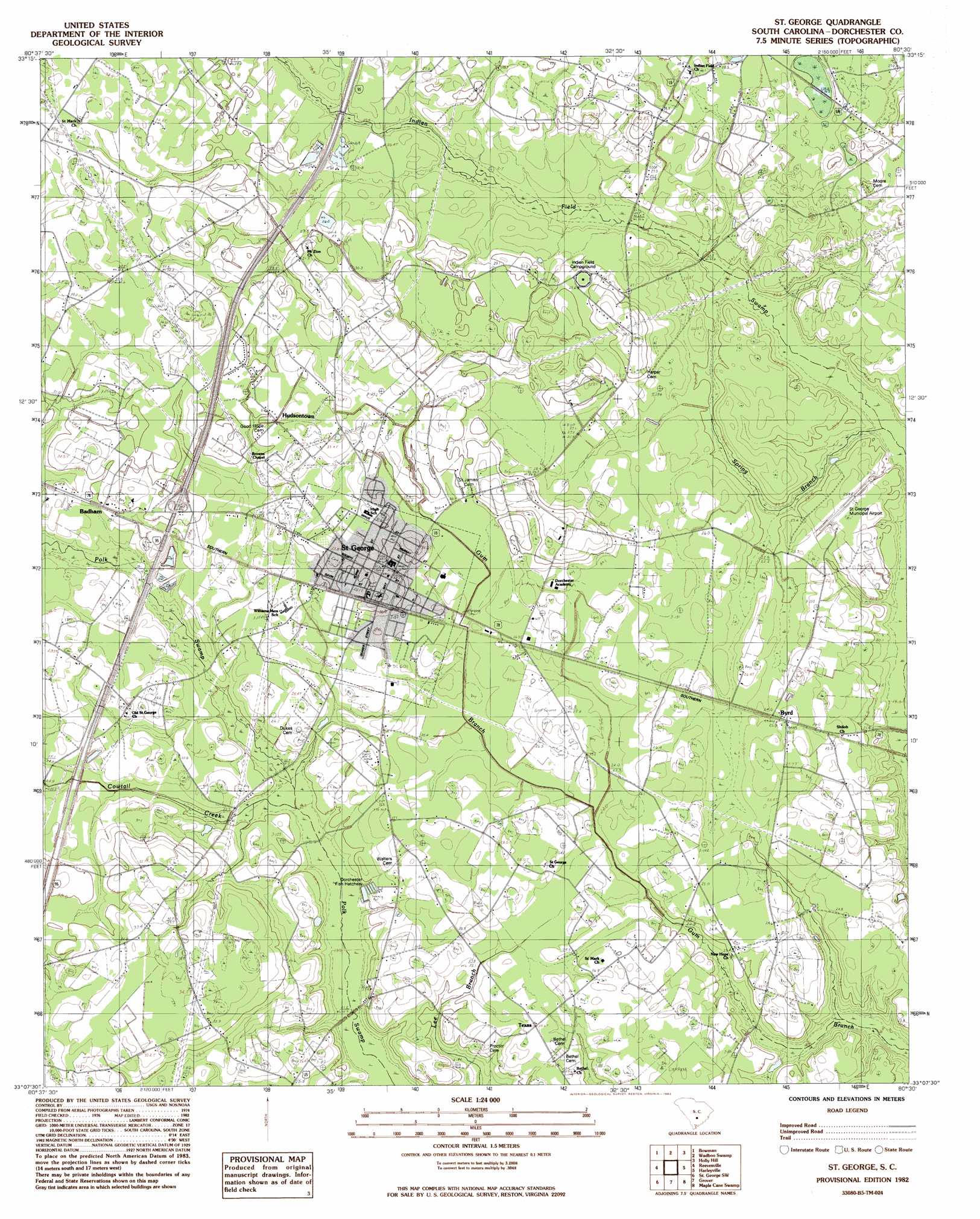
Saint George Topo Map South Carolina
To zoom in, hover over the map of Saint George
USGS Topo Quad 33080b5 - 1:24,000 scale
| Topo Map Name: | Saint George |
| USGS Topo Quad ID: | 33080b5 |
| Print Size: | ca. 21 1/4" wide x 27" high |
| Southeast Coordinates: | 33.125° N latitude / 80.5° W longitude |
| Map Center Coordinates: | 33.1875° N latitude / 80.5625° W longitude |
| U.S. State: | SC |
| Filename: | o33080b5.jpg |
| Download Map JPG Image: | Saint George topo map 1:24,000 scale |
| Map Type: | Topographic |
| Topo Series: | 7.5´ |
| Map Scale: | 1:24,000 |
| Source of Map Images: | United States Geological Survey (USGS) |
| Alternate Map Versions: |
St. George SC 1982, updated 1983 Download PDF Buy paper map Saint George SC 2011 Download PDF Buy paper map Saint George SC 2014 Download PDF Buy paper map |
1:24,000 Topo Quads surrounding Saint George
Orangeburg South |
Indian Camp Branch |
Felderville |
Vance |
Eutawville |
Branchville North |
Bowman |
Wadboo Swamp |
Holly Hill |
Sandridge |
Branchville South |
Reevesville |
Saint George |
Harleyville |
Pringletown |
Williams |
Saint George Sw |
Canadys |
Maple Cane Swamp |
Ridgeville |
Sniders Crossroads |
Walterboro |
Round O |
Cottageville |
Clubhouse Crossroads |
> Back to 33080a1 at 1:100,000 scale
> Back to 33080a1 at 1:250,000 scale
> Back to U.S. Topo Maps home
Saint George topo map: Gazetteer
Saint George: Airports
Saint George Airport elevation 25m 82′Saint George: Crossings
Interchange 77 elevation 35m 114′Saint George: Populated Places
Badham elevation 30m 98′Byrd elevation 26m 85′
Cow Tail (historical) elevation 33m 108′
Hudsontown elevation 30m 98′
Mount Zion elevation 31m 101′
Old Saint George elevation 27m 88′
Saint George elevation 32m 104′
Texas elevation 25m 82′
Saint George: Post Offices
Grover Post Office elevation 24m 78′Saint George Post Office elevation 31m 101′
Saint George: Springs
Blue Spring elevation 25m 82′Saint George: Streams
Cowtail Creek elevation 21m 68′Spring Branch elevation 24m 78′
Wadboo Branch elevation 28m 91′
Saint George digital topo map on disk
Buy this Saint George topo map showing relief, roads, GPS coordinates and other geographical features, as a high-resolution digital map file on DVD:
South Carolina, Western North Carolina & Northeastern Georgia
Buy digital topo maps: South Carolina, Western North Carolina & Northeastern Georgia