Tony Hill Bay Topo Map South Carolina
To zoom in, hover over the map of Tony Hill Bay
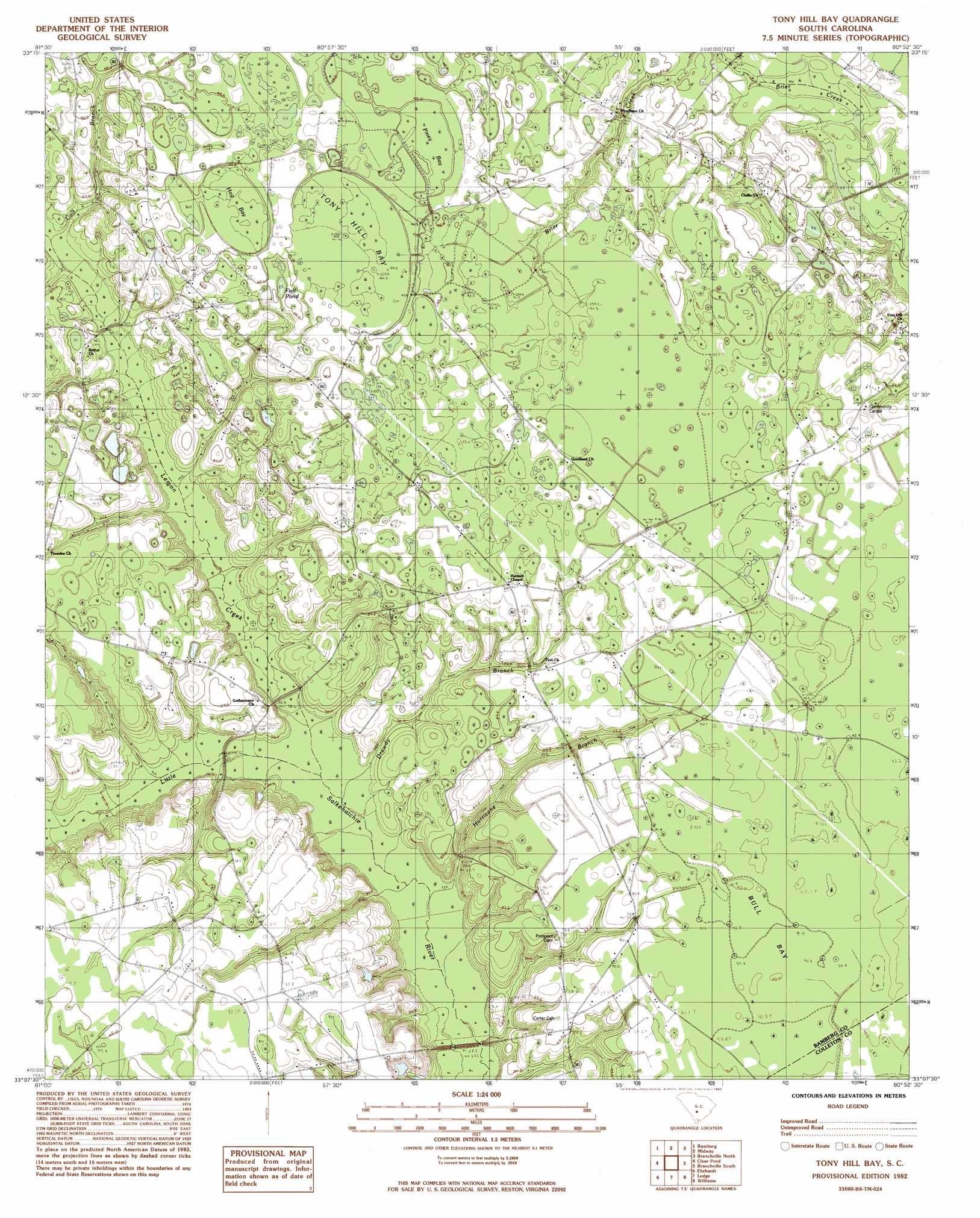
USGS Topo Quad 33080b8 - 1:24,000 scale
| Topo Map Name: | Tony Hill Bay |
| USGS Topo Quad ID: | 33080b8 |
| Print Size: | ca. 21 1/4" wide x 27" high |
| Southeast Coordinates: | 33.125° N latitude / 80.875° W longitude |
| Map Center Coordinates: | 33.1875° N latitude / 80.9375° W longitude |
| U.S. State: | SC |
| Filename: | o33080b8.jpg |
| Download Map JPG Image: | Tony Hill Bay topo map 1:24,000 scale |
| Map Type: | Topographic |
| Topo Series: | 7.5´ |
| Map Scale: | 1:24,000 |
| Source of Map Images: | United States Geological Survey (USGS) |
| Alternate Map Versions: |
Tony Hill Bay SC 1982, updated 1983 Download PDF Buy paper map Tony Hill Bay SC 2011 Download PDF Buy paper map Tony Hill Bay SC 2014 Download PDF Buy paper map |
1:24,000 Topo Quads surrounding Tony Hill Bay
Norway West |
Norway East |
Cordova |
Orangeburg South |
Indian Camp Branch |
Denmark |
Bamberg |
Midway |
Branchville North |
Bowman |
Olar |
Clear Pond |
Tony Hill Bay |
Branchville South |
Reevesville |
Sycamore |
Ehrhardt |
Lodge |
Williams |
Saint George Sw |
Fairfax |
Crocketville |
Islandton |
Sniders Crossroads |
Walterboro |
> Back to 33080a1 at 1:100,000 scale
> Back to 33080a1 at 1:250,000 scale
> Back to U.S. Topo Maps home
Tony Hill Bay topo map: Gazetteer
Tony Hill Bay: Crossings
Cowpen Ford elevation 29m 95′Tony Hill Bay: Dams
Butlers Pond Dam D-2824 elevation 34m 111′Tony Hill Bay: Lakes
Crooked Pond elevation 39m 127′Fish Pond elevation 40m 131′
Tony Hill Bay: Populated Places
Millersville (historical) elevation 38m 124′Tony Hill Bay: Streams
Colt Branch elevation 34m 111′Drawdy Branch elevation 25m 82′
Hurricane Branch elevation 27m 88′
Lemon Creek elevation 30m 98′
Tony Hill Bay: Swamps
Bull Bay elevation 40m 131′Hog Bay elevation 40m 131′
Little Swamp elevation 40m 131′
Piney Bay elevation 44m 144′
Schofield Swamp elevation 44m 144′
Tony Hill Bay elevation 47m 154′
Tony Hill Bay digital topo map on disk
Buy this Tony Hill Bay topo map showing relief, roads, GPS coordinates and other geographical features, as a high-resolution digital map file on DVD:
South Carolina, Western North Carolina & Northeastern Georgia
Buy digital topo maps: South Carolina, Western North Carolina & Northeastern Georgia