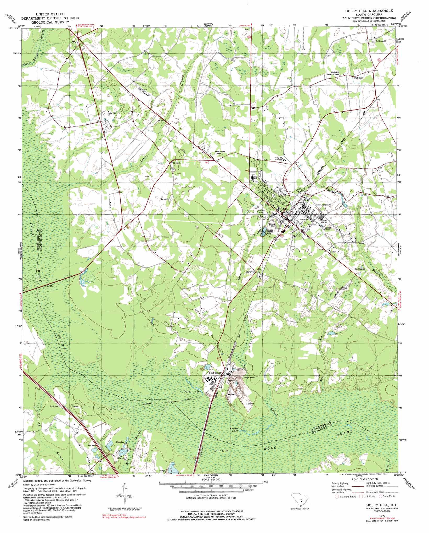
Holly Hill Topo Map South Carolina
To zoom in, hover over the map of Holly Hill
USGS Topo Quad 33080c4 - 1:24,000 scale
| Topo Map Name: | Holly Hill |
| USGS Topo Quad ID: | 33080c4 |
| Print Size: | ca. 21 1/4" wide x 27" high |
| Southeast Coordinates: | 33.25° N latitude / 80.375° W longitude |
| Map Center Coordinates: | 33.3125° N latitude / 80.4375° W longitude |
| U.S. State: | SC |
| Filename: | o33080c4.jpg |
| Download Map JPG Image: | Holly Hill topo map 1:24,000 scale |
| Map Type: | Topographic |
| Topo Series: | 7.5´ |
| Map Scale: | 1:24,000 |
| Source of Map Images: | United States Geological Survey (USGS) |
| Alternate Map Versions: |
Holly Hill SC 1979, updated 1980 Download PDF Buy paper map Holly Hill SC 1979, updated 1991 Download PDF Buy paper map Holly Hill SC 2011 Download PDF Buy paper map Holly Hill SC 2014 Download PDF Buy paper map |
1:24,000 Topo Quads surrounding Holly Hill
Cameron |
Elloree |
Saint Paul |
Summerton |
Jordan |
Indian Camp Branch |
Felderville |
Vance |
Eutawville |
Eadytown |
Bowman |
Wadboo Swamp |
Holly Hill |
Sandridge |
Cross |
Reevesville |
Saint George |
Harleyville |
Pringletown |
Summerville Nw |
Saint George Sw |
Canadys |
Maple Cane Swamp |
Ridgeville |
Summerville |
> Back to 33080a1 at 1:100,000 scale
> Back to 33080a1 at 1:250,000 scale
> Back to U.S. Topo Maps home
Holly Hill topo map: Gazetteer
Holly Hill: Airports
Holly Hill Airport elevation 31m 101′Russell Airport elevation 33m 108′
Holly Hill: Dams
Bunch Pond Dam D-3778 elevation 24m 78′Holly Hill: Lakes
Peedee Lake elevation 19m 62′Rowser Lake elevation 20m 65′
Holly Hill: Parks
Gilmore Park elevation 30m 98′Holly Hill: Populated Places
Bowyer elevation 27m 88′Connors (historical) elevation 35m 114′
Four Holes elevation 23m 75′
Holly Hill elevation 32m 104′
Wells elevation 31m 101′
Holly Hill: Post Offices
Holly Hill Post Office elevation 31m 101′Holly Hill: Streams
Dam Branch elevation 18m 59′Home Branch elevation 19m 62′
Mill Branch elevation 21m 68′
Mill Run elevation 18m 59′
Spring Branch elevation 22m 72′
Target Swamp elevation 24m 78′
Holly Hill digital topo map on disk
Buy this Holly Hill topo map showing relief, roads, GPS coordinates and other geographical features, as a high-resolution digital map file on DVD:
South Carolina, Western North Carolina & Northeastern Georgia
Buy digital topo maps: South Carolina, Western North Carolina & Northeastern Georgia