Branchville North Topo Map South Carolina
To zoom in, hover over the map of Branchville North
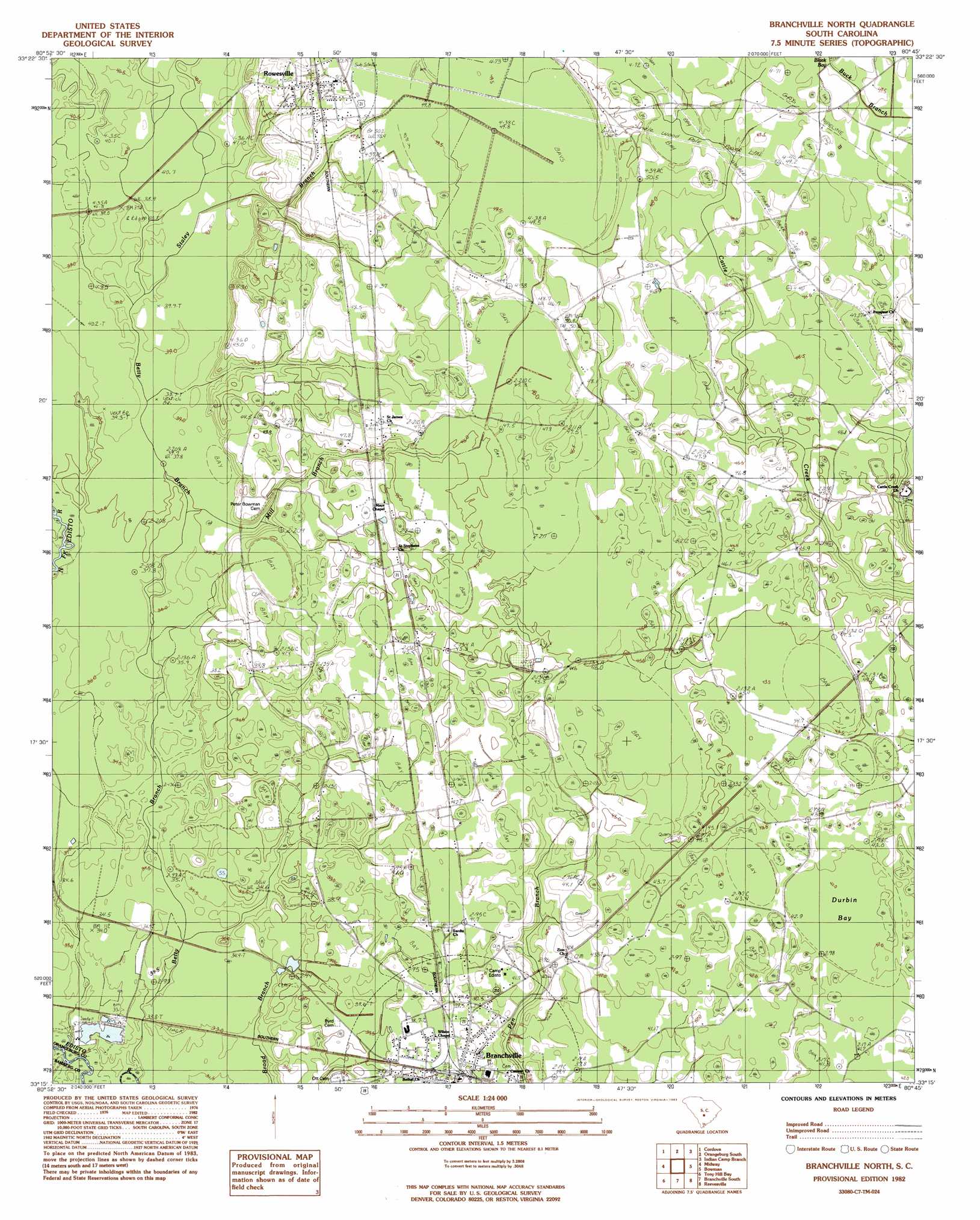
USGS Topo Quad 33080c7 - 1:24,000 scale
| Topo Map Name: | Branchville North |
| USGS Topo Quad ID: | 33080c7 |
| Print Size: | ca. 21 1/4" wide x 27" high |
| Southeast Coordinates: | 33.25° N latitude / 80.75° W longitude |
| Map Center Coordinates: | 33.3125° N latitude / 80.8125° W longitude |
| U.S. State: | SC |
| Filename: | o33080c7.jpg |
| Download Map JPG Image: | Branchville North topo map 1:24,000 scale |
| Map Type: | Topographic |
| Topo Series: | 7.5´ |
| Map Scale: | 1:24,000 |
| Source of Map Images: | United States Geological Survey (USGS) |
| Alternate Map Versions: |
Branchville North SC 1982, updated 1983 Download PDF Buy paper map Branchville North SC 2011 Download PDF Buy paper map Branchville North SC 2014 Download PDF Buy paper map |
1:24,000 Topo Quads surrounding Branchville North
North |
Wolfton |
Orangeburg North |
Cameron |
Elloree |
Norway East |
Cordova |
Orangeburg South |
Indian Camp Branch |
Felderville |
Bamberg |
Midway |
Branchville North |
Bowman |
Wadboo Swamp |
Clear Pond |
Tony Hill Bay |
Branchville South |
Reevesville |
Saint George |
Ehrhardt |
Lodge |
Williams |
Saint George Sw |
Canadys |
> Back to 33080a1 at 1:100,000 scale
> Back to 33080a1 at 1:250,000 scale
> Back to U.S. Topo Maps home
Branchville North topo map: Gazetteer
Branchville North: Basins
Durbin Bay elevation 38m 124′Robinsons Bay elevation 47m 154′
Branchville North: Populated Places
Branchville elevation 35m 114′Rowesville elevation 50m 164′
Sixty Six elevation 43m 141′
Branchville North: Post Offices
Branchville Post Office elevation 36m 118′Rowesville Post Office elevation 52m 170′
Branchville North: Streams
Mill Branch elevation 38m 124′Staley Branch elevation 36m 118′
Branchville North digital topo map on disk
Buy this Branchville North topo map showing relief, roads, GPS coordinates and other geographical features, as a high-resolution digital map file on DVD:
South Carolina, Western North Carolina & Northeastern Georgia
Buy digital topo maps: South Carolina, Western North Carolina & Northeastern Georgia