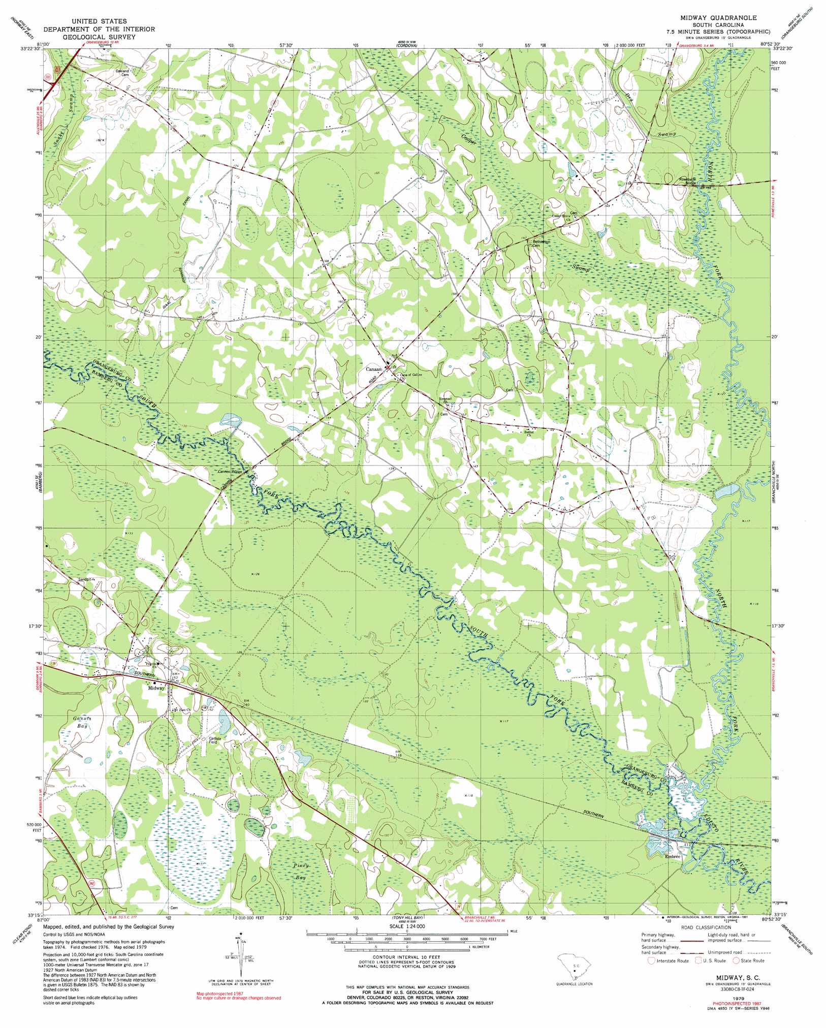
Midway Topo Map South Carolina
To zoom in, hover over the map of Midway
USGS Topo Quad 33080c8 - 1:24,000 scale
| Topo Map Name: | Midway |
| USGS Topo Quad ID: | 33080c8 |
| Print Size: | ca. 21 1/4" wide x 27" high |
| Southeast Coordinates: | 33.25° N latitude / 80.875° W longitude |
| Map Center Coordinates: | 33.3125° N latitude / 80.9375° W longitude |
| U.S. State: | SC |
| Filename: | o33080c8.jpg |
| Download Map JPG Image: | Midway topo map 1:24,000 scale |
| Map Type: | Topographic |
| Topo Series: | 7.5´ |
| Map Scale: | 1:24,000 |
| Source of Map Images: | United States Geological Survey (USGS) |
| Alternate Map Versions: |
Midway SC 1979, updated 1980 Download PDF Buy paper map Midway SC 1979, updated 1991 Download PDF Buy paper map Midway SC 2011 Download PDF Buy paper map Midway SC 2014 Download PDF Buy paper map |
1:24,000 Topo Quads surrounding Midway
Harleys Millpond |
North |
Wolfton |
Orangeburg North |
Cameron |
Norway West |
Norway East |
Cordova |
Orangeburg South |
Indian Camp Branch |
Denmark |
Bamberg |
Midway |
Branchville North |
Bowman |
Olar |
Clear Pond |
Tony Hill Bay |
Branchville South |
Reevesville |
Sycamore |
Ehrhardt |
Lodge |
Williams |
Saint George Sw |
> Back to 33080a1 at 1:100,000 scale
> Back to 33080a1 at 1:250,000 scale
> Back to U.S. Topo Maps home
Midway topo map: Gazetteer
Midway: Bridges
Cannon Bridge elevation 36m 118′Fork Bridges (historical) elevation 33m 108′
Rowesville Bridge elevation 36m 118′
Midway: Canals
Isaac Jennings Canal elevation 47m 154′Midway: Dams
Tatums Pond Dam D-2823 elevation 44m 144′Midway: Populated Places
Canaan elevation 45m 147′Embree elevation 31m 101′
Midway elevation 46m 150′
Midway: Streams
Cooper Swamp elevation 36m 118′Dry Swamp elevation 37m 121′
North Fork Edisto River elevation 31m 101′
South Fork Edisto River elevation 31m 101′
Midway: Swamps
Gannts Bay elevation 44m 144′Midway digital topo map on disk
Buy this Midway topo map showing relief, roads, GPS coordinates and other geographical features, as a high-resolution digital map file on DVD:
South Carolina, Western North Carolina & Northeastern Georgia
Buy digital topo maps: South Carolina, Western North Carolina & Northeastern Georgia