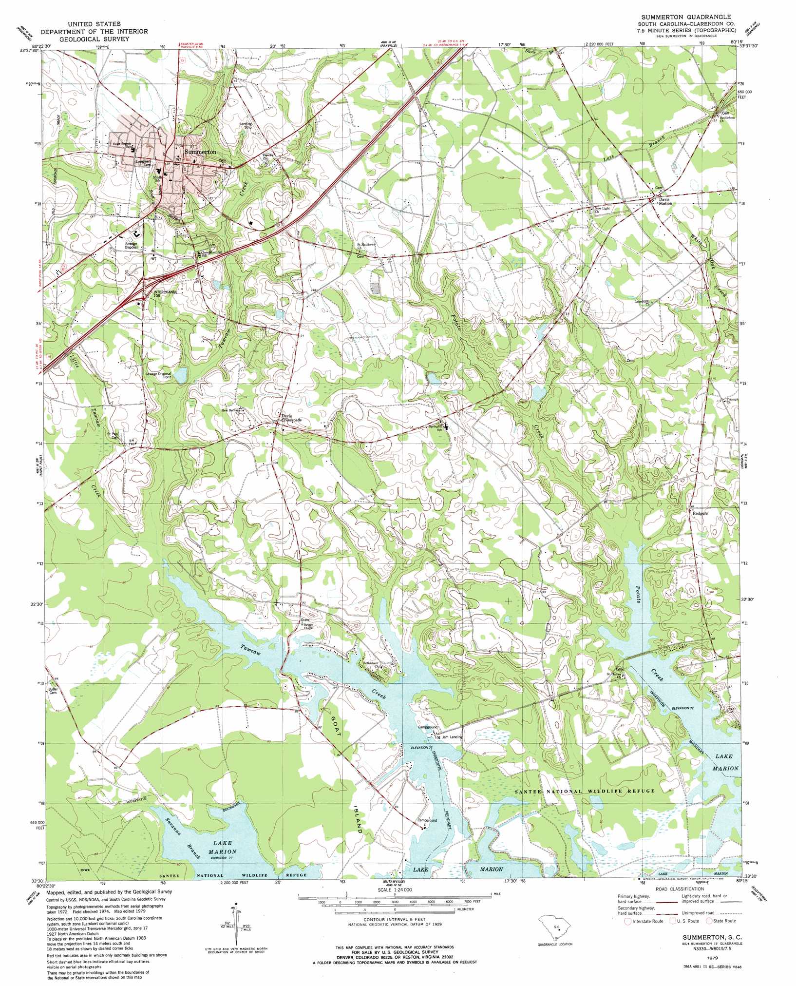
Summerton Topo Map South Carolina
To zoom in, hover over the map of Summerton
USGS Topo Quad 33080e3 - 1:24,000 scale
| Topo Map Name: | Summerton |
| USGS Topo Quad ID: | 33080e3 |
| Print Size: | ca. 21 1/4" wide x 27" high |
| Southeast Coordinates: | 33.5° N latitude / 80.25° W longitude |
| Map Center Coordinates: | 33.5625° N latitude / 80.3125° W longitude |
| U.S. State: | SC |
| Filename: | o33080e3.jpg |
| Download Map JPG Image: | Summerton topo map 1:24,000 scale |
| Map Type: | Topographic |
| Topo Series: | 7.5´ |
| Map Scale: | 1:24,000 |
| Source of Map Images: | United States Geological Survey (USGS) |
| Alternate Map Versions: |
Summerton SC 2011 Download PDF Buy paper map Summerton SC 2014 Download PDF Buy paper map |
1:24,000 Topo Quads surrounding Summerton
Poinsett State Park |
Privateer |
Brogdon |
Tearcoat Branch |
Sardinia |
Lone Star |
Pinewood |
Paxville |
Manning |
Foreston |
Elloree |
Saint Paul |
Summerton |
Jordan |
Butlers Bay |
Felderville |
Vance |
Eutawville |
Eadytown |
Pineville |
Wadboo Swamp |
Holly Hill |
Sandridge |
Cross |
Chicora |
> Back to 33080e1 at 1:100,000 scale
> Back to 33080a1 at 1:250,000 scale
> Back to U.S. Topo Maps home
Summerton topo map: Gazetteer
Summerton: Crossings
Interchange 108 elevation 37m 121′Summerton: Dams
Wards Pasture Pond Dam D-3502 elevation 29m 95′Summerton: Islands
Goat Island elevation 24m 78′Summerton: Parks
Taw Caw Creek Park elevation 24m 78′Summerton: Populated Places
Davis Crossroads elevation 37m 121′Davis Station elevation 42m 137′
Log Jam Landing elevation 23m 75′
Rodgers elevation 28m 91′
Summerton elevation 42m 137′
Summerton: Post Offices
Davis Station Post Office elevation 42m 137′Summerton: Reservoirs
Summerton Waste Treatment Pond elevation 30m 98′Summerton: Streams
Little Tawcaw Creek elevation 24m 78′Scott Branch elevation 33m 108′
Summerton digital topo map on disk
Buy this Summerton topo map showing relief, roads, GPS coordinates and other geographical features, as a high-resolution digital map file on DVD:
South Carolina, Western North Carolina & Northeastern Georgia
Buy digital topo maps: South Carolina, Western North Carolina & Northeastern Georgia