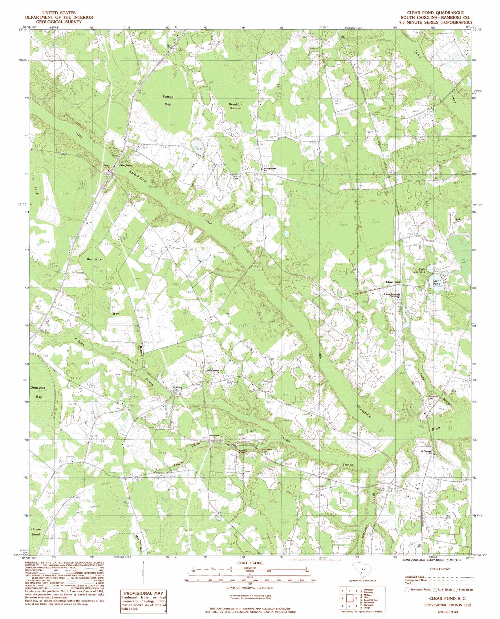
Clear Pond Topo Map South Carolina
To zoom in, hover over the map of Clear Pond
USGS Topo Quad 33081b1 - 1:24,000 scale
| Topo Map Name: | Clear Pond |
| USGS Topo Quad ID: | 33081b1 |
| Print Size: | ca. 21 1/4" wide x 27" high |
| Southeast Coordinates: | 33.125° N latitude / 81° W longitude |
| Map Center Coordinates: | 33.1875° N latitude / 81.0625° W longitude |
| U.S. State: | SC |
| Filename: | o33081b1.jpg |
| Download Map JPG Image: | Clear Pond topo map 1:24,000 scale |
| Map Type: | Topographic |
| Topo Series: | 7.5´ |
| Map Scale: | 1:24,000 |
| Source of Map Images: | United States Geological Survey (USGS) |
| Alternate Map Versions: |
Clear Pond SC 1982, updated 1983 Download PDF Buy paper map Clear Pond SC 2011 Download PDF Buy paper map Clear Pond SC 2014 Download PDF Buy paper map |
1:24,000 Topo Quads surrounding Clear Pond
Springfield |
Norway West |
Norway East |
Cordova |
Orangeburg South |
Blackville |
Denmark |
Bamberg |
Midway |
Branchville North |
Barnwell |
Olar |
Clear Pond |
Tony Hill Bay |
Branchville South |
Allendale |
Sycamore |
Ehrhardt |
Lodge |
Williams |
Barton |
Fairfax |
Crocketville |
Islandton |
Sniders Crossroads |
> Back to 33081a1 at 1:100,000 scale
> Back to 33080a1 at 1:250,000 scale
> Back to U.S. Topo Maps home
Clear Pond topo map: Gazetteer
Clear Pond: Bridges
Odom Bridge elevation 43m 141′Clear Pond: Dams
McMillans Pond Dam D-2818 elevation 41m 134′Priesters Pond Dam D-2821 elevation 41m 134′
Clear Pond: Lakes
Clear Pond elevation 41m 134′Little Clear Pond elevation 41m 134′
Clear Pond: Populated Places
Clear Pond elevation 44m 144′Hughes elevation 47m 154′
Springtown elevation 48m 157′
Clear Pond: Streams
Ben Rice Branch elevation 51m 167′Colston Branch elevation 39m 127′
Indian Camp Branch elevation 38m 124′
Long Branch elevation 32m 104′
McMillian Branch elevation 28m 91′
Clear Pond: Swamps
Ben Rice Bay elevation 49m 160′Brunston Swamp elevation 44m 144′
Doussoss Bay elevation 46m 150′
Sutton Bay elevation 53m 173′
Clear Pond digital topo map on disk
Buy this Clear Pond topo map showing relief, roads, GPS coordinates and other geographical features, as a high-resolution digital map file on DVD:
South Carolina, Western North Carolina & Northeastern Georgia
Buy digital topo maps: South Carolina, Western North Carolina & Northeastern Georgia